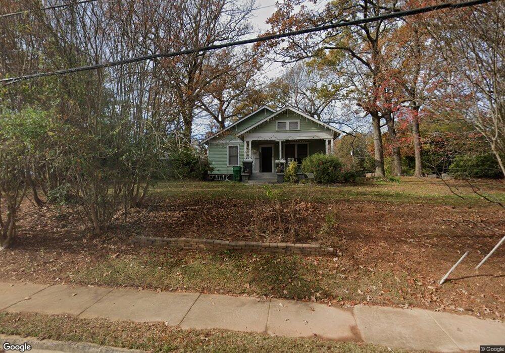
2056 Brockett Rd Tucker, GA 30084
Estimated Value: $314,797 - $356,000
3
Beds
1
Bath
1,376
Sq Ft
$250/Sq Ft
Est. Value
About This Home
This home is located at 2056 Brockett Rd, Tucker, GA 30084 and is currently estimated at $343,699, approximately $249 per square foot. 2056 Brockett Rd is a home located in DeKalb County with nearby schools including Brockett Elementary School, Tucker Middle School, and Tucker High School.
Ownership History
Date
Name
Owned For
Owner Type
Purchase Details
Closed on
May 19, 2005
Sold by
Armstrong Joan K
Bought by
Armstrong Wendi D
Current Estimated Value
Home Financials for this Owner
Home Financials are based on the most recent Mortgage that was taken out on this home.
Original Mortgage
$148,000
Outstanding Balance
$74,825
Interest Rate
5.37%
Mortgage Type
New Conventional
Estimated Equity
$268,874
Purchase Details
Closed on
Aug 26, 2002
Sold by
Osborne Michelle L
Bought by
Armstong Joan K
Home Financials for this Owner
Home Financials are based on the most recent Mortgage that was taken out on this home.
Original Mortgage
$120,800
Interest Rate
5.93%
Mortgage Type
New Conventional
Purchase Details
Closed on
Apr 24, 1996
Sold by
Fitzsimmons Anne
Bought by
Coffin Michelle
Create a Home Valuation Report for This Property
The Home Valuation Report is an in-depth analysis detailing your home's value as well as a comparison with similar homes in the area
Home Values in the Area
Average Home Value in this Area
Purchase History
| Date | Buyer | Sale Price | Title Company |
|---|---|---|---|
| Armstrong Wendi D | $185,000 | -- | |
| Armstong Joan K | $151,000 | -- | |
| Coffin Michelle | $81,900 | -- |
Source: Public Records
Mortgage History
| Date | Status | Borrower | Loan Amount |
|---|---|---|---|
| Open | Armstrong Wendi D | $148,000 | |
| Previous Owner | Armstong Joan K | $120,800 | |
| Previous Owner | Armstong Joan K | $22,650 | |
| Closed | Coffin Michelle | $0 |
Source: Public Records
Tax History Compared to Growth
Tax History
| Year | Tax Paid | Tax Assessment Tax Assessment Total Assessment is a certain percentage of the fair market value that is determined by local assessors to be the total taxable value of land and additions on the property. | Land | Improvement |
|---|---|---|---|---|
| 2025 | $5,890 | $120,320 | $23,400 | $96,920 |
| 2024 | $3,566 | $105,040 | $23,400 | $81,640 |
| 2023 | $3,566 | $103,720 | $32,400 | $71,320 |
| 2022 | $2,569 | $77,040 | $16,200 | $60,840 |
| 2021 | $2,023 | $59,640 | $16,200 | $43,440 |
| 2020 | $1,866 | $55,600 | $15,680 | $39,920 |
| 2019 | $1,663 | $50,080 | $15,680 | $34,400 |
| 2018 | $1,373 | $52,160 | $15,680 | $36,480 |
| 2017 | $1,540 | $44,640 | $15,680 | $28,960 |
| 2016 | $1,602 | $47,480 | $15,680 | $31,800 |
| 2014 | $1,084 | $28,480 | $15,680 | $12,800 |
Source: Public Records
Map
Nearby Homes
- 3962 Brockett Walk
- 3944 Woburn Dr Unit 3
- 2154 Brockett Rd
- 2089 Carthage Rd
- 3599 Woodbriar Cir Unit G
- 3599 Woodbriar Cir Unit A
- 3603 Woodbriar Cir Unit M
- 1926 Brocken Way
- 2215 Nena Way Unit 20
- 2219 Nena Way Unit 22
- 4217 Theresa Ct
- 4257 Freight St
- 2063 Willow Chase Ct
- 4110 Oak Crest Dr
- 3748 Sturbridge Ct
- 1894 Hebron Hills Dr
- 2173 Hannah Ln
- 2050 Brockett Rd
- 4017 Grantland Dr
- 2048 Brockett Rd
- 2078 Brockett Rd
- 2046 Brockett Rd
- 4011 Grantland Dr
- 2057 Brockett Rd
- 2067 Brockett Rd
- 4036 Arborwood Ln
- 2047 Brockett Rd
- 2047 Brockett Rd Unit 27
- 4015 Brockett Walk
- 2073 Brockett Rd
- 2077 Brockett Rd
- 4026 Arborwood Ln
- 4014 Arborwood Ln
- 4020 Arborwood Ln
- 4052 Wildflower Ln
- 4007 Brockett Walk
- 2083 Brockett Rd