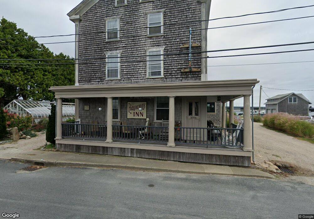
2056 Main Rd Westport, MA 02790
Westport Point Neighborhood
9
Beds
4
Baths
4,992
Sq Ft
0.38
Acres
About This Home
This home is located at 2056 Main Rd, Westport, MA 02790. 2056 Main Rd is a home located in Bristol County with nearby schools including Alice A. Macomber Primary School, Westport Elementary School, and Westport Middle-High School.
Create a Home Valuation Report for This Property
The Home Valuation Report is an in-depth analysis detailing your home's value as well as a comparison with similar homes in the area
Home Values in the Area
Average Home Value in this Area
Tax History Compared to Growth
Tax History
| Year | Tax Paid | Tax Assessment Tax Assessment Total Assessment is a certain percentage of the fair market value that is determined by local assessors to be the total taxable value of land and additions on the property. | Land | Improvement |
|---|---|---|---|---|
| 2025 | $7,896 | $1,059,900 | $729,300 | $330,600 |
| 2024 | $7,925 | $1,025,200 | $694,600 | $330,600 |
| 2023 | $8,203 | $1,005,300 | $650,100 | $355,200 |
| 2022 | $7,093 | $881,700 | $650,100 | $231,600 |
| 2021 | $7,093 | $822,800 | $591,200 | $231,600 |
| 2020 | $6,936 | $822,800 | $591,200 | $231,600 |
| 2019 | $6,872 | $830,900 | $591,200 | $239,700 |
| 2018 | $5,930 | $725,800 | $427,500 | $298,300 |
| 2017 | $5,882 | $738,000 | $427,500 | $310,500 |
| 2016 | $5,804 | $733,800 | $427,500 | $306,300 |
| 2015 | $5,449 | $687,100 | $439,100 | $248,000 |
Source: Public Records
Map
Nearby Homes
- 0 Reed Rd (Ss)
- 1881 Main Rd
- 1702J Drift Rd
- 1702 Drift Rd
- 1749 Main Rd
- 1580 Main Rd
- 19 Seabury Ln
- 238-242 E Beach Rd
- 99 Sylvia Ln
- 1346 Main Rd Unit B
- 189 Brayton Point Rd
- 304 Brayton Point Rd
- Lot 2 Horseneck Rd
- 255 John Dyer Rd
- 245 John Dyer Rd
- 225 Hixbridge Rd
- 17 Quail Trail
- 920 Drift Rd
- Lot 2E Horseneck Rd
- 101 Adamsville Rd