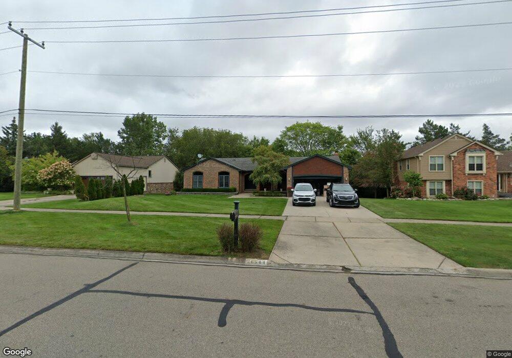
20564 Gill Rd Livonia, MI 48152
Estimated Value: $424,286 - $507,000
3
Beds
3
Baths
1,802
Sq Ft
$260/Sq Ft
Est. Value
About This Home
This home is located at 20564 Gill Rd, Livonia, MI 48152 and is currently estimated at $468,822, approximately $260 per square foot. 20564 Gill Rd is a home located in Wayne County with nearby schools including Webster Elementary School, Coolidge Elementary School, and Riley Upper Elementary School.
Ownership History
Date
Name
Owned For
Owner Type
Purchase Details
Closed on
Jun 3, 2009
Sold by
Lokar Arthur J and Bush Yvonne J
Bought by
Bush Yvonne J
Current Estimated Value
Purchase Details
Closed on
Aug 4, 1994
Sold by
Lokar James J
Bought by
Arthur J Lokar and Bush Yvonne J
Home Financials for this Owner
Home Financials are based on the most recent Mortgage that was taken out on this home.
Original Mortgage
$167,000
Interest Rate
6.25%
Mortgage Type
New Conventional
Create a Home Valuation Report for This Property
The Home Valuation Report is an in-depth analysis detailing your home's value as well as a comparison with similar homes in the area
Home Values in the Area
Average Home Value in this Area
Purchase History
| Date | Buyer | Sale Price | Title Company |
|---|---|---|---|
| Bush Yvonne J | -- | None Available | |
| Arthur J Lokar | $193,000 | -- |
Source: Public Records
Mortgage History
| Date | Status | Borrower | Loan Amount |
|---|---|---|---|
| Previous Owner | Arthur J Lokar | $167,000 |
Source: Public Records
Tax History Compared to Growth
Tax History
| Year | Tax Paid | Tax Assessment Tax Assessment Total Assessment is a certain percentage of the fair market value that is determined by local assessors to be the total taxable value of land and additions on the property. | Land | Improvement |
|---|---|---|---|---|
| 2025 | $2,976 | $204,600 | $0 | $0 |
| 2024 | $2,976 | $189,000 | $0 | $0 |
| 2023 | $2,840 | $176,000 | $0 | $0 |
| 2022 | $4,986 | $169,800 | $0 | $0 |
| 2021 | $4,843 | $163,600 | $0 | $0 |
| 2019 | $4,646 | $142,900 | $0 | $0 |
| 2018 | $2,401 | $139,100 | $0 | $0 |
| 2017 | $3,816 | $131,800 | $0 | $0 |
| 2016 | $4,011 | $129,800 | $0 | $0 |
| 2015 | $9,710 | $121,010 | $0 | $0 |
| 2012 | -- | $91,880 | $26,930 | $64,950 |
Source: Public Records
Map
Nearby Homes
- 33855 Pondview Cir Unit 21
- 33905 Pondview Cir Unit 15
- 33665 Pondview Cir Unit 138
- 33873 Pondview Cir Unit 171
- 33825 Pondview Cir Unit 33
- 33769 Pondview Cir Unit 59
- 20678 Chestnut Cir Unit 2
- 21045 Cass St
- 20154 Riverside Dr
- 21423 Gill Rd
- 21326 Flanders St
- 33155 Meadowlark St
- 33850 Colfax Dr
- 33528 Rhonswood St
- 21456 Flanders St
- 32965 Fargo St
- 32805 Fargo St
- 20622 Golf Ridge Cir
- 21256 Birchwood St
- 22050 Cass St
- 20542 Gill Rd
- 20586 Gill Rd
- 20520 Gill Rd
- 34355 8 Mile Rd
- 20498 Gill Rd
- 34441 Eight Mile Rd Unit 109
- 34441 Eight Mile Rd Unit 107
- 34441 Eight Mile Rd Unit 106
- 34441 Eight Mile Rd
- 33909 Pondview Cir Unit 11
- 33915 Pondview Cir Unit 8
- 33903 Pondview Cir Unit 17
- 33907 Pondview Cir
- 33917 Pondview Cir
- 20551 Gill Rd
- 20476 Gill Rd
- 33889 Pondview Cir Unit 20
- 33901 Pondview Cir
- 33895 Pondview Cir
- 33897 Pondview Cir