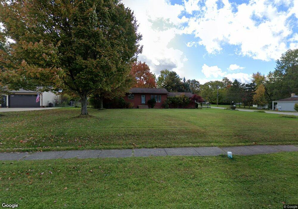
20565 Collier Dr Strongsville, OH 44149
Estimated Value: $214,000 - $254,000
3
Beds
2
Baths
1,075
Sq Ft
$220/Sq Ft
Est. Value
About This Home
This home is located at 20565 Collier Dr, Strongsville, OH 44149 and is currently estimated at $236,821, approximately $220 per square foot. 20565 Collier Dr is a home located in Cuyahoga County with nearby schools including Strongsville High School, Strongsville Academy, and Sts Joseph & John Interparochial School.
Ownership History
Date
Name
Owned For
Owner Type
Purchase Details
Closed on
Nov 3, 2023
Sold by
Caputo Marie
Bought by
Marie Caputo Family Trust and Caputo
Current Estimated Value
Purchase Details
Closed on
Oct 28, 1998
Sold by
Taylor Leonard A and Colegrove Marjorie B
Bought by
Caputo Marie
Home Financials for this Owner
Home Financials are based on the most recent Mortgage that was taken out on this home.
Original Mortgage
$102,000
Interest Rate
6.78%
Purchase Details
Closed on
Mar 11, 1981
Sold by
Swann Jerry T
Bought by
Taylor Leonard A
Purchase Details
Closed on
Jun 14, 1977
Sold by
Mesko Joseph W and Mesko Kathleen
Bought by
Swann Jerry T
Purchase Details
Closed on
Jan 1, 1975
Bought by
Mesko Joseph W and Mesko Kathleen
Create a Home Valuation Report for This Property
The Home Valuation Report is an in-depth analysis detailing your home's value as well as a comparison with similar homes in the area
Home Values in the Area
Average Home Value in this Area
Purchase History
| Date | Buyer | Sale Price | Title Company |
|---|---|---|---|
| Marie Caputo Family Trust | -- | None Listed On Document | |
| Caputo Marie | $124,900 | Approved Statewide Title Age | |
| Taylor Leonard A | $54,500 | -- | |
| Swann Jerry T | $43,000 | -- | |
| Mesko Joseph W | -- | -- |
Source: Public Records
Mortgage History
| Date | Status | Borrower | Loan Amount |
|---|---|---|---|
| Previous Owner | Caputo Marie | $102,000 |
Source: Public Records
Tax History Compared to Growth
Tax History
| Year | Tax Paid | Tax Assessment Tax Assessment Total Assessment is a certain percentage of the fair market value that is determined by local assessors to be the total taxable value of land and additions on the property. | Land | Improvement |
|---|---|---|---|---|
| 2024 | $2,991 | $63,700 | $16,310 | $47,390 |
| 2023 | $3,566 | $56,950 | $17,010 | $39,940 |
| 2022 | $3,540 | $56,950 | $17,010 | $39,940 |
| 2021 | $3,512 | $56,950 | $17,010 | $39,940 |
| 2020 | $3,253 | $46,660 | $13,930 | $32,730 |
| 2019 | $3,157 | $133,300 | $39,800 | $93,500 |
| 2018 | $2,786 | $46,660 | $13,930 | $32,730 |
| 2017 | $2,756 | $41,550 | $11,900 | $29,650 |
| 2016 | $2,734 | $41,550 | $11,900 | $29,650 |
| 2015 | $2,691 | $41,550 | $11,900 | $29,650 |
| 2014 | $2,691 | $40,320 | $11,550 | $28,770 |
Source: Public Records
Map
Nearby Homes
- 13236 Tomson Dr
- 14400 Prospect Rd
- 20078 Trapper Trail
- 12651 Alameda Dr
- 14896 Britannia Ct
- 15017 Regency Dr
- 14890 Prospect Rd
- 22125 Olde Creek Trail
- 19620 Porters Ln Unit 15F
- 14112 Settlers Way
- 12694 Ionia Ct
- 15001 Scarlet Oak Trail
- 12647 Edgepark Cir
- 20678 Spruce Dr
- 13156 Olympus Way
- 13066 Olympus Way
- 22235 North Trail
- 13099 Olympus Way
- 12385 Corinth Ct
- 15447 Oak Hollow Ln
- 20557 Collier Dr
- 20627 Collier Dr
- 20501 Collier Dr
- 20590 Royalton Rd
- 20657 Collier Dr
- 20558 Royalton Rd
- 20588 Collier Dr
- 20560 Collier Dr
- 20618 Collier Dr
- 20485 Collier Dr
- 13737 Atlantic Rd
- 20528 Royalton Rd
- 20624 Royalton Rd
- 20530 Collier Dr
- 20687 Collier Dr
- 13729 Atlantic Rd
- 20656 Royalton Rd
- 20500 Collier Dr
- 20461 Collier Dr
- 20717 Collier Dr