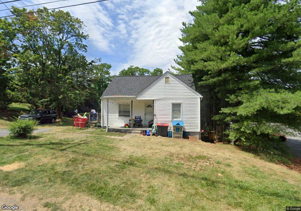
2059 Day Rd Hagerstown, MD 21740
South End NeighborhoodEstimated Value: $380,000
--
Bed
1
Bath
2,367
Sq Ft
$161/Sq Ft
Est. Value
About This Home
This home is located at 2059 Day Rd, Hagerstown, MD 21740 and is currently priced at $380,000, approximately $160 per square foot. 2059 Day Rd is a home located in Washington County with nearby schools including Ruth Ann Monroe Primary School, Eastern Elementary School, and E. Russell Hicks Middle School.
Ownership History
Date
Name
Owned For
Owner Type
Purchase Details
Closed on
Jun 9, 2021
Sold by
Brawner Troy and Brawner Robin S
Bought by
Brawner Troy
Current Estimated Value
Home Financials for this Owner
Home Financials are based on the most recent Mortgage that was taken out on this home.
Original Mortgage
$135,000
Outstanding Balance
$122,226
Interest Rate
2.9%
Mortgage Type
New Conventional
Purchase Details
Closed on
Jul 25, 2006
Sold by
Brennan Robin S
Bought by
Brawner Robin S and Brawner Troy
Create a Home Valuation Report for This Property
The Home Valuation Report is an in-depth analysis detailing your home's value as well as a comparison with similar homes in the area
Home Values in the Area
Average Home Value in this Area
Purchase History
| Date | Buyer | Sale Price | Title Company |
|---|---|---|---|
| Brawner Troy | -- | Olde Towne Title Inc | |
| Brawner Robin S | -- | -- |
Source: Public Records
Mortgage History
| Date | Status | Borrower | Loan Amount |
|---|---|---|---|
| Open | Brawner Troy | $135,000 |
Source: Public Records
Tax History Compared to Growth
Tax History
| Year | Tax Paid | Tax Assessment Tax Assessment Total Assessment is a certain percentage of the fair market value that is determined by local assessors to be the total taxable value of land and additions on the property. | Land | Improvement |
|---|---|---|---|---|
| 2025 | $1,966 | $215,100 | $137,200 | $77,900 |
| 2024 | $1,966 | $209,267 | $0 | $0 |
| 2023 | $1,913 | $203,433 | $0 | $0 |
| 2022 | $1,860 | $197,600 | $137,200 | $60,400 |
| 2021 | $1,722 | $171,867 | $0 | $0 |
| 2020 | $1,186 | $146,133 | $0 | $0 |
| 2019 | $1,186 | $120,400 | $54,800 | $65,600 |
| 2018 | $1,459 | $120,400 | $54,800 | $65,600 |
| 2017 | $1,186 | $120,400 | $0 | $0 |
| 2016 | -- | $120,400 | $0 | $0 |
| 2015 | -- | $120,400 | $0 | $0 |
| 2014 | $4,001 | $120,400 | $0 | $0 |
Source: Public Records
Map
Nearby Homes
- 1874 Abbey Ln
- 342 Landis Rd
- 27 Hebb Rd
- 315 Emmert Rd
- 701 Beaver Creek Rd
- 90 Charlotte St
- 42 Raymond Crossing
- 410 Londontowne Ct
- 1747 Edgewood Hill Cir Unit 201
- 15 Brightwood Dr
- 8 Brightwood Dr
- 608 Trafalgar Dr
- 618 Trafalgar Dr
- 1852 Meridian Dr
- 1924 Applewood Cir
- 650 Trafalgar Dr
- 1635 Edgewood Place Unit 2
- 1814 Meridian Dr
- 1826 Meridian Dr
- 104 Bethlehem Ct
- 2060 Day Rd
- 2053 Day Rd
- 2052 Day Rd
- 2063 Day Rd
- 2049 Day Rd
- 2036 Day Rd
- 1946 Dual Hwy
- 1945 Dual Hwy
- 1936 Dual Hwy
- 1935 Dual Hwy
- 2026 Windsong Dr Unit 3B
- 2026 Windsong Dr Unit 3D
- 2026 Windsong Dr Unit 1B
- 2026 Windsong Dr Unit 1C
- 2026 Windsong Dr Unit 2A
- 2026 Windsong Dr Unit 3A
- 2026 Windsong Dr
- 2026 Windsong Dr Unit 2C
- 2026 Windsong Dr
- 2026 Windsong Dr Unit 2B