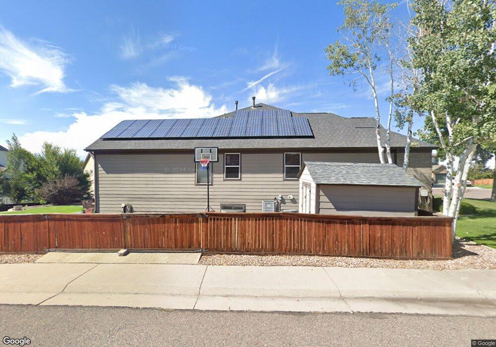
2059 E 101st Way Thornton, CO 80229
Quimby NeighborhoodEstimated Value: $611,320 - $713,000
4
Beds
2
Baths
2,499
Sq Ft
$264/Sq Ft
Est. Value
About This Home
This home is located at 2059 E 101st Way, Thornton, CO 80229 and is currently estimated at $659,080, approximately $263 per square foot. 2059 E 101st Way is a home located in Adams County with nearby schools including Thornton Elementary School, Thornton Middle School, and Thornton High School.
Ownership History
Date
Name
Owned For
Owner Type
Purchase Details
Closed on
Apr 7, 2023
Sold by
Baker Todd E
Bought by
Todd And Stacie Baker Family Trust
Current Estimated Value
Purchase Details
Closed on
Dec 31, 2001
Sold by
Pulte Home Corp
Bought by
Baker Todd E and Baker Stacie L
Home Financials for this Owner
Home Financials are based on the most recent Mortgage that was taken out on this home.
Original Mortgage
$262,600
Interest Rate
7.62%
Create a Home Valuation Report for This Property
The Home Valuation Report is an in-depth analysis detailing your home's value as well as a comparison with similar homes in the area
Home Values in the Area
Average Home Value in this Area
Purchase History
We collect this data history from publicly available records. To have your information removed, we recommend requesting removal directly through your county’s website.
| Date | Buyer | Sale Price | Title Company |
|---|---|---|---|
| Todd And Stacie Baker Family Trust | -- | None Listed On Document | |
| Baker Todd E | $328,899 | Land Title Guarantee Company |
Source: Public Records
Mortgage History
We collect this data history from publicly available records. To have your information removed, we recommend requesting removal directly through your county’s website.
| Date | Status | Borrower | Loan Amount |
|---|---|---|---|
| Previous Owner | Baker Todd E | $262,600 |
Source: Public Records
Tax History
| Year | Tax Paid | Tax Assessment Tax Assessment Total Assessment is a certain percentage of the fair market value that is determined by local assessors to be the total taxable value of land and additions on the property. | Land | Improvement |
|---|---|---|---|---|
| 2025 | $4,251 | $43,040 | $9,180 | $33,860 |
| 2024 | $4,251 | $39,570 | $8,440 | $31,130 |
| 2023 | $4,208 | $44,780 | $7,640 | $37,140 |
| 2022 | $3,750 | $34,040 | $7,850 | $26,190 |
| 2021 | $3,876 | $34,040 | $7,850 | $26,190 |
| 2020 | $3,625 | $32,490 | $8,080 | $24,410 |
| 2019 | $3,632 | $32,490 | $8,080 | $24,410 |
| 2018 | $3,449 | $29,970 | $6,120 | $23,850 |
| 2017 | $3,136 | $29,970 | $6,120 | $23,850 |
| 2016 | $3,245 | $30,200 | $4,860 | $25,340 |
| 2015 | $3,241 | $30,200 | $4,860 | $25,340 |
| 2014 | $2,774 | $25,130 | $4,460 | $20,670 |
Source: Public Records
Map
Nearby Homes
- 1972 E 102nd Cir
- 1971 E 103rd Ave
- 10221 York Place
- 1852 E 99th Ave
- 2285 E 103rd Place
- 10037 Clayton St
- 10088 Elizabeth St
- 1838 E 98th Ave
- 9900 Franklin St
- 2631 E 102nd Place
- 2651 E 102nd Place
- 2632 E 103rd Ave
- 2652 E 103rd Ave
- 1792 E 97th Ave
- 10444 Franklin Way
- 2702 E 103rd Ave
- 1696 E 96th Way
- 2621 E 98th Ave
- 10488 Lafayette St
- 1741 E 105th Place
- 2069 E 101st Way
- 10154 Vine Ct
- 10134 Vine Ct
- 2068 E 101st Way
- 2058 E 101st Way
- 10164 Vine Ct
- 2048 E 101st Way
- 2079 E 101st Way
- 10174 Vine Ct
- 10104 Vine Ct
- 2099 E 101st Way
- 2118 E 101st Way
- 2089 E 101st Way
- 10184 Vine Ct
- 2153 E 101st Place
- 10145 Vine Ct
- 10135 Vine Ct
- 10074 Vine Ct
- 10155 Vine Ct
- 2128 E 101st Way
Your Personal Tour Guide
Ask me questions while you tour the home.