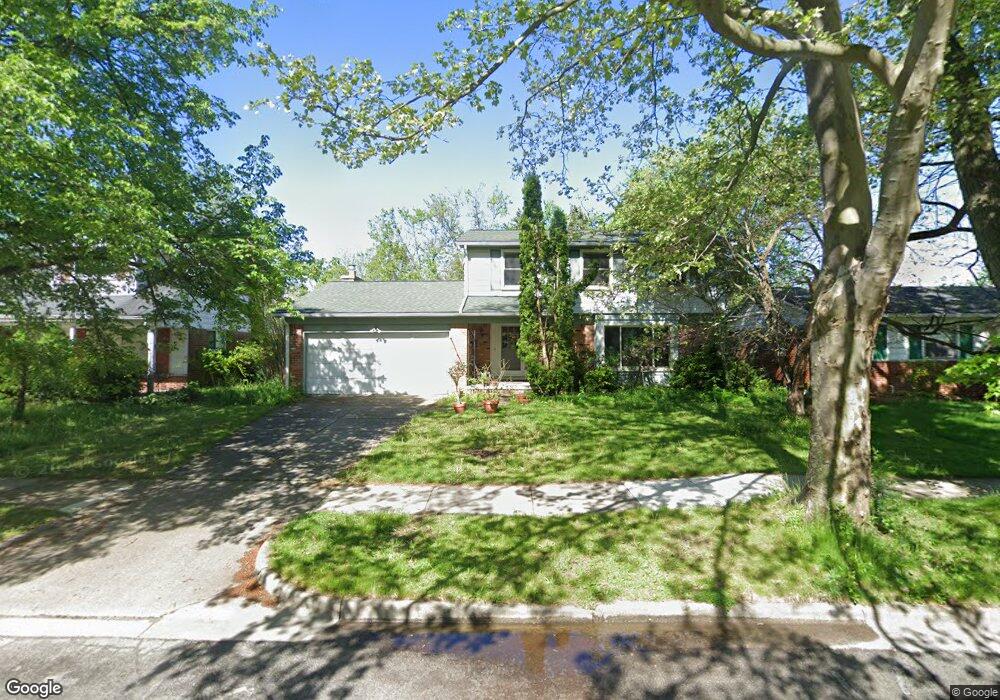
2059 Georgetown Blvd Ann Arbor, MI 48105
Orchard Hills-Maplewood NeighborhoodEstimated Value: $553,505 - $614,000
4
Beds
3
Baths
1,886
Sq Ft
$305/Sq Ft
Est. Value
About This Home
This home is located at 2059 Georgetown Blvd, Ann Arbor, MI 48105 and is currently estimated at $575,876, approximately $305 per square foot. 2059 Georgetown Blvd is a home located in Washtenaw County with nearby schools including Thurston Elementary School, Clague Middle School, and Huron High School.
Ownership History
Date
Name
Owned For
Owner Type
Purchase Details
Closed on
Jun 26, 2006
Sold by
Hutcheson Grace
Bought by
Weber Sagan Bruce Eli and Weber Chandler Sarah
Current Estimated Value
Home Financials for this Owner
Home Financials are based on the most recent Mortgage that was taken out on this home.
Original Mortgage
$180,000
Outstanding Balance
$107,333
Interest Rate
6.73%
Mortgage Type
Unknown
Estimated Equity
$468,543
Create a Home Valuation Report for This Property
The Home Valuation Report is an in-depth analysis detailing your home's value as well as a comparison with similar homes in the area
Home Values in the Area
Average Home Value in this Area
Purchase History
| Date | Buyer | Sale Price | Title Company |
|---|---|---|---|
| Weber Sagan Bruce Eli | $280,000 | None Available |
Source: Public Records
Mortgage History
| Date | Status | Borrower | Loan Amount |
|---|---|---|---|
| Open | Weber Sagan Bruce Eli | $180,000 |
Source: Public Records
Tax History Compared to Growth
Tax History
| Year | Tax Paid | Tax Assessment Tax Assessment Total Assessment is a certain percentage of the fair market value that is determined by local assessors to be the total taxable value of land and additions on the property. | Land | Improvement |
|---|---|---|---|---|
| 2025 | $10,243 | $252,900 | $0 | $0 |
| 2024 | $8,606 | $239,600 | $0 | $0 |
| 2023 | $7,947 | $214,200 | $0 | $0 |
| 2022 | $9,618 | $200,700 | $0 | $0 |
| 2021 | $9,346 | $195,100 | $0 | $0 |
| 2020 | $9,052 | $184,900 | $0 | $0 |
| 2019 | $8,634 | $170,300 | $170,300 | $0 |
| 2018 | $8,471 | $157,800 | $0 | $0 |
| 2017 | $8,172 | $158,600 | $0 | $0 |
| 2016 | $6,359 | $128,696 | $0 | $0 |
| 2015 | $7,636 | $128,312 | $0 | $0 |
| 2014 | $7,636 | $124,304 | $0 | $0 |
| 2013 | -- | $124,304 | $0 | $0 |
Source: Public Records
Map
Nearby Homes
- 2182 Yorktown Dr
- 4990 Saddleridge
- 4763 Curtis
- 2656 Shefman Terrace
- 2605 Nadia Ct Unit 8
- 3024 Bolgos Cir Unit 303
- 2626 Traver Blvd
- 0000 Nixon Rd
- 1 Westbury Ct
- 3629 Frederick Dr
- 4 Haverhill Ct
- 3367 Burbank Dr
- 3252 Bolgos Cir
- 2901 Corston Rd
- 2782 Maitland Dr
- 2824 Ridington Rd
- 2759 Bristol Ridge Dr
- 2805 Rathmore Ln
- 3427 E Dobson Place
- 2856 Barclay Way Unit 38
- 2067 Georgetown Blvd
- 2075 Georgetown Blvd
- 2051 Georgetown Blvd
- 2043 Georgetown Blvd
- 2072 Georgetown Blvd
- 2053 Yorktown Dr
- 2190 Ardenne Dr
- 2035 Georgetown Blvd
- 2080 Georgetown Blvd
- 2050 Yorktown Dr
- 2065 Yorktown Dr
- 2110 Ardenne Dr
- 2027 Georgetown Blvd
- 2088 Georgetown Blvd
- 2120 Ardenne Dr
- 2056 Yorktown Dr
- 0 Ardenne Dr
- 2130 Ardenne Dr
- 2024 Georgetown Blvd
- 2150 Ardenne Dr