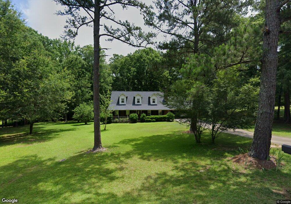
2059 Mountain Laurel Rd Lancaster, SC 29720
Estimated Value: $287,000 - $361,000
Studio
2
Baths
2,059
Sq Ft
$156/Sq Ft
Est. Value
About This Home
This home is located at 2059 Mountain Laurel Rd, Lancaster, SC 29720 and is currently estimated at $321,634, approximately $156 per square foot. 2059 Mountain Laurel Rd is a home located in Lancaster County with nearby schools including Brooklyn Springs Elementary School, South Middle School, and Lancaster High School.
Ownership History
Date
Name
Owned For
Owner Type
Purchase Details
Closed on
Feb 25, 2022
Sold by
Moore Sharon K
Bought by
Moore Christopher Evan
Current Estimated Value
Home Financials for this Owner
Home Financials are based on the most recent Mortgage that was taken out on this home.
Original Mortgage
$5,000
Interest Rate
3.14%
Mortgage Type
Purchase Money Mortgage
Create a Home Valuation Report for This Property
The Home Valuation Report is an in-depth analysis detailing your home's value as well as a comparison with similar homes in the area
Home Values in the Area
Average Home Value in this Area
Purchase History
| Date | Buyer | Sale Price | Title Company |
|---|---|---|---|
| Moore Christopher Evan | $20,000 | Jones Ryan S | |
| Moore Christopher Evan | $20,000 | None Listed On Document |
Source: Public Records
Mortgage History
| Date | Status | Borrower | Loan Amount |
|---|---|---|---|
| Closed | Moore Christopher Evan | $5,000 |
Source: Public Records
Tax History
| Year | Tax Paid | Tax Assessment Tax Assessment Total Assessment is a certain percentage of the fair market value that is determined by local assessors to be the total taxable value of land and additions on the property. | Land | Improvement |
|---|---|---|---|---|
| 2025 | $1,246 | $9,343 | $394 | $8,949 |
| 2024 | $1,246 | $8,124 | $548 | $7,576 |
| 2023 | $1,241 | $8,124 | $548 | $7,576 |
| 2022 | $1,237 | $8,124 | $548 | $7,576 |
| 2021 | $1,210 | $8,124 | $548 | $7,576 |
| 2020 | $1,154 | $7,532 | $548 | $6,984 |
| 2019 | $2,546 | $7,532 | $548 | $6,984 |
| 2018 | $2,450 | $7,532 | $548 | $6,984 |
| 2017 | $1,128 | $0 | $0 | $0 |
| 2016 | $1,100 | $0 | $0 | $0 |
| 2015 | $896 | $0 | $0 | $0 |
| 2014 | $896 | $0 | $0 | $0 |
| 2013 | $896 | $0 | $0 | $0 |
Source: Public Records
Map
Nearby Homes
- 175 Bailey Rd
- 2425 Kershaw Camden Hwy
- 992 S Potter Rd
- 2429 Bartlett St
- 2538 Old Camden Hwy
- 1171 Hilldale Dr
- 1087 Greenbriar Dr
- 0 S Potter Rd
- 2748 Flat Creek Rd
- 4046 W Fairmeadow Dr
- 3461 E Fairmeadow Dr
- 452 Providence Rd
- 03 Old Camden Hwy
- 01 Old Camden Hwy
- 11.53 acres Old Camden Hwy
- 02 Old Camden Hwy
- 00 Old Camden Hwy
- 2488 Cane Mill Rd
- 2990 Flat Creek Rd
- 2509 Oxford Cir
- 2067 Mount Laurel Rd
- 2050 Mount Laurel Rd
- 2056 Mount Laurel Rd
- 2066 Mount Laurel Rd
- 591 Community Ln
- 2093 Mountain Laurel Rd
- 559 Community Ln
- 2076 Mount Laurel Rd
- 2012 Mountain Laurel Rd
- 545 Community Ln
- 611 Community Ln
- 578 Community Ln
- 1983 Mountain Laurel Rd
- 588 Community Ln
- 556 Community Ln
- 2104 Mount Laurel Rd
- 2227 Howle St
- 522 Community Ln
- 2242 Howle St
- 703 Community Ln
Your Personal Tour Guide
Ask me questions while you tour the home.