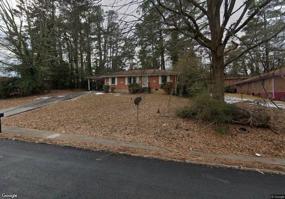
2059 Shamrock Dr Decatur, GA 30032
Estimated Value: $185,430 - $228,000
3
Beds
1
Bath
1,100
Sq Ft
$184/Sq Ft
Est. Value
About This Home
This home is located at 2059 Shamrock Dr, Decatur, GA 30032 and is currently estimated at $202,608, approximately $184 per square foot. 2059 Shamrock Dr is a home located in DeKalb County with nearby schools including Columbia Elementary School, Columbia Middle School, and Columbia High School.
Ownership History
Date
Name
Owned For
Owner Type
Purchase Details
Closed on
Feb 28, 2001
Sold by
Parker Irene L
Bought by
Brown Virginia
Current Estimated Value
Home Financials for this Owner
Home Financials are based on the most recent Mortgage that was taken out on this home.
Original Mortgage
$78,764
Outstanding Balance
$28,766
Interest Rate
7.06%
Mortgage Type
FHA
Estimated Equity
$173,842
Create a Home Valuation Report for This Property
The Home Valuation Report is an in-depth analysis detailing your home's value as well as a comparison with similar homes in the area
Home Values in the Area
Average Home Value in this Area
Purchase History
| Date | Buyer | Sale Price | Title Company |
|---|---|---|---|
| Brown Virginia | $80,000 | -- | |
| Brown Virginia | -- | -- |
Source: Public Records
Mortgage History
| Date | Status | Borrower | Loan Amount |
|---|---|---|---|
| Open | Brown Virginia | $78,764 |
Source: Public Records
Tax History Compared to Growth
Tax History
| Year | Tax Paid | Tax Assessment Tax Assessment Total Assessment is a certain percentage of the fair market value that is determined by local assessors to be the total taxable value of land and additions on the property. | Land | Improvement |
|---|---|---|---|---|
| 2024 | $652 | $71,160 | $24,600 | $46,560 |
| 2023 | $652 | $62,360 | $24,600 | $37,760 |
| 2022 | $1,357 | $47,400 | $8,000 | $39,400 |
| 2021 | $1,346 | $46,880 | $8,000 | $38,880 |
| 2020 | $1,298 | $44,640 | $8,000 | $36,640 |
| 2019 | $1,165 | $39,200 | $8,000 | $31,200 |
| 2018 | $772 | $30,600 | $8,000 | $22,600 |
| 2017 | $740 | $22,680 | $3,200 | $19,480 |
| 2016 | $638 | $20,160 | $3,200 | $16,960 |
| 2014 | $412 | $13,320 | $3,200 | $10,120 |
Source: Public Records
Map
Nearby Homes
- 2064 Shamrock Dr
- 2030 Shamrock Dr
- 3235 Mcafee Rd
- 3199 Mcafee Rd
- 2004 Shamrock Dr
- 1990 Shamrock Dr
- 1986 Bandera Dr
- 3297 Sheffield Cir
- 3168 Mcafee Rd
- 2135 Kilarney Rd
- 2050 Oak Park Ln
- 2167 Kilarney Rd
- 2033 Oak Park Ln
- 2024 Rosewood Rd
- 2009 Oak Park Ln Unit 2009
- 2043 Columbia Dr
- 2003 Rosewood Rd
- 2048 Glendale Dr
- 1882 Rosewood Rd
- 1968 Rosewood Rd
- 3233 Sandusky Dr
- 3227 Sandusky Dr
- 3221 Sandusky Dr
- 2058 Shamrock Dr
- 3217 Sandusky Dr
- 3217 Sandusky Dr
- 2052 Shamrock Dr
- 2070 Shamrock Dr
- 2046 Shamrock Dr
- 3232 Sandusky Dr
- 3226 Sandusky Dr
- 2076 Shamrock Dr
- 2040 Shamrock Dr
- 3220 Sandusky Dr
- 2082 Shamrock Dr
- 2031 Shamrock Dr
- 2036 Shamrock Dr
- 3205 Sandusky Dr
- 3216 Sandusky Dr
- 0 Shamrock Dr Unit 8471373