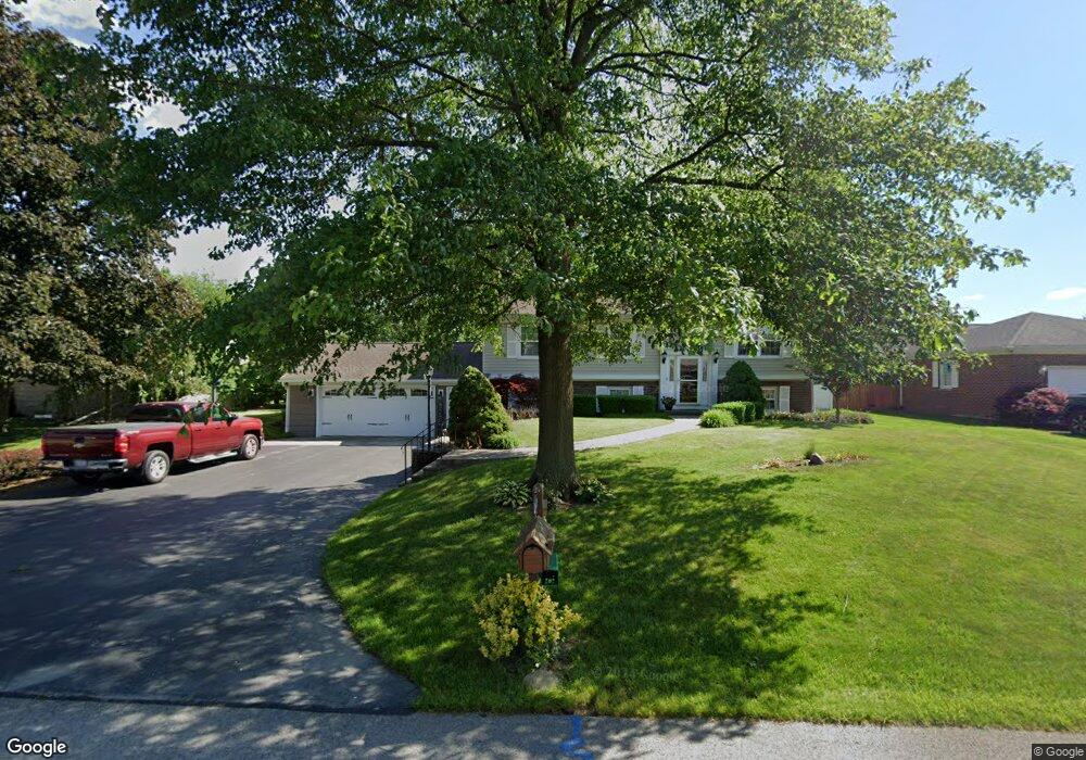
2059 Victor St Fremont, OH 43420
Estimated Value: $252,000 - $315,000
3
Beds
2
Baths
2,369
Sq Ft
$119/Sq Ft
Est. Value
About This Home
This home is located at 2059 Victor St, Fremont, OH 43420 and is currently estimated at $281,649, approximately $118 per square foot. 2059 Victor St is a home located in Sandusky County with nearby schools including Fremont Ross High School, Sacred Heart School, and Temple Christian Academy.
Ownership History
Date
Name
Owned For
Owner Type
Purchase Details
Closed on
Jan 9, 2010
Sold by
Alt Jerome H and Alt Marcia A
Bought by
Alt Jerome H and Alt Marcia A
Current Estimated Value
Purchase Details
Closed on
Dec 23, 2002
Sold by
Light Timothy M
Bought by
Alt Jerome H and Alt Marcia A
Purchase Details
Closed on
Sep 27, 1996
Sold by
Clark Russell M
Bought by
Light Timothy M and Light Robin C
Home Financials for this Owner
Home Financials are based on the most recent Mortgage that was taken out on this home.
Original Mortgage
$89,250
Interest Rate
7.97%
Mortgage Type
New Conventional
Purchase Details
Closed on
May 1, 1989
Bought by
Alt Jerome H & Marcia A Trustees
Create a Home Valuation Report for This Property
The Home Valuation Report is an in-depth analysis detailing your home's value as well as a comparison with similar homes in the area
Home Values in the Area
Average Home Value in this Area
Purchase History
| Date | Buyer | Sale Price | Title Company |
|---|---|---|---|
| Alt Jerome H | -- | None Available | |
| Alt Jerome H | $158,000 | -- | |
| Light Timothy M | $105,000 | -- | |
| Alt Jerome H & Marcia A Trustees | $70,000 | -- |
Source: Public Records
Mortgage History
| Date | Status | Borrower | Loan Amount |
|---|---|---|---|
| Previous Owner | Light Timothy M | $89,250 |
Source: Public Records
Tax History Compared to Growth
Tax History
| Year | Tax Paid | Tax Assessment Tax Assessment Total Assessment is a certain percentage of the fair market value that is determined by local assessors to be the total taxable value of land and additions on the property. | Land | Improvement |
|---|---|---|---|---|
| 2024 | $2,205 | $66,470 | $12,920 | $53,550 |
| 2023 | $2,205 | $56,360 | $10,960 | $45,400 |
| 2022 | $1,978 | $56,360 | $10,960 | $45,400 |
| 2021 | $2,039 | $56,360 | $10,960 | $45,400 |
| 2020 | $1,873 | $51,630 | $10,960 | $40,670 |
| 2019 | $1,871 | $51,630 | $10,960 | $40,670 |
| 2018 | $1,821 | $51,630 | $10,960 | $40,670 |
| 2017 | $1,748 | $49,710 | $10,960 | $38,750 |
| 2016 | $1,533 | $49,710 | $10,960 | $38,750 |
| 2015 | $1,508 | $49,710 | $10,960 | $38,750 |
| 2014 | $1,462 | $46,800 | $10,850 | $35,950 |
| 2013 | $1,431 | $46,800 | $10,850 | $35,950 |
Source: Public Records
Map
Nearby Homes
- 199 Saint Thomas Dr
- 251 Saint Paul Dr
- 315 Ethan Dr
- 2248 E State St
- 318 Ethan Dr
- 263 Saint Paul Dr
- 1526 Sunrise Blvd
- 800 Lawndale Dr
- 546 Oaklawn Ave
- 1014 S County Road 198
- 230 N Pennsylvania Ave
- 314 S Collinwood Blvd
- 924 Birdseye Blvd
- 906 Amsden Blvd
- 714 E State St
- 0 S Buchanan St
- 600 S Buchanan St
- 322 4th St
- 612 2nd St
- 533 Sandusky Ave Unit 535
- 2071 Victor St
- 2045 Victor St
- 2097 Victor St
- 2037 Victor St
- 152 Saint Thomas Dr
- 151 Saint Paul Dr
- 153 Saint Thomas Dr
- 2105 Victor St
- 168 Saint Thomas Dr
- 167 Saint Paul Dr
- 171 Saint Thomas Dr
- 122 Saint Paul Dr
- 132 Saint Paul Dr
- 140 Saint Paul Dr
- 180 Saint Thomas Dr
- 144 Norbert Dr
- 158 Norbert Dr
- 179 Saint Thomas Dr
- 132 Norbert Dr
- 183 Saint Paul Dr