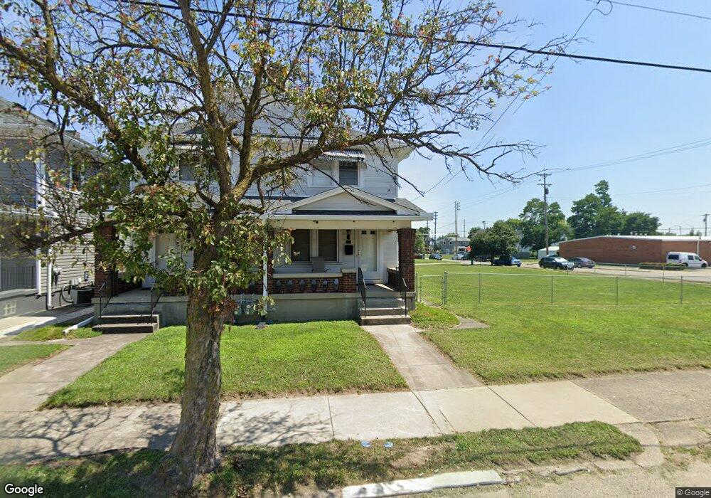
206 Brandt St Dayton, OH 45404
Old North Dayton NeighborhoodEstimated Value: $144,000 - $245,000
6
Beds
3
Baths
2,860
Sq Ft
$67/Sq Ft
Est. Value
About This Home
This home is located at 206 Brandt St, Dayton, OH 45404 and is currently estimated at $191,670, approximately $67 per square foot. 206 Brandt St is a home located in Montgomery County with nearby schools including Kiser Elementary, Ruskin Elementary School, and Pathway School of Discovery.
Ownership History
Date
Name
Owned For
Owner Type
Purchase Details
Closed on
Jul 16, 2009
Sold by
Thomas Michelle L
Bought by
Thomas Kenneth E
Current Estimated Value
Home Financials for this Owner
Home Financials are based on the most recent Mortgage that was taken out on this home.
Original Mortgage
$60,000
Outstanding Balance
$39,398
Interest Rate
5.43%
Mortgage Type
New Conventional
Estimated Equity
$152,272
Purchase Details
Closed on
Feb 1, 1994
Sold by
Thomas Edward B and Thomas Marie V
Bought by
Thomas Kenneth E and Thomas Michelle L
Create a Home Valuation Report for This Property
The Home Valuation Report is an in-depth analysis detailing your home's value as well as a comparison with similar homes in the area
Home Values in the Area
Average Home Value in this Area
Purchase History
| Date | Buyer | Sale Price | Title Company |
|---|---|---|---|
| Thomas Kenneth E | -- | Attorney | |
| Thomas Kenneth E | -- | -- |
Source: Public Records
Mortgage History
| Date | Status | Borrower | Loan Amount |
|---|---|---|---|
| Open | Thomas Kenneth E | $60,000 |
Source: Public Records
Tax History Compared to Growth
Tax History
| Year | Tax Paid | Tax Assessment Tax Assessment Total Assessment is a certain percentage of the fair market value that is determined by local assessors to be the total taxable value of land and additions on the property. | Land | Improvement |
|---|---|---|---|---|
| 2024 | $1,950 | $33,200 | $3,980 | $29,220 |
| 2023 | $1,950 | $33,200 | $3,980 | $29,220 |
| 2022 | $2,141 | $28,300 | $3,400 | $24,900 |
| 2021 | $2,130 | $28,300 | $3,400 | $24,900 |
| 2020 | $1,717 | $22,710 | $3,400 | $19,310 |
| 2019 | $1,874 | $22,410 | $2,860 | $19,550 |
| 2018 | $1,877 | $22,410 | $2,860 | $19,550 |
| 2017 | $1,864 | $22,410 | $2,860 | $19,550 |
| 2016 | $1,830 | $20,900 | $2,720 | $18,180 |
| 2015 | $1,733 | $20,900 | $2,720 | $18,180 |
| 2014 | $1,733 | $20,900 | $2,720 | $18,180 |
| 2012 | -- | $22,250 | $5,610 | $16,640 |
Source: Public Records
Map
Nearby Homes
- 1083 Valley St
- 1304 Valley St
- 544 Brandt St
- 175 Rita St
- 304 Alaska St
- 129 Rita St
- 240 Alaska St
- 1020 Saint Adelbert Ave
- 233 Alton Ave
- 188 Alton Ave
- 1815 Warner Ave
- 111 Alaska St
- 159 Alton Ave Unit 157
- 144 Alton Ave
- 70 Baltimore St
- 96 Notre Dame Ave
- 36 Baltimore St
- 82 Notre Dame Ave
- 260 Grove Ave
- 329 Grove Ave
- 206 Brandt St Unit 208
- 218 Brandt St
- 2121 Stanview Ave
- 2123 Stanview Ave
- 306 Brandt St
- 211 Brandt St
- 2127 Stanview Ave
- 2129 Stanview Ave
- 2130 Stegman Ave
- 201 Brandt St
- 217 Brandt St
- 2117 Stegman Ave
- 2125 Stegman Ave
- 113 Brandt St
- 119 Brandt St
- 1089 Valley St
- 307 Brandt St
- 1085 Valley St
- 115 Brandt St
- 115 Brandt St Unit A