Estimated Value: $211,000 - $296,000
3
Beds
1
Bath
1,026
Sq Ft
$249/Sq Ft
Est. Value
About This Home
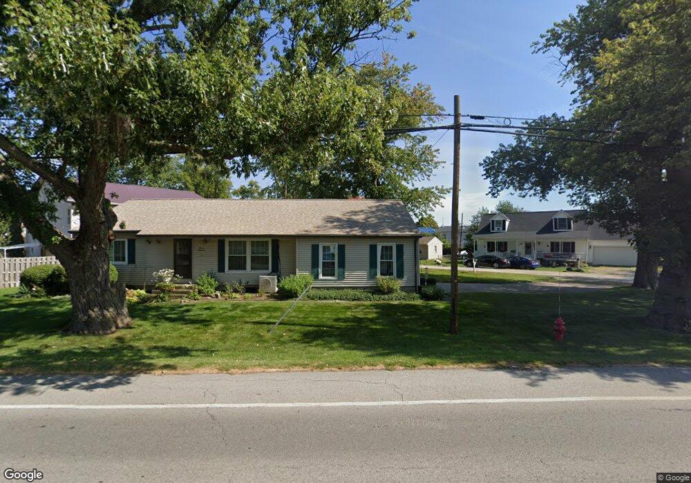
This home is located at 206 Erie Ave, Huron, OH 44839 and is currently estimated at $255,933, approximately $249 per square foot. 206 Erie Ave is a home located in Erie County with nearby schools including Woodlands Intermediate School, Shawnee Elementary School, and McCormick Junior High School.
Ownership History
Date
Name
Owned For
Owner Type
Purchase Details
Closed on
Dec 9, 2021
Sold by
Wade Glen L
Bought by
Bystricky Joseph M and Bystricky Kelly D
Current Estimated Value
Home Financials for this Owner
Home Financials are based on the most recent Mortgage that was taken out on this home.
Original Mortgage
$120,000
Outstanding Balance
$110,413
Interest Rate
3.14%
Mortgage Type
New Conventional
Estimated Equity
$145,520
Purchase Details
Closed on
Mar 11, 2008
Sold by
Wade Wade Glen L Glen L
Bought by
Wade Glen L
Create a Home Valuation Report for This Property
The Home Valuation Report is an in-depth analysis detailing your home's value as well as a comparison with similar homes in the area
Home Values in the Area
Average Home Value in this Area
Purchase History
| Date | Buyer | Sale Price | Title Company |
|---|---|---|---|
| Bystricky Joseph M | $225,000 | Hartung Title Order | |
| Wade Glen L | -- | None Available |
Source: Public Records
Mortgage History
| Date | Status | Borrower | Loan Amount |
|---|---|---|---|
| Open | Bystricky Joseph M | $120,000 |
Source: Public Records
Tax History Compared to Growth
Tax History
| Year | Tax Paid | Tax Assessment Tax Assessment Total Assessment is a certain percentage of the fair market value that is determined by local assessors to be the total taxable value of land and additions on the property. | Land | Improvement |
|---|---|---|---|---|
| 2024 | $3,210 | $76,884 | $14,742 | $62,142 |
| 2023 | $3,210 | $73,153 | $13,104 | $60,049 |
| 2022 | $3,106 | $73,150 | $13,104 | $60,046 |
| 2021 | $3,067 | $30,730 | $13,100 | $17,630 |
| 2020 | $1,296 | $29,810 | $13,100 | $16,710 |
| 2019 | $1,352 | $29,810 | $13,100 | $16,710 |
| 2018 | $1,359 | $29,810 | $13,100 | $16,710 |
| 2017 | $1,344 | $28,620 | $13,760 | $14,860 |
| 2016 | $1,302 | $28,620 | $13,760 | $14,860 |
| 2015 | $1,303 | $28,620 | $13,760 | $14,860 |
| 2014 | $1,318 | $28,620 | $13,760 | $14,860 |
| 2013 | $1,300 | $28,620 | $13,760 | $14,860 |
Source: Public Records
Map
Nearby Homes
- 1003 Cleveland Rd W
- 1311 Cleveland Rd W Unit 6
- 416 Wexford Dr
- 720 Strowbridge Dr
- 748 Chestnut Ln
- 11 Turtle Bay
- 620 Cleveland Rd W
- 319 Ironwood Rd
- 301 Gumwood Rd
- 216 Marion Ave
- 505 Liberty Dr Unit 9B
- 2016 Cleveland Rd W
- 932 Glenview Dr
- 40 Poplar St
- 919 Glenview Dr
- 41 Poplar St
- 346 Main St
- 220 Overlook Rd
- 224 Atwood Place
- 2008 Shore Dr
- 0 Erie Ave
- 201 Ashland Ave
- 203 Ashland Ave
- 205 Ashland Ave
- 214 Erie Ave
- 202 Erie Ave
- 211 Erie Ave
- 1113 Cleveland Rd W
- 216 Erie Ave
- 211 Ashland Ave
- 211 Ashland Ave
- 205 Erie Ave
- 218 Erie Ave
- 202 Ashland Ave
- 1205 Cleveland Rd W
- 215 Ashland Ave
- 203 Erie Ave
- 1107 Cleveland Rd W
- 204 Ashland Ave
- 1204 Cleveland Rd W