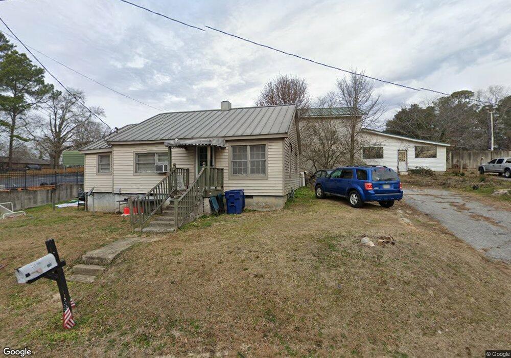
206 Foster Ave W Dallas, GA 30132
Estimated Value: $170,000 - $277,000
2
Beds
1
Bath
1,012
Sq Ft
$207/Sq Ft
Est. Value
About This Home
This home is located at 206 Foster Ave W, Dallas, GA 30132 and is currently estimated at $209,239, approximately $206 per square foot. 206 Foster Ave W is a home located in Paulding County with nearby schools including Dallas Elementary School, Herschel Jones Middle School, and Paulding County High School.
Ownership History
Date
Name
Owned For
Owner Type
Purchase Details
Closed on
Apr 1, 2011
Sold by
Benson Funeral Home Inc
Bought by
Hill James M
Current Estimated Value
Home Financials for this Owner
Home Financials are based on the most recent Mortgage that was taken out on this home.
Original Mortgage
$33,400
Interest Rate
4.92%
Mortgage Type
Trade
Purchase Details
Closed on
Jan 27, 2004
Sold by
Benson James
Bought by
Hill James M
Home Financials for this Owner
Home Financials are based on the most recent Mortgage that was taken out on this home.
Original Mortgage
$43,200
Interest Rate
5.81%
Create a Home Valuation Report for This Property
The Home Valuation Report is an in-depth analysis detailing your home's value as well as a comparison with similar homes in the area
Home Values in the Area
Average Home Value in this Area
Purchase History
| Date | Buyer | Sale Price | Title Company |
|---|---|---|---|
| Hill James M | $48,000 | -- | |
| Hill James M | $48,000 | -- |
Source: Public Records
Mortgage History
| Date | Status | Borrower | Loan Amount |
|---|---|---|---|
| Closed | Hill James M | $33,400 | |
| Previous Owner | Hill James M | $43,200 |
Source: Public Records
Tax History Compared to Growth
Tax History
| Year | Tax Paid | Tax Assessment Tax Assessment Total Assessment is a certain percentage of the fair market value that is determined by local assessors to be the total taxable value of land and additions on the property. | Land | Improvement |
|---|---|---|---|---|
| 2024 | $1,830 | $58,656 | $1,320 | $57,336 |
| 2023 | $1,718 | $56,812 | $1,280 | $55,532 |
| 2022 | $1,233 | $47,296 | $1,160 | $46,136 |
| 2021 | $738 | $25,400 | $1,432 | $23,968 |
| 2020 | $860 | $25,400 | $1,432 | $23,968 |
| 2019 | $956 | $27,880 | $1,680 | $26,200 |
| 2018 | $530 | $17,600 | $3,160 | $14,440 |
| 2017 | $561 | $16,160 | $3,160 | $13,000 |
| 2016 | $509 | $14,800 | $3,160 | $11,640 |
| 2015 | $454 | $14,760 | $3,160 | $11,600 |
| 2014 | $417 | $13,200 | $3,160 | $10,040 |
| 2013 | -- | $13,040 | $5,880 | $7,160 |
Source: Public Records
Map
Nearby Homes
- 216 Hardee St
- 208 Park St Unit 114
- 199 Highland Ave
- 353 Spring Ridge Path
- 0 Merchants Dr Unit 7658248
- 0 Merchants Dr Unit 10615716
- 217 Victory Dr
- 234 E Memorial Dr
- 157 Hampton Dr
- 193 Hampton Dr
- 156 Hampton Dr
- 176 Hampton Dr
- 211 Hampton Dr
- 0 Jimmy Campbell Pkwy Unit 10556704
- 0 Jimmy Campbell Pkwy Unit 7607737
- 250 E Memorial Dr
- 207 Confederate Ave
- 201 Oak View Ln
- 210 N Johnston St
- 313 Hardee St
- 309 Hardee St
- 241 Foster Ave W
- 245 W Foster Ave
- 245 Foster Ave W
- 103 Highland Ave
- 227 Foster Ave W
- 101 Highland Ave
- 489 Hardee St
- 109 Highland Ave
- 497 Hardee St
- 201 Foster Ave W
- 0 W Foster Ave Unit 8481906
- W W Foster Ave
- 499 Hardee St
- 151 Highland Ave
- 306 Hardee St
- 102 Highland Ave
- 112 Highland Ave
- 310 Hardee St