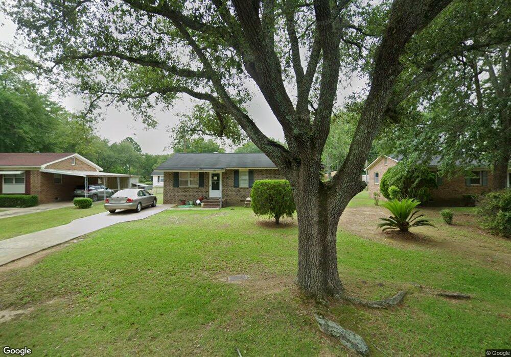
206 Lexington Dr Albany, GA 31705
Estimated Value: $66,000 - $83,449
3
Beds
2
Baths
1,148
Sq Ft
$62/Sq Ft
Est. Value
About This Home
This home is located at 206 Lexington Dr, Albany, GA 31705 and is currently estimated at $71,362, approximately $62 per square foot. 206 Lexington Dr is a home located in Dougherty County with nearby schools including Turner Elementary School, Albany Middle School, and Radium Springs Middle School.
Ownership History
Date
Name
Owned For
Owner Type
Purchase Details
Closed on
May 12, 2006
Sold by
Thomas Eddie
Bought by
Thomas Robert Lee
Current Estimated Value
Home Financials for this Owner
Home Financials are based on the most recent Mortgage that was taken out on this home.
Original Mortgage
$22,000
Interest Rate
6.09%
Mortgage Type
New Conventional
Purchase Details
Closed on
Nov 6, 2001
Sold by
Lawson Bruce J By Atty In Fact
Bought by
Thomas Eddie
Purchase Details
Closed on
Nov 17, 1999
Sold by
Bullock James Thomas By Delma Hope (Guar
Bought by
Lawson Bruce J
Purchase Details
Closed on
Mar 1, 1971
Sold by
Hatcher David
Bought by
Bullock James
Create a Home Valuation Report for This Property
The Home Valuation Report is an in-depth analysis detailing your home's value as well as a comparison with similar homes in the area
Home Values in the Area
Average Home Value in this Area
Purchase History
| Date | Buyer | Sale Price | Title Company |
|---|---|---|---|
| Thomas Robert Lee | $26,000 | -- | |
| Thomas Eddie | -- | -- | |
| Lawson Bruce J | $22,000 | -- | |
| Bullock James | -- | -- |
Source: Public Records
Mortgage History
| Date | Status | Borrower | Loan Amount |
|---|---|---|---|
| Closed | Thomas Robert Lee | $22,000 |
Source: Public Records
Tax History Compared to Growth
Tax History
| Year | Tax Paid | Tax Assessment Tax Assessment Total Assessment is a certain percentage of the fair market value that is determined by local assessors to be the total taxable value of land and additions on the property. | Land | Improvement |
|---|---|---|---|---|
| 2024 | $661 | $20,120 | $2,200 | $17,920 |
| 2023 | $0 | $20,120 | $2,200 | $17,920 |
| 2022 | $645 | $20,120 | $2,200 | $17,920 |
| 2021 | $590 | $20,120 | $2,200 | $17,920 |
| 2020 | $591 | $20,120 | $2,200 | $17,920 |
| 2019 | $593 | $20,120 | $2,200 | $17,920 |
| 2018 | $596 | $20,120 | $2,200 | $17,920 |
| 2017 | $547 | $20,120 | $2,200 | $17,920 |
| 2016 | $548 | $20,120 | $2,200 | $17,920 |
| 2015 | $549 | $20,120 | $2,200 | $17,920 |
| 2014 | $539 | $20,120 | $2,200 | $17,920 |
Source: Public Records
Map
Nearby Homes
- 308 Forrestal Ln
- 2725 Yorktown Ave
- 2731 Yorktown Ave
- 2529 Cherokee Dr
- 148 Force Dr
- 2523 Cherokee Dr
- 2802 Banks Ave
- 3007 E Park Ct
- 410 Johnson Rd
- 234 Cone St
- 513 Johnson Rd
- 405 Pine Bluff Rd
- 306 Elsom St
- 2921 Madeline Rd
- 2215 E Broad Ave
- 307 Acorn St
- 309 Acorn St
- 2006 Keystone Ave
- 2004 Keystone Ave
- 119 N West Rd
- 204 Lexington Dr
- 208 Lexington Dr
- 213 Enterprise Dr
- 215 Enterprise Dr
- 213 Enterprise Cir
- 215 Enterprise Cir
- 202 Lexington Dr
- 209 Lexington Dr
- 207 Lexington Dr
- 200 Lexington Dr
- 211 Enterprise Cir
- 205 Lexington Dr
- 210 Independence Dr
- 301 Independence Dr
- 203 Lexington Dr
- 301 Enterprise Dr
- 301 Lexington Dr
- 209 Enterprise Cir
- 201 Lexington Dr
- 302 Lexington Dr