206 Maple Tree Dr Bristol, TN 37620
Estimated Value: $281,626 - $400,000
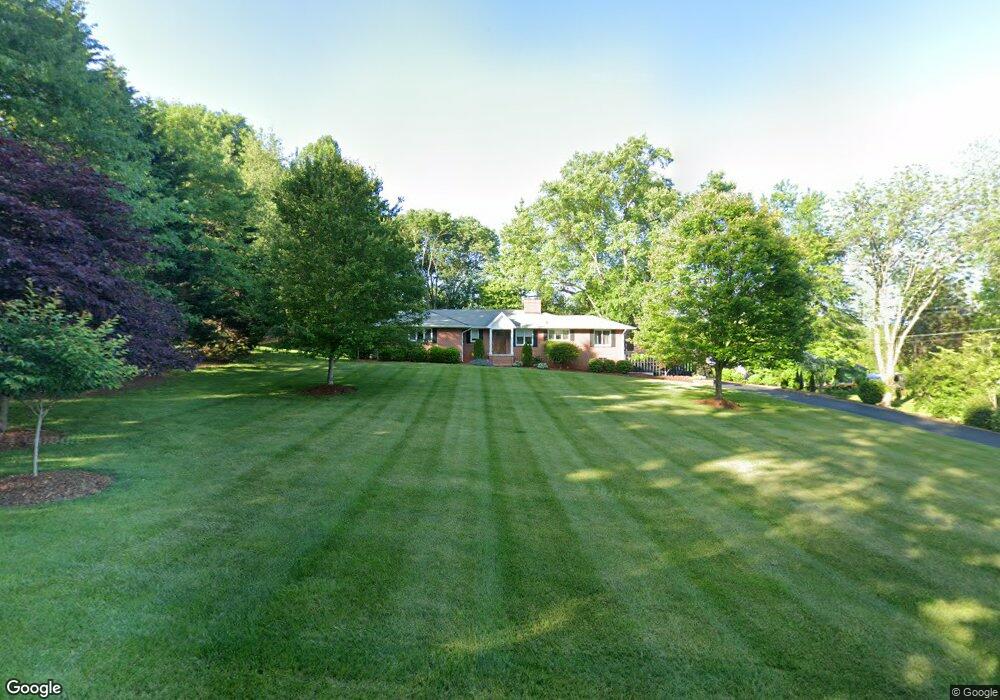
About This Home
This home is located at 206 Maple Tree Dr, Bristol, TN 37620 and is currently estimated at $342,657, approximately $103 per square foot. 206 Maple Tree Dr is a home located in Sullivan County with nearby schools including Anderson Elementary School, Vance Middle School, and Tennessee High School.
Ownership History
We collect this data history from publicly available records. To have your information removed, we recommend requesting removal directly through your county’s website.
Purchase Details
Purchase Details
Purchase Details
Home Financials for this Owner
Home Financials are based on the most recent Mortgage that was taken out on this home.Purchase Details
Purchase History
We collect this data history from publicly available records. To have your information removed, we recommend requesting removal directly through your county’s website.
| Date | Buyer | Sale Price | Title Company |
|---|---|---|---|
| -- | Tri City Title | ||
| -- | None Available | ||
| $125,000 | -- | ||
| $120,000 | -- |
Mortgage History
We collect this data history from publicly available records. To have your information removed, we recommend requesting removal directly through your county’s website.
| Date | Status | Borrower | Loan Amount |
|---|---|---|---|
| Previous Owner | $100,000 |
Tax History
We collect this data history from publicly available records. To have your information removed, we recommend requesting removal directly through your county’s website.
| Year | Tax Paid | Tax Assessment Tax Assessment Total Assessment is a certain percentage of the fair market value that is determined by local assessors to be the total taxable value of land and additions on the property. | Land | Improvement |
|---|---|---|---|---|
| 2025 | -- | $77,750 | $6,775 | $70,975 |
| 2024 | -- | $40,800 | $10,325 | $30,475 |
| 2023 | $1,792 | $40,800 | $10,325 | $30,475 |
| 2022 | $1,792 | $40,800 | $10,325 | $30,475 |
| 2021 | $1,792 | $40,800 | $10,325 | $30,475 |
| 2020 | $1,845 | $40,800 | $10,325 | $30,475 |
| 2019 | $1,845 | $39,000 | $10,325 | $28,675 |
| 2018 | $1,838 | $39,000 | $10,325 | $28,675 |
| 2017 | $1,838 | $39,000 | $10,325 | $28,675 |
| 2016 | $1,846 | $38,250 | $10,325 | $27,925 |
| 2014 | -- | $38,263 | $0 | $0 |
Map
- 617 Vance Dr
- 435 Shelby Ln
- 409 Shelby Ln
- 2 Serenity Ridge Trail
- 54 Three Oaks Dr
- 100 Earlway Rd
- 105 Dale Place
- 1461 Holston Dr
- Tbd Kelly Ridge Rd
- 117 Skyline Dr
- 314 Morris St
- 380 Glenwood Rd
- 302 Hale St
- 1300 Holston Dr
- Tbd Barber Rd
- 146 Cloudland Dr
- 208 Lynfield Rd
- 2118 King College Rd
- 1601 Edgemont Ave
- 1617 Tremont Ave
- 208 Maple Tree Dr
- 204 Maple Tree Dr
- 101 Mimosa Rd
- 202 Maple Tree Dr
- 200 Maple Tree Dr
- 212 Maple Tree Dr
- 209 Maple Tree Dr
- 207 Maple Tree Dr
- 105 Mimosa Rd
- 102 Mimosa Rd
- 205 Maple Tree Dr
- 214 Maple Tree Dr
- 203 Maple Tree Dr
- 102 Maple Tree Dr
- 213 Maple Tree Dr
- 201 Maple Tree Dr
- 111 Fieldcrest Rd
- 200 Fieldcrest Rd
- 0 Fieldcrest Rd
- 125 Lick Branch Rd
Ask me questions while you tour the home.