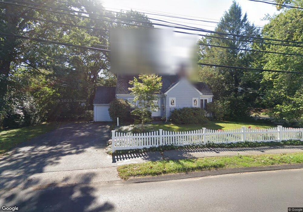
206 Marked Tree Rd Needham, MA 02492
Estimated Value: $920,000 - $1,260,983
2
Beds
2
Baths
952
Sq Ft
$1,127/Sq Ft
Est. Value
About This Home
This home is located at 206 Marked Tree Rd, Needham, MA 02492 and is currently estimated at $1,072,996, approximately $1,127 per square foot. 206 Marked Tree Rd is a home located in Norfolk County with nearby schools including Newman Elementary School, High Rock Middle School, and Pollard Middle School.
Ownership History
Date
Name
Owned For
Owner Type
Purchase Details
Closed on
Sep 5, 1997
Sold by
Andre Mary L and Andre Thomas J
Bought by
Jones Lynn C
Current Estimated Value
Purchase Details
Closed on
Nov 12, 1993
Sold by
Oconnor Robert W
Bought by
Andre Mary L and Andre Thomas J
Home Financials for this Owner
Home Financials are based on the most recent Mortgage that was taken out on this home.
Original Mortgage
$199,500
Interest Rate
6.79%
Mortgage Type
Purchase Money Mortgage
Purchase Details
Closed on
Dec 30, 1988
Sold by
Ryan Richard J
Bought by
Oconnor Robert W
Create a Home Valuation Report for This Property
The Home Valuation Report is an in-depth analysis detailing your home's value as well as a comparison with similar homes in the area
Home Values in the Area
Average Home Value in this Area
Purchase History
| Date | Buyer | Sale Price | Title Company |
|---|---|---|---|
| Jones Lynn C | $265,000 | -- | |
| Jones Lynn C | $265,000 | -- | |
| Andre Mary L | $210,000 | -- | |
| Andre Mary L | $210,000 | -- | |
| Oconnor Robert W | $212,000 | -- |
Source: Public Records
Mortgage History
| Date | Status | Borrower | Loan Amount |
|---|---|---|---|
| Previous Owner | Oconnor Robert W | $199,500 | |
| Previous Owner | Oconnor Robert W | $136,500 | |
| Previous Owner | Oconnor Robert W | $20,000 |
Source: Public Records
Tax History
| Year | Tax Paid | Tax Assessment Tax Assessment Total Assessment is a certain percentage of the fair market value that is determined by local assessors to be the total taxable value of land and additions on the property. | Land | Improvement |
|---|---|---|---|---|
| 2025 | $10,153 | $957,800 | $800,500 | $157,300 |
| 2024 | $7,448 | $594,900 | $430,900 | $164,000 |
| 2023 | $7,594 | $582,400 | $430,900 | $151,500 |
| 2022 | $7,229 | $540,700 | $395,500 | $145,200 |
| 2021 | $7,045 | $540,700 | $395,500 | $145,200 |
| 2020 | $6,758 | $541,100 | $395,500 | $145,600 |
| 2019 | $6,246 | $504,100 | $359,800 | $144,300 |
| 2018 | $5,989 | $504,100 | $359,800 | $144,300 |
| 2017 | $5,777 | $485,900 | $359,800 | $126,100 |
| 2016 | $5,628 | $487,700 | $359,800 | $127,900 |
| 2015 | $5,506 | $487,700 | $359,800 | $127,900 |
| 2014 | $5,087 | $437,000 | $313,100 | $123,900 |
Source: Public Records
Map
Nearby Homes
- 95 Deerfield Rd
- 620 High Rock St
- 287 High Rock St
- 73 Maple St Unit 1
- 189 Bridle Trail Rd
- 52 Hancock Rd
- 47 Emerson Rd
- 193 Garden St
- 3 Hancock Rd
- 233 Warren St
- 569 Chestnut St
- 90 Norfolk St
- 68 Pleasant St Unit 68
- 21 Brewster Dr
- 19 Highland Ct Unit 19
- 37 Carleton Dr
- 150 Laurel Dr
- 19 Mason Rd
- 19 Oakland Ave Unit 19
- 102 Jarvis Cir Unit 102
- 14 Barrett St
- 480 High Rock St
- 218 Marked Tree Rd
- 207 Marked Tree Rd
- 494 High Rock St
- 22 Barrett St
- 213 Marked Tree Rd
- 222 Marked Tree Rd
- 15 Barrett St
- 66 Avalon Rd
- 19 Barrett St
- 462 High Rock St
- 30 Barrett St
- 182 Marked Tree Rd
- 493 High Rock St
- 228 Marked Tree Rd
- 506 High Rock St
- 473 High Rock St
- 58 Avalon Rd
- 25 Barrett St
Your Personal Tour Guide
Ask me questions while you tour the home.