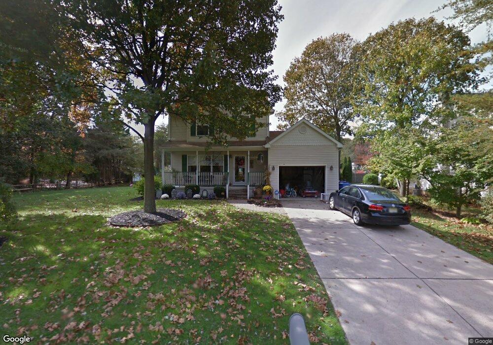
206 Monroe Ave Mantua, NJ 08051
Mantua Township NeighborhoodEstimated Value: $320,000 - $381,416
3
Beds
3
Baths
1,438
Sq Ft
$250/Sq Ft
Est. Value
About This Home
This home is located at 206 Monroe Ave, Mantua, NJ 08051 and is currently estimated at $359,354, approximately $249 per square foot. 206 Monroe Ave is a home located in Gloucester County with nearby schools including Centre City School, Clearview Regional Middle School, and Clearview Regional High School.
Ownership History
Date
Name
Owned For
Owner Type
Purchase Details
Closed on
Jan 30, 2002
Sold by
Schultes Peter W and Schultes Lisa M
Bought by
Mcanally Daniel M and Mcanally Suzanne
Current Estimated Value
Home Financials for this Owner
Home Financials are based on the most recent Mortgage that was taken out on this home.
Original Mortgage
$143,000
Outstanding Balance
$59,421
Interest Rate
7.13%
Estimated Equity
$299,933
Purchase Details
Closed on
Mar 21, 1997
Sold by
Cushman Development Corp
Bought by
Schultes Pete W
Purchase Details
Closed on
Jan 31, 1996
Sold by
Turkot Karl and Turkot Paul
Bought by
Cushman Development
Create a Home Valuation Report for This Property
The Home Valuation Report is an in-depth analysis detailing your home's value as well as a comparison with similar homes in the area
Home Values in the Area
Average Home Value in this Area
Purchase History
| Date | Buyer | Sale Price | Title Company |
|---|---|---|---|
| Mcanally Daniel M | $163,000 | -- | |
| Schultes Pete W | $124,850 | Congress Title Corp | |
| Cushman Development | $15,000 | Congress Title Corp |
Source: Public Records
Mortgage History
| Date | Status | Borrower | Loan Amount |
|---|---|---|---|
| Open | Mcanally Daniel M | $143,000 |
Source: Public Records
Tax History Compared to Growth
Tax History
| Year | Tax Paid | Tax Assessment Tax Assessment Total Assessment is a certain percentage of the fair market value that is determined by local assessors to be the total taxable value of land and additions on the property. | Land | Improvement |
|---|---|---|---|---|
| 2025 | $7,197 | $279,500 | $70,700 | $208,800 |
| 2024 | $7,122 | $279,500 | $70,700 | $208,800 |
| 2023 | $7,122 | $279,500 | $70,700 | $208,800 |
| 2022 | $6,695 | $191,400 | $50,700 | $140,700 |
| 2021 | $6,745 | $191,400 | $50,700 | $140,700 |
| 2020 | $6,691 | $191,400 | $50,700 | $140,700 |
| 2019 | $6,578 | $191,400 | $50,700 | $140,700 |
| 2018 | $6,485 | $191,400 | $50,700 | $140,700 |
| 2017 | $6,387 | $191,400 | $50,700 | $140,700 |
| 2016 | $6,314 | $191,400 | $50,700 | $140,700 |
| 2015 | $6,159 | $191,400 | $50,700 | $140,700 |
| 2014 | $5,953 | $191,400 | $50,700 | $140,700 |
Source: Public Records
Map
Nearby Homes
- 119 Monroe Ave
- 325 Bridgeton Pike
- 485 Harrison Ave
- 204 W Landing Rd
- 41 Woodbrook Dr Unit C041
- 8 Barry Dr
- 36 Bluebird Rd
- 1433 Tristram Cir
- 239 Tony Cir
- 590 Bridgeton Pike
- 17 Oakton Dr
- 1215 Tristram Cir
- 1145 Tristram Cir
- 1147 Tristram Cir Unit 1147
- 284 Columbus Dr
- 19 Marathon Dr
- 155 Whippoorwill Way
- 1134 Tristram Cir Unit 4
- 333 Jackson Rd
- 1121 Tristram Cir Unit 1
- 202 Monroe Ave
- 207 Taylor Ave
- 203 Taylor Ave
- 205 Monroe Ave
- 211 Taylor Ave
- 201 Monroe Ave
- 121 Taylor Ave
- 215 Monroe Ave
- 200 Taylor Ave
- 204 Lincoln Ave
- 219 Monroe Ave
- 117 Taylor Ave Unit 119
- 212 Taylor Ave
- 202 Lincoln Ave
- 120 Taylor Ave
- 118 Lincoln Ave
- 205 Lincoln Ave
- 222 Taylor Ave
- 115 Taylor Ave
- 225 Taylor Ave