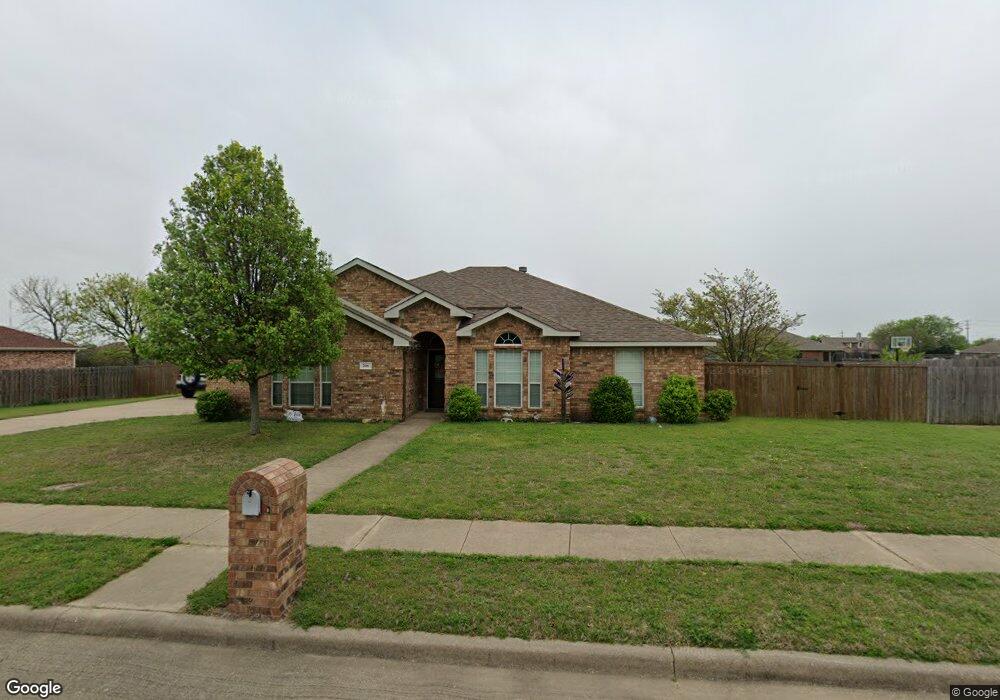
206 Mountain Peak Bend Midlothian, TX 76065
Estimated Value: $428,000 - $433,337
3
Beds
2
Baths
2,150
Sq Ft
$200/Sq Ft
Est. Value
About This Home
This home is located at 206 Mountain Peak Bend, Midlothian, TX 76065 and is currently estimated at $430,669, approximately $200 per square foot. 206 Mountain Peak Bend is a home located in Ellis County with nearby schools including Mount Peak Elementary School and Frank Seale Middle School.
Ownership History
Date
Name
Owned For
Owner Type
Purchase Details
Closed on
Jul 14, 2015
Sold by
Esberger Michael and Esberger Karen
Bought by
Woodard Bradley R and Woodard Lisa E
Current Estimated Value
Purchase Details
Closed on
Jan 19, 2006
Sold by
Choice Homes Inc
Bought by
Esberger Michel
Home Financials for this Owner
Home Financials are based on the most recent Mortgage that was taken out on this home.
Original Mortgage
$33,034
Interest Rate
6.24%
Mortgage Type
Stand Alone Second
Create a Home Valuation Report for This Property
The Home Valuation Report is an in-depth analysis detailing your home's value as well as a comparison with similar homes in the area
Home Values in the Area
Average Home Value in this Area
Purchase History
| Date | Buyer | Sale Price | Title Company |
|---|---|---|---|
| Woodard Bradley R | -- | None Available | |
| Esberger Michel | -- | None Available |
Source: Public Records
Mortgage History
| Date | Status | Borrower | Loan Amount |
|---|---|---|---|
| Previous Owner | Esberger Michel | $33,034 | |
| Previous Owner | Esberger Michel | $132,136 |
Source: Public Records
Tax History Compared to Growth
Tax History
| Year | Tax Paid | Tax Assessment Tax Assessment Total Assessment is a certain percentage of the fair market value that is determined by local assessors to be the total taxable value of land and additions on the property. | Land | Improvement |
|---|---|---|---|---|
| 2025 | $4,845 | $379,436 | -- | -- |
| 2024 | $4,845 | $344,942 | -- | -- |
| 2023 | $4,845 | $313,584 | $0 | $0 |
| 2022 | $6,387 | $285,076 | $0 | $0 |
| 2021 | $6,133 | $259,160 | $52,500 | $206,660 |
| 2020 | $6,337 | $251,900 | $50,000 | $201,900 |
| 2019 | $6,405 | $244,590 | $0 | $0 |
| 2018 | $5,155 | $237,680 | $35,000 | $202,680 |
| 2017 | $5,475 | $220,280 | $35,000 | $185,280 |
| 2016 | $4,978 | $187,000 | $35,000 | $152,000 |
| 2015 | $4,483 | $191,200 | $35,000 | $156,200 |
| 2014 | $4,483 | $168,400 | $0 | $0 |
Source: Public Records
Map
Nearby Homes
- 414 Mountain Peak Bend
- 437 Rusty Run Dr
- 4633 Rawhide Trail
- 418 Hillstone Dr
- 4637 Saddlehorn Dr
- 730 Celebrity Ct
- 5038 W Fall Dr
- 5014 Prosperity Row
- 806 Monza Dr
- 805 Monza Dr
- 4414 Biscayne Dr
- 4410 Biscayne Dr
- 4213 Biscayne Dr
- Hawthorne Side Entry Plan at Ridgepoint
- Dewberry III Side Entry Plan at Ridgepoint
- Primrose V Plan at Ridgepoint
- Primrose VI Plan at Ridgepoint
- Seaberry Plan at Ridgepoint
- Rockcress Plan at Ridgepoint
- Primrose III Plan at Ridgepoint
- 210 Mountain Peak Bend
- 202 Mountain Peak Bend
- 217 Brandi Ridge Dr
- 221 Brandi Ridge Dr
- 213 Brandi Ridge Dr
- 205 Mountain Peak Bend
- 214 Mountain Peak Bend
- 209 Mountain Peak Bend
- 201 Mountain Peak Bend
- 4629 Cedar Run Dr
- 4621 Cedar Run Dr
- 4625 Cedar Run Dr
- 225 Brandi Ridge Dr
- 4633 Cedar Run Dr
- 213 Mountain Peak Bend
- 218 Mountain Peak Bend
- 214 Brandi Ridge Dr
- 210 Brandi Ridge Dr
- 218 Brandi Ridge Dr
- 229 Brandi Ridge Dr