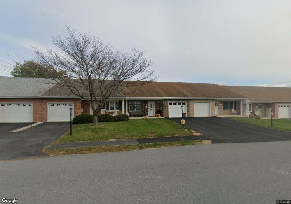
206 S Fork Dr Hagerstown, MD 21740
South End NeighborhoodEstimated Value: $268,977 - $287,000
Studio
2
Baths
1,310
Sq Ft
$210/Sq Ft
Est. Value
About This Home
This home is located at 206 S Fork Dr, Hagerstown, MD 21740 and is currently estimated at $275,244, approximately $210 per square foot. 206 S Fork Dr is a home located in Washington County with nearby schools including Emma K. Doub Elementary School, E. Russell Hicks Middle School, and South Hagerstown High School.
Ownership History
Date
Name
Owned For
Owner Type
Purchase Details
Closed on
Sep 30, 2020
Sold by
Shank Joanna K
Bought by
Shank Joyce E
Current Estimated Value
Purchase Details
Closed on
Jan 31, 2014
Sold by
Shank Nevin M
Bought by
Shank Joanna K
Purchase Details
Closed on
Dec 31, 2013
Sold by
Rokane Llc
Bought by
Shank Ii Nevin M
Purchase Details
Closed on
Feb 11, 2004
Sold by
Crampton Paul Llc
Bought by
Rokane Llc
Create a Home Valuation Report for This Property
The Home Valuation Report is an in-depth analysis detailing your home's value as well as a comparison with similar homes in the area
Home Values in the Area
Average Home Value in this Area
Purchase History
| Date | Buyer | Sale Price | Title Company |
|---|---|---|---|
| Shank Joyce E | $160,000 | None Available | |
| Shank Joanna K | -- | None Available | |
| Shank Ii Nevin M | -- | None Available | |
| Rokane Llc | $141,015 | -- |
Source: Public Records
Tax History
| Year | Tax Paid | Tax Assessment Tax Assessment Total Assessment is a certain percentage of the fair market value that is determined by local assessors to be the total taxable value of land and additions on the property. | Land | Improvement |
|---|---|---|---|---|
| 2025 | $1,853 | $203,567 | $0 | $0 |
| 2024 | $1,853 | $179,000 | $35,000 | $144,000 |
| 2023 | $1,786 | $172,533 | $0 | $0 |
| 2022 | $1,719 | $166,067 | $0 | $0 |
| 2021 | $1,692 | $159,600 | $35,000 | $124,600 |
| 2020 | $1,629 | $154,400 | $0 | $0 |
| 2019 | $1,582 | $149,200 | $0 | $0 |
| 2018 | $1,691 | $144,000 | $35,000 | $109,000 |
| 2017 | $1,432 | $139,533 | $0 | $0 |
| 2016 | -- | $135,067 | $0 | $0 |
| 2015 | -- | $130,600 | $0 | $0 |
| 2014 | $1,692 | $130,600 | $0 | $0 |
Source: Public Records
Map
Nearby Homes
- 202 S Fork Dr
- 307 Winding Oak Dr
- 124 Buttercup Dr
- Lot 7-16 Lawton Ln
- 12.3 AC Southern Blvd
- 1462 Oakmont Dr
- 3 W Oak Ridge Dr
- 605 Knightsbridge Dr
- 1010 201 Brinker Dr
- 636 Knightsbridge Dr
- 1058 S Potomac St
- 1024 Pope Ave
- 0 Kenly Ave
- 904 Kuhn Ave
- 925 Frederick St
- 920 Frederick St
- 1037 & 1037 1/2 Spruce St
- 832 Maryland Ave
- 767 Spruce St
- 219 W Howard St
- 208 S Fork Dr
- 204 S Fork Dr
- 210 S Fork Dr
- 212 S Fork Dr
- 216 S Fork Dr
- 205 S Fork Dr
- 207 S Fork Dr
- 203 S Fork Dr
- 209 S Fork Dr
- 376 Winding Oak Dr
- 201 S Fork Dr
- 374 Winding Oak Dr
- 211 S Fork Dr
- 218 S Fork Dr
- 378 Winding Oak Dr
- 372 Winding Oak Dr
- 380 Winding Oak Dr
- 370 Winding Oak Dr
- 215 S Fork Dr
- 165 Southern Oak Dr
Your Personal Tour Guide
Ask me questions while you tour the home.