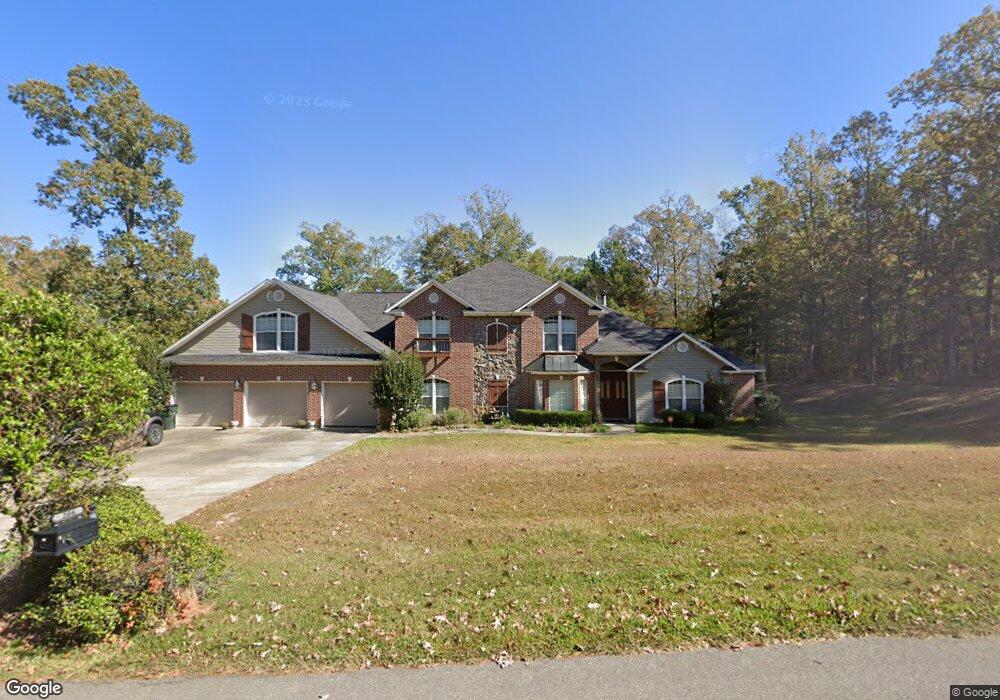
206 Saint Andrews Rd Calhoun, LA 71225
Estimated Value: $520,000 - $637,000
4
Beds
3
Baths
4,162
Sq Ft
$139/Sq Ft
Est. Value
About This Home
This home is located at 206 Saint Andrews Rd, Calhoun, LA 71225 and is currently estimated at $577,007, approximately $138 per square foot. 206 Saint Andrews Rd is a home located in Ouachita Parish with nearby schools including Calhoun Elementary School, Central Elementary School, and Calhoun Middle School.
Ownership History
Date
Name
Owned For
Owner Type
Purchase Details
Closed on
Jun 25, 2007
Sold by
Haisty Ronny Carroll and Haisty Melissa Renee Baines
Bought by
Ward Joseph Dennis and Ward Laurie Anne
Current Estimated Value
Home Financials for this Owner
Home Financials are based on the most recent Mortgage that was taken out on this home.
Original Mortgage
$391,600
Outstanding Balance
$239,618
Interest Rate
6.19%
Mortgage Type
New Conventional
Estimated Equity
$337,389
Create a Home Valuation Report for This Property
The Home Valuation Report is an in-depth analysis detailing your home's value as well as a comparison with similar homes in the area
Home Values in the Area
Average Home Value in this Area
Purchase History
| Date | Buyer | Sale Price | Title Company |
|---|---|---|---|
| Ward Joseph Dennis | $449,000 | None Available |
Source: Public Records
Mortgage History
| Date | Status | Borrower | Loan Amount |
|---|---|---|---|
| Open | Ward Joseph Dennis | $391,600 |
Source: Public Records
Tax History Compared to Growth
Tax History
| Year | Tax Paid | Tax Assessment Tax Assessment Total Assessment is a certain percentage of the fair market value that is determined by local assessors to be the total taxable value of land and additions on the property. | Land | Improvement |
|---|---|---|---|---|
| 2024 | $3,497 | $45,665 | $5,175 | $40,490 |
| 2023 | $3,497 | $43,182 | $5,175 | $38,007 |
| 2022 | $3,831 | $43,182 | $5,175 | $38,007 |
| 2021 | $3,879 | $43,182 | $5,175 | $38,007 |
| 2020 | $3,879 | $43,182 | $5,175 | $38,007 |
| 2019 | $3,566 | $39,817 | $4,500 | $35,317 |
| 2018 | $2,894 | $39,817 | $4,500 | $35,317 |
| 2017 | $3,566 | $39,817 | $4,500 | $35,317 |
| 2016 | $3,564 | $44,900 | $4,700 | $40,200 |
| 2015 | $3,341 | $44,900 | $4,700 | $40,200 |
| 2014 | $3,341 | $44,900 | $4,700 | $40,200 |
| 2013 | $3,329 | $44,900 | $4,700 | $40,200 |
Source: Public Records
Map
Nearby Homes
- 257 Sugarloaf Dr
- 0 Laguna Villas Dr
- 138 Mangum Ln
- 111 Yellow Pine Dr
- 131 Yellow Pine Dr
- 301 Pine Hills Dr
- 0 (A) Carter Rd
- 0 (B) Carter Rd
- 000 C Carter Rd
- 3235 Highway 15
- 000 J T Griggs Rd Unit 454 J T Griggs Road
- 00 J T Griggs Rd Unit 454 J T Griggs Road
- 454 J T Griggs Rd
- 0 J T Griggs Rd Unit 454 J T Griggs Road
- 3375 Highway 15
- 430 Pine Hills Dr
- 1014 Highway 80 E
- 201 Glen Acres Rd
- 137 Patricks Cove
- 144 Patricks Cove
- 206 Saint Andrews Dr
- 116 Saint Andrews Dr
- 100 Glen Eagles Ct
- 102 Glen Eagles Ct
- 114 Saint Andrews Rd
- 104 Glen Eagles Rd
- 100/102 Glen Eagles Ct
- 112 Saint Andrews Dr
- 241 Mcintosh Rd
- 117 Saint Andrews Rd
- 115 Saint Andrews Rd
- 1402 Brownlee Rd
- 113 Saint Andrews Rd
- 103 Glen Eagles Ct
- 103 Glen Eagles Rd
- 119 Saint Andrews Rd
- 109 Saint Andrews Dr
- 105 Turnberry Ct
- 121 Saint Andrews Rd
- 103 Turnberry Ct