Estimated Value: $253,000 - $288,000
3
Beds
1
Bath
1,689
Sq Ft
$160/Sq Ft
Est. Value
About This Home
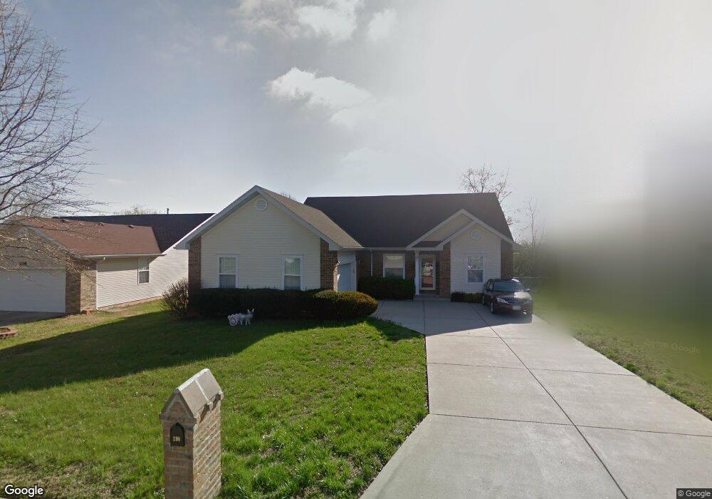
This home is located at 206 Shady Acres Cir, Nixa, MO 65714 and is currently estimated at $270,806, approximately $160 per square foot. 206 Shady Acres Cir is a home with nearby schools including Deauville Gardens Elementary School, Hugh W. Gregg Elementary School, and Century Elementary School.
Ownership History
Date
Name
Owned For
Owner Type
Purchase Details
Closed on
Mar 11, 2005
Sold by
Humbyrd Sandra J and Humbyrd Lewis Wayne
Bought by
Boyd Paul and Boyd Patricia
Current Estimated Value
Create a Home Valuation Report for This Property
The Home Valuation Report is an in-depth analysis detailing your home's value as well as a comparison with similar homes in the area
Home Values in the Area
Average Home Value in this Area
Purchase History
| Date | Buyer | Sale Price | Title Company |
|---|---|---|---|
| Boyd Paul | -- | None Available |
Source: Public Records
Tax History Compared to Growth
Tax History
| Year | Tax Paid | Tax Assessment Tax Assessment Total Assessment is a certain percentage of the fair market value that is determined by local assessors to be the total taxable value of land and additions on the property. | Land | Improvement |
|---|---|---|---|---|
| 2024 | $1,498 | $24,040 | -- | -- |
| 2023 | $1,498 | $24,040 | $0 | $0 |
| 2022 | $1,500 | $24,040 | $0 | $0 |
| 2021 | $1,501 | $24,040 | $0 | $0 |
| 2020 | $1,336 | $20,430 | $0 | $0 |
| 2019 | $1,336 | $20,430 | $0 | $0 |
| 2018 | $1,245 | $20,430 | $0 | $0 |
| 2017 | $1,245 | $20,430 | $0 | $0 |
| 2016 | $1,226 | $20,430 | $0 | $0 |
| 2015 | $1,227 | $20,430 | $20,430 | $0 |
| 2014 | $1,190 | $20,310 | $0 | $0 |
| 2013 | $12 | $20,310 | $0 | $0 |
| 2011 | $12 | $40,620 | $0 | $0 |
Source: Public Records
Map
Nearby Homes
- 209 Shady Acres Cir
- 111 Daleview Cir
- 287 Sunrise Dr
- 000 Citydel Rd W
- 000 Old Riverdale Rd
- 000 Croley Blvd Unit Lots 12,13, 14
- 138 W Silver Oak St
- 643 W Brook Hollow Rd
- 653 W Brook Hollow Rd
- 621 W Arbor Glenn Dr
- 609 W Arbor Glenn Dr
- 945 S Ozark Rd
- 656 W Castor Loop
- 662 W Castor Loop
- 843 S Black Sands Ave Unit Lot 115
- 845 S Black Sands
- 836 S Black Sands Ave
- 689 W Castor Loop
- 955 S Silverwood Ln
- 915 S Silverwood Ln
- 204 Shady Acres Cir
- 208 Shady Acres Cir
- 210 Shady Acres Cir
- 202 Shady Acres Cir
- 205 Shady Acres Cir
- 101 Daleview Cir
- 969 Creekside Place
- 212 Shady Acres Cir
- 103 Daleview Cir
- 967 Creekside Place
- 215 Shady Acres Cir
- 965 Creekside Place
- 214 Shady Acres Cir
- 197 Shady Acres Cir
- 200 Shady Acres Cir
- 198 Shady Acres Cir
- 102 Daleview Cir
- 963 Creekside Place
- 216 Shady Acres Cir
- 196 Shady Acres Cir