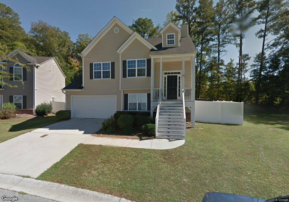
206 Sheffield Dr Carrollton, GA 30117
Estimated Value: $255,000 - $279,000
3
Beds
3
Baths
1,108
Sq Ft
$238/Sq Ft
Est. Value
About This Home
This home is located at 206 Sheffield Dr, Carrollton, GA 30117 and is currently estimated at $263,694, approximately $237 per square foot. 206 Sheffield Dr is a home located in Carroll County with nearby schools including Carrollton Elementary School, Carrollton Upper Elementary School, and Carrollton Middle School.
Ownership History
Date
Name
Owned For
Owner Type
Purchase Details
Closed on
Jun 17, 2005
Sold by
Forrest Homes Inc
Bought by
Barker Mittie A
Current Estimated Value
Home Financials for this Owner
Home Financials are based on the most recent Mortgage that was taken out on this home.
Original Mortgage
$133,065
Outstanding Balance
$69,020
Interest Rate
5.66%
Mortgage Type
FHA
Estimated Equity
$194,674
Purchase Details
Closed on
Mar 20, 2003
Sold by
Sheffield Of Carrollton Llc
Bought by
Forrest Homes Inc
Purchase Details
Closed on
Aug 30, 2002
Sold by
Lost Lake Dev Corp
Bought by
Sheffield Of Carrollton Llc
Purchase Details
Closed on
Apr 1, 2002
Sold by
Matthews Brenda
Bought by
Sheffield Of Carrollton Llc
Create a Home Valuation Report for This Property
The Home Valuation Report is an in-depth analysis detailing your home's value as well as a comparison with similar homes in the area
Home Values in the Area
Average Home Value in this Area
Purchase History
| Date | Buyer | Sale Price | Title Company |
|---|---|---|---|
| Barker Mittie A | $138,000 | -- | |
| Forrest Homes Inc | $1,530,000 | -- | |
| Sheffield Of Carrollton Llc | -- | -- | |
| Sheffield Of Carrollton Llc | -- | -- |
Source: Public Records
Mortgage History
| Date | Status | Borrower | Loan Amount |
|---|---|---|---|
| Open | Barker Mittie A | $133,065 |
Source: Public Records
Tax History Compared to Growth
Tax History
| Year | Tax Paid | Tax Assessment Tax Assessment Total Assessment is a certain percentage of the fair market value that is determined by local assessors to be the total taxable value of land and additions on the property. | Land | Improvement |
|---|---|---|---|---|
| 2024 | $2,255 | $99,367 | $10,000 | $89,367 |
| 2023 | $2,255 | $91,304 | $10,000 | $81,304 |
| 2022 | $1,826 | $75,327 | $10,000 | $65,327 |
| 2021 | $1,611 | $65,952 | $10,000 | $55,952 |
| 2020 | $1,462 | $59,442 | $10,000 | $49,442 |
| 2019 | $1,406 | $56,536 | $10,000 | $46,536 |
| 2018 | $1,298 | $51,320 | $10,000 | $41,320 |
| 2017 | $1,303 | $51,320 | $10,000 | $41,320 |
| 2016 | $1,356 | $53,264 | $10,000 | $43,264 |
| 2015 | $929 | $34,088 | $6,000 | $28,088 |
| 2014 | $934 | $34,088 | $6,000 | $28,088 |
Source: Public Records
Map
Nearby Homes
- 114 Green Point Way
- 123 Autumn Glen Dr
- 119 Oxford Square
- 325 Almon Rd
- 123 Cedar Park Way
- 201 Stewart St
- 111 Lakeview Dr
- 541 N White St Unit 12
- 541 N White St
- 120 Stewart St
- 777 College St
- 322 Cedar St
- 816 Stewart St
- 103 W Chandler St
- 0 Carroll Cir Unit LOTS 4-8 10571562
- 110 Town Walk Ln
- 403 Burns Rd
- 0 Burns Rd Unit LOT 2 10571612
- 0 Burns Rd Unit LOT 3 10571635
- 0 Burns Rd Unit LOT 1 10571595
- 208 Sheffield Dr
- 120 Deese Ct
- 210 Sheffield Dr
- 207 Sheffield Dr
- 117 Deese Ct
- 118 Deese Ct
- 115 Deese Ct
- 200 Sheffield Dr
- 116 Deese Ct
- 215 Sheffield Dr
- 214 Sheffield Dr
- 214 Sheffield Dr Unit 31
- 141 Ashgate Way
- 114 Deese Ct
- 113 Deese Ct
- 134 Sheffield Dr
- 0 Deese Ct Unit 8765438
- 0 Deese Ct Unit 8827643
- 0 Deese Ct Unit 7515062
- 0 Deese Ct Unit 7619504