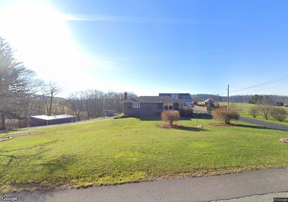
206 Smock Rd Smock, PA 15480
Franklin Township NeighborhoodEstimated Value: $143,000 - $494,000
3
Beds
2
Baths
1,260
Sq Ft
$224/Sq Ft
Est. Value
About This Home
This home is located at 206 Smock Rd, Smock, PA 15480 and is currently estimated at $282,634, approximately $224 per square foot. 206 Smock Rd is a home located in Fayette County with nearby schools including Uniontown Area Senior High School.
Ownership History
Date
Name
Owned For
Owner Type
Purchase Details
Closed on
Sep 28, 2018
Sold by
Karem Wendy
Bought by
Hall Derek N
Current Estimated Value
Home Financials for this Owner
Home Financials are based on the most recent Mortgage that was taken out on this home.
Original Mortgage
$225,834
Outstanding Balance
$199,979
Interest Rate
5.25%
Mortgage Type
FHA
Estimated Equity
$82,655
Create a Home Valuation Report for This Property
The Home Valuation Report is an in-depth analysis detailing your home's value as well as a comparison with similar homes in the area
Home Values in the Area
Average Home Value in this Area
Purchase History
| Date | Buyer | Sale Price | Title Company |
|---|---|---|---|
| Hall Derek N | $230,000 | Equity National Title |
Source: Public Records
Mortgage History
| Date | Status | Borrower | Loan Amount |
|---|---|---|---|
| Open | Hall Derek N | $225,834 |
Source: Public Records
Tax History Compared to Growth
Tax History
| Year | Tax Paid | Tax Assessment Tax Assessment Total Assessment is a certain percentage of the fair market value that is determined by local assessors to be the total taxable value of land and additions on the property. | Land | Improvement |
|---|---|---|---|---|
| 2025 | $1,880 | $73,865 | $17,185 | $56,680 |
| 2024 | $1,793 | $73,865 | $17,185 | $56,680 |
| 2023 | $3,586 | $73,865 | $17,185 | $56,680 |
| 2022 | $3,586 | $73,865 | $17,185 | $56,680 |
| 2021 | $3,586 | $73,865 | $17,185 | $56,680 |
| 2020 | $3,503 | $73,865 | $17,185 | $56,680 |
| 2019 | $3,248 | $73,865 | $17,185 | $56,680 |
| 2018 | $3,075 | $73,865 | $17,185 | $56,680 |
| 2017 | $2,925 | $70,260 | $16,330 | $53,930 |
| 2016 | -- | $70,260 | $16,330 | $53,930 |
| 2015 | -- | $70,260 | $16,330 | $53,930 |
| 2014 | -- | $84,420 | $32,960 | $51,460 |
Source: Public Records
Map
Nearby Homes
- 185 Main St
- 0 Alpine Ln Unit 1706795
- 507 Old Route 51 Rd
- 0 Curfew Rd
- 1161 1st St
- Crabapple Ln
- 419 2nd St
- 912 Keisterville Rd
- 218 Hatfield Rd
- 120 E 1st St
- 102 E 2nd St
- 107 Madison St
- 217 Virgin Run Rd
- 104 Royal Rd
- 133 Cemetery Rd
- LR26026-NR Bitner Rd
- 198 Church St
- 405 1st St
- SR 51 Vances Mill Rd
- 428 Grindstone Rd