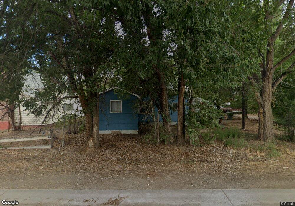
206 SW 5th St Olathe, CO 81425
Estimated Value: $278,000 - $306,000
2
Beds
1
Bath
936
Sq Ft
$308/Sq Ft
Est. Value
About This Home
This home is located at 206 SW 5th St, Olathe, CO 81425 and is currently estimated at $288,695, approximately $308 per square foot. 206 SW 5th St is a home located in Montrose County with nearby schools including Olathe Elementary School, Olathe Middle and High School, and Olathe Middle School.
Ownership History
Date
Name
Owned For
Owner Type
Purchase Details
Closed on
May 20, 2016
Sold by
Hatch Roland L and Hatch Muriel E
Bought by
Vargas Diana Perez and Estrada Santiago Rodriguez
Current Estimated Value
Home Financials for this Owner
Home Financials are based on the most recent Mortgage that was taken out on this home.
Original Mortgage
$122,244
Outstanding Balance
$98,347
Interest Rate
3.99%
Mortgage Type
FHA
Estimated Equity
$190,348
Purchase Details
Closed on
Feb 3, 1992
Sold by
Clubb James E and Clubb Marjory Louise
Bought by
Hatch Roland L and Hatch Muriel E
Create a Home Valuation Report for This Property
The Home Valuation Report is an in-depth analysis detailing your home's value as well as a comparison with similar homes in the area
Purchase History
| Date | Buyer | Sale Price | Title Company |
|---|---|---|---|
| Vargas Diana Perez | $124,500 | Land Title Guarantee Company | |
| Hatch Roland L | $65,000 | -- |
Source: Public Records
Mortgage History
| Date | Status | Borrower | Loan Amount |
|---|---|---|---|
| Open | Vargas Diana Perez | $122,244 |
Source: Public Records
Tax History
| Year | Tax Paid | Tax Assessment Tax Assessment Total Assessment is a certain percentage of the fair market value that is determined by local assessors to be the total taxable value of land and additions on the property. | Land | Improvement |
|---|---|---|---|---|
| 2024 | $1,574 | $14,120 | $2,990 | $11,130 |
| 2023 | $1,118 | $18,470 | $3,910 | $14,560 |
| 2022 | $1,040 | $14,110 | $2,240 | $11,870 |
| 2021 | $1,074 | $14,520 | $2,310 | $12,210 |
| 2020 | $824 | $11,340 | $1,840 | $9,500 |
| 2019 | $799 | $11,340 | $1,840 | $9,500 |
| 2018 | $638 | $8,750 | $1,550 | $7,200 |
| 2017 | $626 | $8,750 | $1,550 | $7,200 |
| 2016 | $291 | $8,220 | $1,310 | $6,910 |
| 2015 | $541 | $8,220 | $1,310 | $6,910 |
| 2014 | $479 | $7,720 | $1,310 | $6,410 |
Source: Public Records
Map
Nearby Homes
- 612 S Church Ave
- 615 S Church Ave
- 217 N Highway 50 Business Loop
- Lot 2(TBD) Wilson Ave
- 6859 Church St
- 6851 Church Rd
- 59727 U S 50
- 6910 High Mesa Rd
- 7528 S River Rd
- 58177 Garner Ln
- 7655 6075 Rd
- 6617 5700 Rd
- 56577 Hawthorne Ln
- TBD (Lot 2) Gunnison Rd
- TBD (Lot 1) Gunnison Rd
- TBD (Lot 3) Gunnison Rd
- 5345 Highway 348
- 9550 High Mesa Rd
- 57001 Begonia Rd
- 7276 5550 Rd
- 206 SW 5th St
- 207 6th St
- 513 Church Ave
- 201 6th St
- 501 S Hersum Ave
- 120 S 5th St
- 0 Hersum Ave Unit 756949
- 0 Hersum Ave Unit 645850
- 0 Hersum Ave Unit 645852
- 0 Hersum Ave Unit 657561
- 0 Hersum Ave Unit 720245
- 0 Hersum Ave Unit 729315
- 511 Hersum Ave
- 5th Street
- 215 S 6th St
- 513 S Church Ave
- 517 S Hersum Ave
- 0 Church St Unit 754969
- 0 Church St Unit 674310
- 114 SW 5th St
Your Personal Tour Guide
Ask me questions while you tour the home.