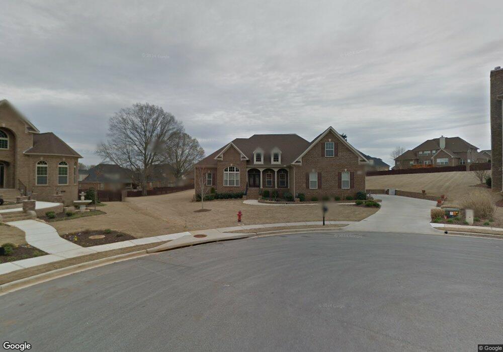
206 Tyro Cir Madison, AL 35758
Estimated Value: $733,000 - $816,833
6
Beds
5
Baths
4,087
Sq Ft
$187/Sq Ft
Est. Value
About This Home
This home is located at 206 Tyro Cir, Madison, AL 35758 and is currently estimated at $765,208, approximately $187 per square foot. 206 Tyro Cir is a home located in Madison County with nearby schools including Madison Elementary School, Discovery Middle School, and Bob Jones High School.
Ownership History
Date
Name
Owned For
Owner Type
Purchase Details
Closed on
Nov 22, 2010
Sold by
Woodland Homes Of Huntsville I Nc
Bought by
Williams Anthony C and Williams Chauntell
Current Estimated Value
Home Financials for this Owner
Home Financials are based on the most recent Mortgage that was taken out on this home.
Original Mortgage
$427,363
Outstanding Balance
$313,415
Interest Rate
6%
Mortgage Type
Construction
Estimated Equity
$451,793
Create a Home Valuation Report for This Property
The Home Valuation Report is an in-depth analysis detailing your home's value as well as a comparison with similar homes in the area
Home Values in the Area
Average Home Value in this Area
Purchase History
| Date | Buyer | Sale Price | Title Company |
|---|---|---|---|
| Williams Anthony C | -- | -- | |
| Woodland Homes Of Huntsville Inc | -- | -- |
Source: Public Records
Mortgage History
| Date | Status | Borrower | Loan Amount |
|---|---|---|---|
| Open | Williams Anthony C | $427,363 |
Source: Public Records
Tax History Compared to Growth
Tax History
| Year | Tax Paid | Tax Assessment Tax Assessment Total Assessment is a certain percentage of the fair market value that is determined by local assessors to be the total taxable value of land and additions on the property. | Land | Improvement |
|---|---|---|---|---|
| 2024 | $5,140 | $74,500 | $11,000 | $63,500 |
| 2023 | $5,140 | $71,940 | $11,000 | $60,940 |
| 2022 | $4,233 | $61,460 | $8,500 | $52,960 |
| 2021 | $3,839 | $55,780 | $8,500 | $47,280 |
| 2020 | $3,655 | $53,130 | $8,500 | $44,630 |
| 2019 | $2,908 | $51,240 | $8,500 | $42,740 |
| 2018 | $2,770 | $48,840 | $0 | $0 |
| 2017 | $2,748 | $48,460 | $0 | $0 |
| 2016 | $2,761 | $48,680 | $0 | $0 |
| 2015 | $2,761 | $48,680 | $0 | $0 |
| 2014 | $2,786 | $49,280 | $0 | $0 |
Source: Public Records
Map
Nearby Homes
- 111 Martingale Cir
- 148 Foxfield Dr
- 164 Silo Hill Rd
- 118 Conservancy Dr
- 147 Bridgefield Rd
- 137 Spotted Fawn Rd
- 102 Kayo Rd
- 200 Overbrook Dr
- 107 Monument Ln
- 117 Spotted Fawn Rd
- 122 Sunnyfield Dr
- 125 Monument Ln
- 0 Neldabrook Way Unit 1056736
- 109 Bayberry Ln
- 104 Pitalo St
- 363 Mose Chapel Rd
- 102 Mabscott Dr
- 108 Sunnyfield Dr
- 127 Landers Dr
- 117 Christy Dr