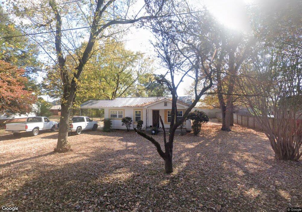
206 West Dr Calhoun, GA 30701
Estimated Value: $129,000 - $181,000
2
Beds
2
Baths
1,128
Sq Ft
$132/Sq Ft
Est. Value
About This Home
This home is located at 206 West Dr, Calhoun, GA 30701 and is currently estimated at $149,216, approximately $132 per square foot. 206 West Dr is a home located in Gordon County with nearby schools including Calhoun Elementary School, Calhoun Middle School, and Calhoun High School.
Ownership History
Date
Name
Owned For
Owner Type
Purchase Details
Closed on
Feb 2, 2023
Sold by
Thomas Dorothy
Bought by
Samples Sean A and Samples Amanda N
Current Estimated Value
Home Financials for this Owner
Home Financials are based on the most recent Mortgage that was taken out on this home.
Original Mortgage
$101,600
Outstanding Balance
$87,595
Interest Rate
5.73%
Mortgage Type
New Conventional
Estimated Equity
$61,621
Purchase Details
Closed on
Mar 28, 2007
Sold by
Barton James W
Bought by
Thomas Dorothy
Create a Home Valuation Report for This Property
The Home Valuation Report is an in-depth analysis detailing your home's value as well as a comparison with similar homes in the area
Purchase History
| Date | Buyer | Sale Price | Title Company |
|---|---|---|---|
| Samples Sean A | $127,000 | -- | |
| Thomas Dorothy | $85,000 | -- |
Source: Public Records
Mortgage History
| Date | Status | Borrower | Loan Amount |
|---|---|---|---|
| Open | Samples Sean A | $101,600 |
Source: Public Records
Tax History
| Year | Tax Paid | Tax Assessment Tax Assessment Total Assessment is a certain percentage of the fair market value that is determined by local assessors to be the total taxable value of land and additions on the property. | Land | Improvement |
|---|---|---|---|---|
| 2025 | $1,693 | $68,560 | $5,600 | $62,960 |
| 2023 | $204 | $26,600 | $5,600 | $21,000 |
| 2022 | $205 | $25,524 | $5,600 | $19,924 |
| 2021 | $163 | $21,096 | $5,600 | $15,496 |
| 2020 | $167 | $21,380 | $5,600 | $15,780 |
| 2019 | $167 | $21,380 | $5,600 | $15,780 |
| 2018 | $157 | $20,268 | $5,600 | $14,668 |
| 2017 | $143 | $18,548 | $5,600 | $12,948 |
| 2016 | $143 | $18,548 | $5,600 | $12,948 |
| 2015 | $142 | $18,268 | $5,600 | $12,668 |
| 2014 | $133 | $17,691 | $5,600 | $12,091 |
Source: Public Records
Map
Nearby Homes
- 0 S Wall St Unit 10665175
- 1136 S Wall St
- 0 W Belmont Dr Unit 10703135
- 0 W Belmont Dr Unit 7729054
- 1311 Us Highway 41
- 503 Peters St
- 120 Dan Cheri Dr
- 119 Peters St
- 511 Circle Dr
- 111 Rory Dr
- 402 Linda Ln
- 108 Rips Rd
- 199 Cherry St SE
- 00 Hwy 53 and Kenmoreland Cir
- 00 Cir
- 506 McDaniel Station Rd SW
- 425 McDaniel Station Rd SW
- 153 Thelma Rd SW
- 169 Red Oak Ln
- 300 Woodland Dr
Your Personal Tour Guide
Ask me questions while you tour the home.