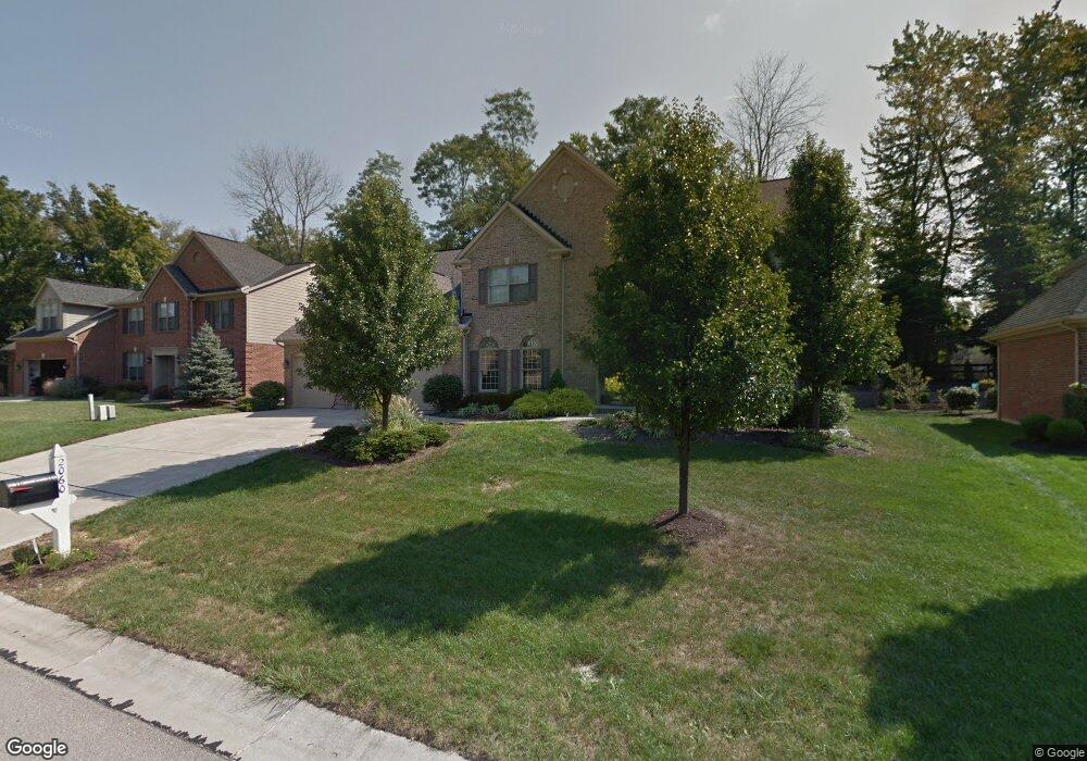
2060 Anderson Cove Ln Cincinnati, OH 45244
Dry Run NeighborhoodEstimated Value: $664,674 - $763,000
4
Beds
4
Baths
3,429
Sq Ft
$210/Sq Ft
Est. Value
About This Home
This home is located at 2060 Anderson Cove Ln, Cincinnati, OH 45244 and is currently estimated at $720,419, approximately $210 per square foot. 2060 Anderson Cove Ln is a home located in Hamilton County with nearby schools including Summit Elementary School, Nagel Middle School, and Anderson High School.
Ownership History
Date
Name
Owned For
Owner Type
Purchase Details
Closed on
Jan 21, 2004
Sold by
Zicka Walker Homes Ltd
Bought by
Hummel D Scott and Hummel Heather A
Current Estimated Value
Home Financials for this Owner
Home Financials are based on the most recent Mortgage that was taken out on this home.
Original Mortgage
$415,700
Outstanding Balance
$173,595
Interest Rate
4.37%
Mortgage Type
Unknown
Estimated Equity
$546,824
Purchase Details
Closed on
Apr 19, 2002
Sold by
Chanticleer Properties Ltd Partnership
Bought by
Zicka Walker Homes Ltd
Create a Home Valuation Report for This Property
The Home Valuation Report is an in-depth analysis detailing your home's value as well as a comparison with similar homes in the area
Home Values in the Area
Average Home Value in this Area
Purchase History
| Date | Buyer | Sale Price | Title Company |
|---|---|---|---|
| Hummel D Scott | $462,000 | Classic Title Agency Llc | |
| Zicka Walker Homes Ltd | $977,000 | -- |
Source: Public Records
Mortgage History
| Date | Status | Borrower | Loan Amount |
|---|---|---|---|
| Open | Hummel D Scott | $415,700 |
Source: Public Records
Tax History Compared to Growth
Tax History
| Year | Tax Paid | Tax Assessment Tax Assessment Total Assessment is a certain percentage of the fair market value that is determined by local assessors to be the total taxable value of land and additions on the property. | Land | Improvement |
|---|---|---|---|---|
| 2024 | $11,899 | $195,979 | $29,190 | $166,789 |
| 2023 | $11,318 | $195,979 | $29,190 | $166,789 |
| 2022 | $10,635 | $163,997 | $28,676 | $135,321 |
| 2021 | $10,383 | $163,997 | $28,676 | $135,321 |
| 2020 | $10,503 | $163,997 | $28,676 | $135,321 |
| 2019 | $10,237 | $145,128 | $25,375 | $119,753 |
| 2018 | $9,589 | $145,128 | $25,375 | $119,753 |
| 2017 | $9,043 | $145,128 | $25,375 | $119,753 |
| 2016 | $8,541 | $133,911 | $25,883 | $108,028 |
| 2015 | $8,295 | $133,911 | $25,883 | $108,028 |
| 2014 | $8,300 | $133,911 | $25,883 | $108,028 |
| 2013 | $7,696 | $131,285 | $25,375 | $105,910 |
Source: Public Records
Map
Nearby Homes
- 2020 Knightsbridge Dr
- 2051 Tall Pines Ln
- 2067 Knightsbridge Dr
- 8588 Denallen Dr
- 2161 Knightsbridge Dr
- 2197 8 Mile Rd
- 8575 Bethany Ln
- 8413 Summitridge Dr
- 8486 Bethany Ln
- 4383 Wiborg Dr
- 4386 Wiborg Dr
- 1612 Clemson Cir
- 1629 Muskegon Dr
- 1624 Pinebluff Ln
- 1596 Pinebluff Ln
- 4417 Wiborg Dr
- 471 Sanctuary Way
- 8069 Ashgrove Dr
- 473 Sanctuary Way
- 2547 Teuton Ct
- 2060 Anderson Cove Ln Unit 9
- 2050 Anderson Cove Ln
- 2070 Anderson Cove Ln
- 2057 Harcourt Estates Dr
- 2051 Anderson Cove Ln
- 2051 Anderson Cove Ln Unit 3
- 2067 Harcourt Estates Dr
- 2067 Harcourt Dr
- 2057 Harcourt Dr
- 2069 Anderson Cove Ln
- 2069 Anderson Cove Ln Unit 4
- 2045 Anderson Cove Ln
- 2040 Anderson Cove Ln
- 2049 Harcourt Estates Dr
- 2049 Harcourt Dr
- 2075 Harcourt Estates Dr
- 2077 Anderson Cove Ln
- 2035 Anderson Cove Ln
- 2004 Knightsbridge Dr
- 2007 Knightsbridge Dr