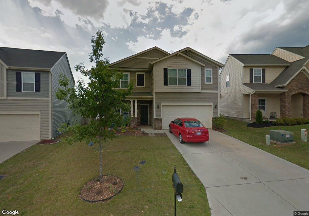
2060 Blue Iris Dr Matthews, NC 28104
Estimated Value: $448,000 - $536,000
5
Beds
3
Baths
2,648
Sq Ft
$191/Sq Ft
Est. Value
About This Home
This home is located at 2060 Blue Iris Dr, Matthews, NC 28104 and is currently estimated at $505,442, approximately $190 per square foot. 2060 Blue Iris Dr is a home located in Union County with nearby schools including Stallings Elementary School, Porter Ridge Middle School, and Porter Ridge High School.
Ownership History
Date
Name
Owned For
Owner Type
Purchase Details
Closed on
Jul 8, 2011
Sold by
M/I Homes Of Charlotte Llc
Bought by
Preston Mary Lynn and Preston Dennis James
Current Estimated Value
Home Financials for this Owner
Home Financials are based on the most recent Mortgage that was taken out on this home.
Original Mortgage
$188,204
Outstanding Balance
$128,479
Interest Rate
4.5%
Mortgage Type
FHA
Estimated Equity
$376,963
Create a Home Valuation Report for This Property
The Home Valuation Report is an in-depth analysis detailing your home's value as well as a comparison with similar homes in the area
Home Values in the Area
Average Home Value in this Area
Purchase History
| Date | Buyer | Sale Price | Title Company |
|---|---|---|---|
| Preston Mary Lynn | $193,500 | None Available |
Source: Public Records
Mortgage History
| Date | Status | Borrower | Loan Amount |
|---|---|---|---|
| Open | Preston Mary Lynn | $188,204 |
Source: Public Records
Tax History Compared to Growth
Tax History
| Year | Tax Paid | Tax Assessment Tax Assessment Total Assessment is a certain percentage of the fair market value that is determined by local assessors to be the total taxable value of land and additions on the property. | Land | Improvement |
|---|---|---|---|---|
| 2025 | $3,382 | $497,800 | $0 | $0 |
| 2024 | $2,786 | $317,900 | $55,000 | $262,900 |
| 2023 | $2,668 | $317,900 | $55,000 | $262,900 |
| 2022 | $2,647 | $317,900 | $55,000 | $262,900 |
| 2021 | $2,647 | $317,900 | $55,000 | $262,900 |
| 2020 | $2,281 | $224,700 | $38,000 | $186,700 |
| 2019 | $2,281 | $224,700 | $38,000 | $186,700 |
| 2018 | $0 | $224,700 | $38,000 | $186,700 |
| 2017 | $2,351 | $224,700 | $38,000 | $186,700 |
| 2016 | $2,360 | $224,700 | $38,000 | $186,700 |
| 2015 | $2,389 | $224,700 | $38,000 | $186,700 |
| 2014 | -- | $240,040 | $35,000 | $205,040 |
Source: Public Records
Map
Nearby Homes
- 2126 Blue Iris Dr
- 5028 Haven Lodge Rd
- 5033 Haven Lodge Rd
- 4324 Stallingswood Dr
- 4006 Scarlet Dr Unit 29
- 5401 Stevens Mill Rd
- 4023 Lawrence Daniel Dr
- 3017 Stevens Schultz Ln
- 1419 Vickery Dr
- 15108 Castlebridge Ln
- 812 Dogwood Creek Ln
- 5703 Hillcrest Cir
- 0000 White Oak Ln
- 831 White Oak Ln
- 201 Limerick Dr
- 14601 Phillips Rd
- 8003 Hemby Wood Dr
- 2108 Stallings Rd
- 2001 Thurston Dr
- 1830 Light Brigade Dr Unit v512
- 2064 Blue Iris Dr
- 2056 Blue Iris Dr
- 2068 Blue Iris Dr
- 2052 Blue Iris Dr
- 1024 Mountain Laurel Ct
- 1028 Mountain Laurel Ct
- 1020 Mountain Laurel Ct
- 2048 Blue Iris Dr
- 2072 Blue Iris Dr
- 1032 Mountain Laurel Ct
- 1032 Mountain Laurel Ct Unit 134
- 2059 Blue Iris Dr
- 2059 Blue Iris Dr
- 2059 Blue Iris Dr Unit 210
- 2055 Blue Iris Dr
- 3008 Shady Knoll Cir
- 1016 Mountain Laurel Ct
- 1036 Mountain Laurel Ct
- 2065 Blue Iris Dr
- 2044 Blue Iris Dr