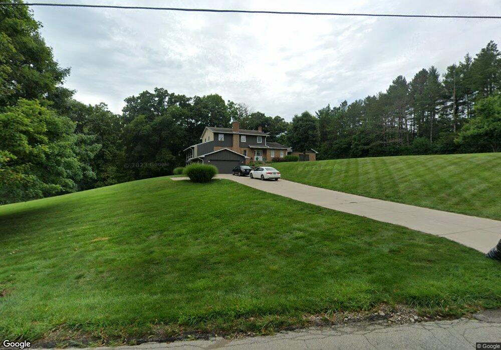
2060 Byerly Mill Rd West Jefferson, OH 43162
Estimated Value: $454,452 - $726,000
3
Beds
4
Baths
2,495
Sq Ft
$220/Sq Ft
Est. Value
About This Home
This home is located at 2060 Byerly Mill Rd, West Jefferson, OH 43162 and is currently estimated at $548,863, approximately $219 per square foot. 2060 Byerly Mill Rd is a home located in Madison County with nearby schools including Norwood Elementary School, West Jefferson Middle School, and West Jefferson High School.
Ownership History
Date
Name
Owned For
Owner Type
Purchase Details
Closed on
Nov 16, 2016
Sold by
Higgins Crystal L
Bought by
Higgins Chad A
Current Estimated Value
Purchase Details
Closed on
Sep 5, 2006
Sold by
Murray Joseph R and Murray Suzanne R
Bought by
Higgins Chad A and Higgins Crystal L
Home Financials for this Owner
Home Financials are based on the most recent Mortgage that was taken out on this home.
Original Mortgage
$290,000
Interest Rate
5.99%
Mortgage Type
Purchase Money Mortgage
Create a Home Valuation Report for This Property
The Home Valuation Report is an in-depth analysis detailing your home's value as well as a comparison with similar homes in the area
Home Values in the Area
Average Home Value in this Area
Purchase History
| Date | Buyer | Sale Price | Title Company |
|---|---|---|---|
| Higgins Chad A | -- | Attorney | |
| Higgins Chad A | $410,000 | Claddagh Title |
Source: Public Records
Mortgage History
| Date | Status | Borrower | Loan Amount |
|---|---|---|---|
| Closed | Higgins Chad A | $290,000 |
Source: Public Records
Tax History Compared to Growth
Tax History
| Year | Tax Paid | Tax Assessment Tax Assessment Total Assessment is a certain percentage of the fair market value that is determined by local assessors to be the total taxable value of land and additions on the property. | Land | Improvement |
|---|---|---|---|---|
| 2024 | $5,088 | $112,300 | $20,320 | $91,980 |
| 2023 | $5,088 | $112,300 | $20,320 | $91,980 |
| 2022 | $4,032 | $82,710 | $14,970 | $67,740 |
| 2021 | $4,250 | $82,710 | $14,970 | $67,740 |
| 2020 | $4,119 | $82,710 | $14,970 | $67,740 |
| 2019 | $4,083 | $80,740 | $13,470 | $67,270 |
| 2018 | $3,804 | $80,740 | $13,470 | $67,270 |
| 2017 | $3,812 | $80,740 | $13,470 | $67,270 |
| 2016 | $3,241 | $67,290 | $13,470 | $53,820 |
| 2015 | $3,404 | $67,290 | $13,470 | $53,820 |
| 2014 | $5,495 | $67,290 | $13,470 | $53,820 |
| 2013 | -- | $72,200 | $14,590 | $57,610 |
Source: Public Records
Map
Nearby Homes
- 2915 US Highway 42 NE
- 6270 South Rd
- 3980 Us-40
- 4 Thorn Locust Ln
- 7 Thorn Locust Ln
- 13 Thorn Locust Ln
- 41 Thorn Locust Ln
- 23 Thorn Locust Ln
- 24 Thorn Locust Ln
- 33 Thorn Locust Ln
- 37 Thorn Locust Ln
- 161 Maplewood Ln
- 158 Maplewood Ln
- 156 Maplewood Ln
- 177 Thorn Locust Ln
- 183 Thorn Locust Ln
- 269 Thorn Locust Ln
- 2209 Grewell Rd
- 1000 W Main St Unit Lot 13
- 85 Middle St SE
- 2060 Byerly Mill Rd
- 2140 Byerly Mill Rd
- 4400 Goodson Rd
- 2095 Byerly Mill Rd
- 4450 Goodson Rd
- 2200 Byerly Mill Rd
- 2135 Byerly Mill Rd
- 4425 Goodson Rd
- 1990 Upper Valley Dr
- 2250 Byerly Mill Rd
- 1930 Byerly Mill Rd
- 4540 Goodson Rd
- 1921 Byerly Mill Rd
- 1921 Byerly Mill Rd
- 1995 Upper Valley Dr
- 1960 Upper Valley Dr
- 1920 Byerly Mill Rd
- 0 Byerly Mill Rd
- 93 Byerly Mill Rd
- 4503 Goodson Rd