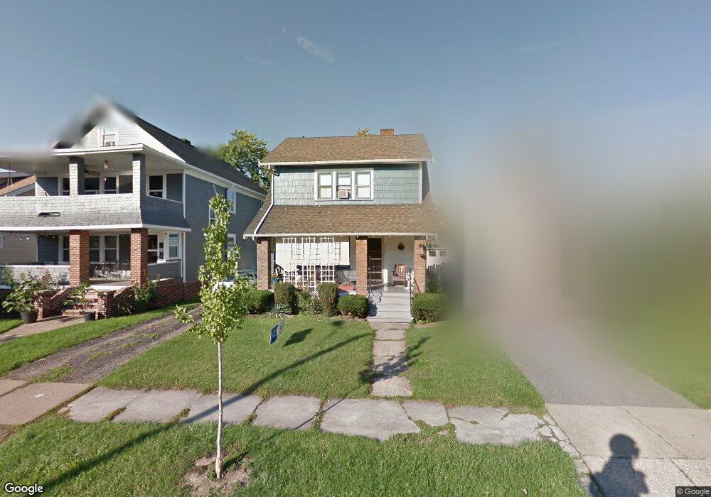
2060 Richland Ave Lakewood, OH 44107
Estimated Value: $232,000 - $278,000
3
Beds
1
Bath
1,116
Sq Ft
$237/Sq Ft
Est. Value
About This Home
This home is located at 2060 Richland Ave, Lakewood, OH 44107 and is currently estimated at $264,484, approximately $236 per square foot. 2060 Richland Ave is a home located in Cuyahoga County with nearby schools including Roosevelt Elementary School, Garfield Middle School, and Lakewood High School.
Ownership History
Date
Name
Owned For
Owner Type
Purchase Details
Closed on
Oct 12, 2021
Sold by
Miller Robert C
Bought by
Fig and Fig Oh18 Llc
Current Estimated Value
Purchase Details
Closed on
Jan 24, 2000
Sold by
Miller Robert C
Bought by
Miller Robert C and Miller Carolyn C
Home Financials for this Owner
Home Financials are based on the most recent Mortgage that was taken out on this home.
Original Mortgage
$80,000
Interest Rate
7.84%
Purchase Details
Closed on
Jul 24, 1990
Sold by
Rohan Peter J and Rohan Karen L
Bought by
Miller Robert C
Purchase Details
Closed on
Jan 1, 1975
Bought by
Rohan Peter J and Rohan Karen L
Create a Home Valuation Report for This Property
The Home Valuation Report is an in-depth analysis detailing your home's value as well as a comparison with similar homes in the area
Home Values in the Area
Average Home Value in this Area
Purchase History
| Date | Buyer | Sale Price | Title Company |
|---|---|---|---|
| Fig | $2,051 | None Listed On Document | |
| Miller Robert C | -- | -- | |
| Miller Robert C | $73,900 | -- | |
| Rohan Peter J | -- | -- |
Source: Public Records
Mortgage History
| Date | Status | Borrower | Loan Amount |
|---|---|---|---|
| Previous Owner | Miller Robert C | $80,000 |
Source: Public Records
Tax History Compared to Growth
Tax History
| Year | Tax Paid | Tax Assessment Tax Assessment Total Assessment is a certain percentage of the fair market value that is determined by local assessors to be the total taxable value of land and additions on the property. | Land | Improvement |
|---|---|---|---|---|
| 2024 | $4,854 | $75,565 | $17,920 | $57,645 |
| 2023 | $3,728 | $49,670 | $13,760 | $35,910 |
| 2022 | $3,752 | $49,670 | $13,760 | $35,910 |
| 2021 | $3,714 | $49,670 | $13,760 | $35,910 |
| 2020 | $3,294 | $38,500 | $10,680 | $27,830 |
| 2019 | $3,228 | $110,000 | $30,500 | $79,500 |
| 2018 | $3,224 | $38,500 | $10,680 | $27,830 |
| 2017 | $3,225 | $35,000 | $8,680 | $26,320 |
| 2016 | $3,203 | $35,000 | $8,680 | $26,320 |
| 2015 | $3,613 | $35,000 | $8,680 | $26,320 |
| 2014 | $3,613 | $37,940 | $8,330 | $29,610 |
Source: Public Records
Map
Nearby Homes
- 2100 Wascana Ave
- 2078 Baxterly Ave
- 1669 Robinwood Ave
- 1675 Roosevelt Ave
- 2203 Bunts Rd
- 14404 Bayes Ave
- 2180 Elbur Ave
- 2045 Chesterland Ave
- 2233 Bunts Rd
- 2180 Lewis Dr
- 2035 Chesterland Ave
- 2204 Lewis Dr
- 14031 Lakewood Heights Blvd
- 1576 Wyandotte Ave
- 14428 Delaware Ave
- 1593 Marlowe Ave
- 1605 Lewis Dr
- 2070 Clarence Ave
- 1532 Parkwood Rd
- 2208 Waterbury Rd
- 2054 Richland Ave
- 2062 Richland Ave
- 2064 Richland Ave
- 2068 Richland Ave
- 2050 Richland Ave
- 2050 Richland Ave
- 2050 Richland Ave Unit Down
- 2048 Richland Ave
- 2070 Richland Ave
- 2070 2072 Richland Ave
- 2063 Brown Rd
- 2057 Brown Rd
- 2067 Brown Rd
- 2053 Brown Rd
- 2071 Brown Rd
- 2042 Richland Ave
- 2042 Richland Ave Unit 1
- 2076 Richland Ave
- 2059 Richland Ave
- 2049 Brown Rd