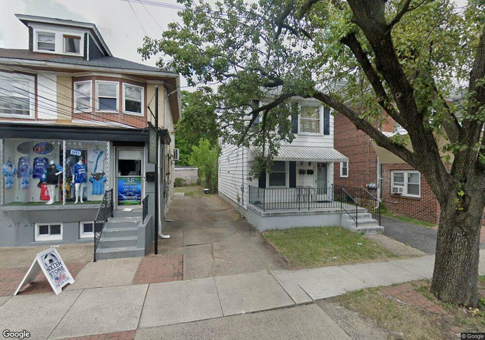
2060 S Broad St Trenton, NJ 08610
Estimated Value: $219,898
2
Beds
1
Bath
1,274
Sq Ft
$173/Sq Ft
Est. Value
About This Home
This home is located at 2060 S Broad St, Trenton, NJ 08610 and is currently estimated at $219,898, approximately $172 per square foot. 2060 S Broad St is a home located in Mercer County with nearby schools including Lalor Elementary School, Albert E. Grice Middle School, and Hamilton West-Watson High School.
Ownership History
Date
Name
Owned For
Owner Type
Purchase Details
Closed on
May 16, 2019
Sold by
Basile Joshua D and Muse Kris P
Bought by
Sandoval Marco
Current Estimated Value
Purchase Details
Closed on
Nov 6, 1995
Sold by
Bilancio Debora
Bought by
Basile Anthony
Home Financials for this Owner
Home Financials are based on the most recent Mortgage that was taken out on this home.
Original Mortgage
$50,000
Interest Rate
7.62%
Mortgage Type
Purchase Money Mortgage
Create a Home Valuation Report for This Property
The Home Valuation Report is an in-depth analysis detailing your home's value as well as a comparison with similar homes in the area
Home Values in the Area
Average Home Value in this Area
Purchase History
| Date | Buyer | Sale Price | Title Company |
|---|---|---|---|
| Sandoval Marco | $57,500 | None Available | |
| Basile Anthony | $55,000 | -- |
Source: Public Records
Mortgage History
| Date | Status | Borrower | Loan Amount |
|---|---|---|---|
| Previous Owner | Basile Anthony | $50,000 |
Source: Public Records
Tax History Compared to Growth
Tax History
| Year | Tax Paid | Tax Assessment Tax Assessment Total Assessment is a certain percentage of the fair market value that is determined by local assessors to be the total taxable value of land and additions on the property. | Land | Improvement |
|---|---|---|---|---|
| 2025 | $3,982 | $113,000 | $22,500 | $90,500 |
| 2024 | $3,732 | $113,000 | $22,500 | $90,500 |
| 2023 | $3,732 | $113,000 | $22,500 | $90,500 |
| 2022 | $3,300 | $101,500 | $22,500 | $79,000 |
| 2021 | $4,083 | $101,500 | $22,500 | $79,000 |
| 2020 | $3,718 | $101,500 | $22,500 | $79,000 |
| 2019 | $3,608 | $101,500 | $22,500 | $79,000 |
| 2018 | $3,561 | $101,500 | $22,500 | $79,000 |
| 2017 | $3,402 | $101,500 | $22,500 | $79,000 |
| 2016 | $2,745 | $101,500 | $22,500 | $79,000 |
| 2015 | $3,662 | $70,300 | $11,300 | $59,000 |
| 2014 | $3,614 | $70,300 | $11,300 | $59,000 |
Source: Public Records
Map
Nearby Homes
- 2033 Genesee St
- 109 E Park Ave
- 1961 S Broad St
- 604 Schiller Ave
- 1857 S Broad St
- 316 W Park Ave
- 1856 S Broad St
- 429 Wilfred Ave
- 238 Grand Ave
- 949 Schiller Ave
- 323 Wilfred Ave
- 34 Sewell Ave
- 229 Parkinson Ave
- 1816 Chambers St
- 218 Sewell Ave
- 229 Wilfred Ave
- 408 Berg Ave
- 27 Westcott Ave
- 314 Joseph St
- 164 Lillian Ave
- 2062 S Broad St
- 2058 S Broad St
- 2056 S Broad St
- 2054 S Broad St
- 2072 S Broad St
- 2052 S Broad St
- 2076 S Broad St
- 2050 S Broad St
- 2025 Genesee St
- 2027 Genesee St
- 2078 S Broad St
- 2001 Genesee St Unit 2
- 2001 Genesee St Unit 1
- 2001 Genesee St
- 2031 Genesee St
- 2080 S Broad St
- 4 Mary St
- 94 Mary St
- 2041 S Broad St
- 2047 S Broad St