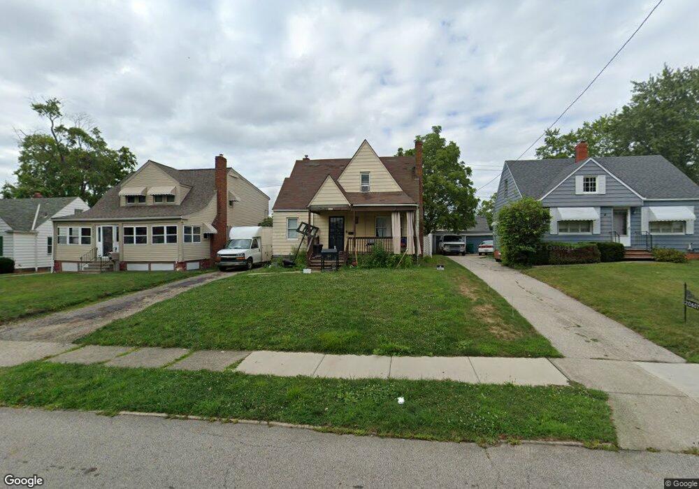
20605 Franklin Rd Maple Heights, OH 44137
Estimated Value: $108,000 - $137,000
3
Beds
2
Baths
1,107
Sq Ft
$107/Sq Ft
Est. Value
About This Home
This home is located at 20605 Franklin Rd, Maple Heights, OH 44137 and is currently estimated at $118,412, approximately $106 per square foot. 20605 Franklin Rd is a home located in Cuyahoga County with nearby schools including Abraham Lincoln Elementary School, Rockside/ J.F. Kennedy School, and Barack Obama School.
Ownership History
Date
Name
Owned For
Owner Type
Purchase Details
Closed on
Jul 28, 2009
Sold by
Chambers Robinson Shanices and Robinson Ian
Bought by
Adp Properties Llc
Current Estimated Value
Purchase Details
Closed on
Aug 22, 2005
Sold by
Myford Rebecca S
Bought by
Chambers Robinson Shanices and Robinson Ian
Home Financials for this Owner
Home Financials are based on the most recent Mortgage that was taken out on this home.
Original Mortgage
$97,900
Interest Rate
9.5%
Mortgage Type
Fannie Mae Freddie Mac
Purchase Details
Closed on
Feb 16, 2004
Sold by
Myford Rebecca S
Bought by
Myford Rebecca S
Purchase Details
Closed on
Jan 1, 1975
Bought by
Myford Sherman J and R S
Create a Home Valuation Report for This Property
The Home Valuation Report is an in-depth analysis detailing your home's value as well as a comparison with similar homes in the area
Home Values in the Area
Average Home Value in this Area
Purchase History
| Date | Buyer | Sale Price | Title Company |
|---|---|---|---|
| Adp Properties Llc | $22,500 | Barristers Of Ohio | |
| Chambers Robinson Shanices | $97,900 | Suntrust Title Agency | |
| Myford Rebecca S | -- | -- | |
| Myford Sherman J | -- | -- |
Source: Public Records
Mortgage History
| Date | Status | Borrower | Loan Amount |
|---|---|---|---|
| Previous Owner | Chambers Robinson Shanices | $97,900 |
Source: Public Records
Tax History
| Year | Tax Paid | Tax Assessment Tax Assessment Total Assessment is a certain percentage of the fair market value that is determined by local assessors to be the total taxable value of land and additions on the property. | Land | Improvement |
|---|---|---|---|---|
| 2025 | $2,523 | $29,400 | $7,420 | $21,980 |
| 2024 | $2,796 | $29,400 | $7,420 | $21,980 |
| 2023 | $2,136 | $18,940 | $4,480 | $14,460 |
| 2022 | $2,129 | $18,940 | $4,480 | $14,460 |
| 2021 | $2,267 | $18,940 | $4,480 | $14,460 |
| 2020 | $1,947 | $14,350 | $3,400 | $10,960 |
| 2019 | $1,935 | $41,000 | $9,700 | $31,300 |
| 2018 | $1,038 | $14,350 | $3,400 | $10,960 |
| 2017 | $1,800 | $12,920 | $3,150 | $9,770 |
| 2016 | $1,740 | $12,920 | $3,150 | $9,770 |
| 2015 | $1,733 | $12,920 | $3,150 | $9,770 |
| 2014 | $1,733 | $14,220 | $3,470 | $10,750 |
Source: Public Records
Map
Nearby Homes
- 5147 Warrensville Center Rd
- 20600 Watson Rd
- 20715 Watson Rd
- 20905 Clare Ave
- 20705 Hansen Rd
- 20814 Clare Ave
- 19931 Raymond St
- 20111 Mountville Dr
- 21202 Hillgrove Ave
- 21207 Franklin Rd
- 19910 Mountville Dr
- 21202 Gardenview Dr
- 19520 Maple Heights Blvd
- 21601 Gardenview Dr
- 5165 Camden Rd
- 19289 Stafford Ave
- 21860 Louis Rd
- 5194 Homewood Ave
- 19411 Marvin Rd
- 18990 Raymond St
- 20517 Franklin Rd
- 20607 Franklin Rd
- 20509 Franklin Rd
- 20609 Franklin Rd
- 20600 Raymond St
- 20505 Franklin Rd
- 20514 Raymond St
- 20604 Raymond St
- 20611 Franklin Rd
- 20510 Raymond St
- 20650 Raymond St
- 20600 Franklin Rd
- 20516 Franklin Rd
- 20501 Franklin Rd
- 20604 Franklin Rd
- 20512 Franklin Rd
- 20615 Franklin Rd
- 20504 Raymond St
- 20608 Franklin Rd
- 20508 Franklin Rd
Your Personal Tour Guide
Ask me questions while you tour the home.