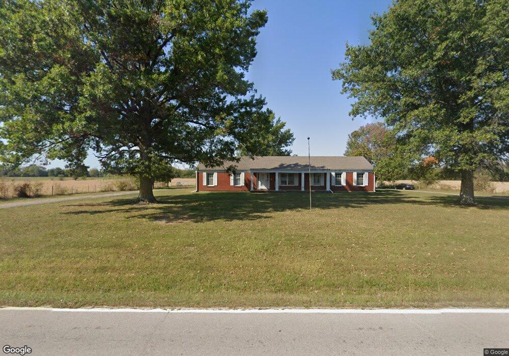
20606 S State Route Cc Pleasant Hill, MO 64080
Estimated Value: $339,000 - $413,141
3
Beds
2
Baths
2,400
Sq Ft
$161/Sq Ft
Est. Value
About This Home
This home is located at 20606 S State Route Cc, Pleasant Hill, MO 64080 and is currently estimated at $386,047, approximately $160 per square foot. 20606 S State Route Cc is a home located in Cass County.
Ownership History
Date
Name
Owned For
Owner Type
Purchase Details
Closed on
Oct 3, 2005
Sold by
Scrudder Wayne E and Scrudder Pamela A
Bought by
Roscher Theresa K and Roscher Pat E
Current Estimated Value
Home Financials for this Owner
Home Financials are based on the most recent Mortgage that was taken out on this home.
Original Mortgage
$180,000
Outstanding Balance
$96,162
Interest Rate
5.73%
Mortgage Type
New Conventional
Estimated Equity
$289,885
Create a Home Valuation Report for This Property
The Home Valuation Report is an in-depth analysis detailing your home's value as well as a comparison with similar homes in the area
Home Values in the Area
Average Home Value in this Area
Purchase History
| Date | Buyer | Sale Price | Title Company |
|---|---|---|---|
| Roscher Theresa K | -- | -- |
Source: Public Records
Mortgage History
| Date | Status | Borrower | Loan Amount |
|---|---|---|---|
| Open | Roscher Theresa K | $180,000 |
Source: Public Records
Tax History Compared to Growth
Tax History
| Year | Tax Paid | Tax Assessment Tax Assessment Total Assessment is a certain percentage of the fair market value that is determined by local assessors to be the total taxable value of land and additions on the property. | Land | Improvement |
|---|---|---|---|---|
| 2024 | $2,114 | $30,530 | $4,140 | $26,390 |
| 2023 | $2,107 | $30,530 | $4,140 | $26,390 |
| 2022 | $1,861 | $26,640 | $4,140 | $22,500 |
| 2021 | $1,836 | $26,640 | $4,140 | $22,500 |
| 2020 | $1,720 | $25,600 | $4,140 | $21,460 |
| 2019 | $1,695 | $25,600 | $4,140 | $21,460 |
| 2018 | $1,531 | $22,900 | $3,310 | $19,590 |
| 2017 | $1,460 | $22,900 | $3,310 | $19,590 |
| 2016 | $1,460 | $21,820 | $3,310 | $18,510 |
| 2015 | $1,480 | $21,820 | $3,310 | $18,510 |
| 2014 | $1,487 | $21,820 | $3,310 | $18,510 |
| 2013 | -- | $21,820 | $3,310 | $18,510 |
Source: Public Records
Map
Nearby Homes
- 312 N East Hwy
- 0 E 215th St
- 0000 E 219th St
- 33701 E State Route 58
- 115 SW 1991st Rd
- 227th St
- 000 227th St -124 Acres
- 1936 SW 200th Rd
- 22920 S Staley Mound Rd
- Tbd South Pryor Rd
- 0000 S Pryor Rd
- TBD S Pryor Rd
- 0 S Staley Mound Rd
- 30909 E 219th St
- S Staley Mound Rd
- 21 Acres Staley Mound Rd
- Lot 4 State Rt K Hwy
- Lot 2 State Rt K Hwy
- Lot 3 State Rt K Hwy
- 23700 S State Rt K Hwy
- 20718 S State Route Cc
- 20603 S State Route Cc
- 20719 S State Route Cc
- 20719 S State Route Cc
- 20501 S State Route Cc
- 20803 S State Route Cc
- 20405 S State Route Cc
- 20324 S State Route Cc
- 20900 S State Route Cc
- 20817 S State Route Cc
- 20914 S State Route Cc
- 36805 E 203rd St
- 20400 S State Route Cc
- 20915 S State Route Cc
- 20211 S State Route Cc
- 20211 S State Route Cc
- 20211 S Highway Cc
- 21017 S State Route Cc
- 37608 E 209th St
- 37300 E 203rd St