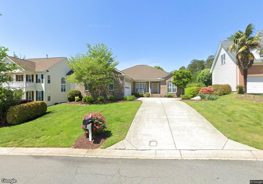
20609 Mystic Cove Rd Cornelius, NC 28031
Estimated Value: $593,000 - $763,000
3
Beds
2
Baths
2,235
Sq Ft
$305/Sq Ft
Est. Value
About This Home
This home is located at 20609 Mystic Cove Rd, Cornelius, NC 28031 and is currently estimated at $682,008, approximately $305 per square foot. 20609 Mystic Cove Rd is a home located in Mecklenburg County with nearby schools including Cornelius Elementary School, Bailey Middle School, and William Amos Hough High School.
Ownership History
Date
Name
Owned For
Owner Type
Purchase Details
Closed on
Dec 5, 2006
Sold by
Riesenhuber Richard D and Riesenhuber Lila D
Bought by
Soriano Jose and Soriano Ruth
Current Estimated Value
Purchase Details
Closed on
Aug 18, 2000
Sold by
Niblock Development Corp
Bought by
Riesenhuber Richard D and Riesenhuber Lila D
Home Financials for this Owner
Home Financials are based on the most recent Mortgage that was taken out on this home.
Original Mortgage
$80,000
Interest Rate
8.17%
Mortgage Type
Purchase Money Mortgage
Create a Home Valuation Report for This Property
The Home Valuation Report is an in-depth analysis detailing your home's value as well as a comparison with similar homes in the area
Home Values in the Area
Average Home Value in this Area
Purchase History
| Date | Buyer | Sale Price | Title Company |
|---|---|---|---|
| Soriano Jose | $332,000 | None Available | |
| Riesenhuber Richard D | $281,000 | -- |
Source: Public Records
Mortgage History
| Date | Status | Borrower | Loan Amount |
|---|---|---|---|
| Previous Owner | Riesenhuber Richard D | $80,000 |
Source: Public Records
Tax History Compared to Growth
Tax History
| Year | Tax Paid | Tax Assessment Tax Assessment Total Assessment is a certain percentage of the fair market value that is determined by local assessors to be the total taxable value of land and additions on the property. | Land | Improvement |
|---|---|---|---|---|
| 2025 | -- | $485,400 | $125,000 | $360,400 |
| 2024 | -- | $485,400 | $125,000 | $360,400 |
| 2023 | $3,129 | $477,400 | $125,000 | $352,400 |
| 2022 | $3,248 | $378,000 | $100,000 | $278,000 |
| 2021 | $3,211 | $378,000 | $100,000 | $278,000 |
| 2020 | $3,211 | $378,000 | $100,000 | $278,000 |
| 2019 | $3,205 | $378,000 | $100,000 | $278,000 |
| 2018 | $2,864 | $263,100 | $60,000 | $203,100 |
| 2017 | $2,841 | $263,100 | $60,000 | $203,100 |
| 2016 | $2,838 | $263,100 | $60,000 | $203,100 |
| 2015 | $2,795 | $263,100 | $60,000 | $203,100 |
| 2014 | $2,793 | $0 | $0 | $0 |
Source: Public Records
Map
Nearby Homes
- 20305 Queensdale Dr
- 20324 Middletown Rd
- 20517 Queensdale Dr
- 19934 Walter Henderson Rd
- 20314 Colony Point Ln
- 18937 Southport Dr
- 20015 N Cove Rd
- 19307 Beaufain St Unit 14
- 20400 Marblehead Ct
- 20028 Northport Dr
- 20711 Bethel Church Rd
- 19005 Northport Dr
- 20114 Norman Colony Rd
- 19040 Mary Ardrey Cir
- 17834 Jetton Green Loop Unit 20
- 20105 Chapel Point Ln
- 20845 Lagoona Dr
- 19901 Henderson Rd Unit C
- 19525 Mary Ardrey Cir
- 19506 Mary Ardrey Cir
- 20615 Mystic Cove Rd
- 20603 Mystic Cove Rd
- 20402 Queensdale Dr Unit Lot17
- 20402 Queensdale Dr
- 20621 Mystic Cove Rd
- 20606 Mystic Cove Rd
- 20614 Mystic Cove Rd
- 20600 Mystic Cove Rd
- 20622 Mystic Cove Rd
- 20408 Queensdale Dr
- 20627 Mystic Cove Rd
- 20349 Queensdale Dr
- 20343 Queensdale Dr
- 20337 Queensdale Dr
- 20320 Queensdale Dr
- 20403 Queensdale Dr Unit L16
- 20403 Queensdale Dr
- 20633 Mystic Cove Rd
- 20325 Northport Dr
- 20414 Queensdale Dr