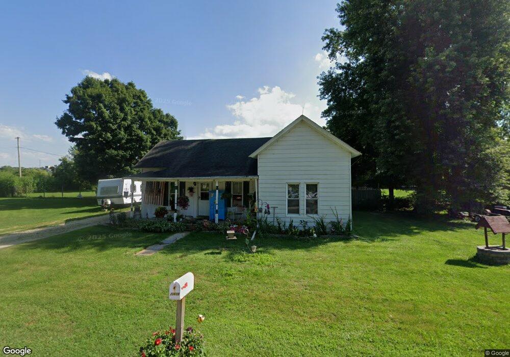
20609 State Line Rd Harvard, IL 60033
Estimated Value: $231,000 - $300,000
--
Bed
--
Bath
--
Sq Ft
0.55
Acres
About This Home
This home is located at 20609 State Line Rd, Harvard, IL 60033 and is currently estimated at $260,787. 20609 State Line Rd is a home located in McHenry County with nearby schools including Jefferson Elementary School, Crosby Elementary School, and Harvard Junior High School.
Ownership History
Date
Name
Owned For
Owner Type
Purchase Details
Closed on
Mar 11, 2008
Sold by
Morrissy Matthew J and Morrissy Kris L
Bought by
Morrissy Matthew J and Morrissy Kris L
Current Estimated Value
Purchase Details
Closed on
Jun 29, 1998
Sold by
Schalk Stephen E
Bought by
Morrissy Matthew J and Morrissy Kris L
Home Financials for this Owner
Home Financials are based on the most recent Mortgage that was taken out on this home.
Original Mortgage
$63,600
Outstanding Balance
$13,435
Interest Rate
7.37%
Estimated Equity
$247,352
Create a Home Valuation Report for This Property
The Home Valuation Report is an in-depth analysis detailing your home's value as well as a comparison with similar homes in the area
Home Values in the Area
Average Home Value in this Area
Purchase History
| Date | Buyer | Sale Price | Title Company |
|---|---|---|---|
| Morrissy Matthew J | -- | None Available | |
| Morrissy Matthew J | $79,500 | Chicago Title |
Source: Public Records
Mortgage History
| Date | Status | Borrower | Loan Amount |
|---|---|---|---|
| Open | Morrissy Matthew J | $63,600 |
Source: Public Records
Tax History Compared to Growth
Tax History
| Year | Tax Paid | Tax Assessment Tax Assessment Total Assessment is a certain percentage of the fair market value that is determined by local assessors to be the total taxable value of land and additions on the property. | Land | Improvement |
|---|---|---|---|---|
| 2024 | $4,596 | $65,357 | $6,666 | $58,691 |
| 2023 | $4,530 | $59,082 | $6,026 | $53,056 |
| 2022 | $4,190 | $52,675 | $6,026 | $46,649 |
| 2021 | $4,028 | $49,055 | $5,612 | $43,443 |
| 2020 | $3,954 | $46,702 | $5,343 | $41,359 |
| 2019 | $3,768 | $43,704 | $5,000 | $38,704 |
| 2018 | $2,334 | $25,872 | $5,001 | $20,871 |
| 2017 | $2,248 | $23,310 | $4,506 | $18,804 |
| 2016 | $2,172 | $22,003 | $4,253 | $17,750 |
| 2013 | -- | $22,038 | $4,260 | $17,778 |
Source: Public Records
Map
Nearby Homes
- 19602 Hebron Rd
- 940 Laurie Ct
- 815 Bennett Dr
- 408 Savannah Dr
- 677 Cook St
- 147 Fremont St
- 218 Wood St
- 656 Baker St
- 642 Baker St
- 805 Devils Ln
- 103 Kenosha St
- 100 N Main St
- 126 N 5th Ave
- 306 N Main St
- 262 Castle Terrace Ave
- 348 County Road B Unit 8
- 350 County Road B Unit 8
- 1019 Tarrant Dr
- 352 County Road B Unit 12
- 1090 Shabbona Dr
- 20613 State Line Rd
- W6120 State Line Rd
- Lt0 State Line Rd
- Lt0 State Line Rd Unit Lt0
- 20617 State Line Rd
- W6132 State Line Rd
- W6102 State Line Rd
- 20701 State Line Rd
- W6146 State Line Rd
- N106 Us Highway 14
- 11524 U S 14
- 20705 State Line Rd
- W6150 State Line Rd
- W6096 State Line Rd
- 11417 N Us Highway 14
- W6160 State Line Rd
- W6090 State Line Rd
- 11508 N Us Highway 14
- W6082 State Line Rd
- N130 Us Highway 14