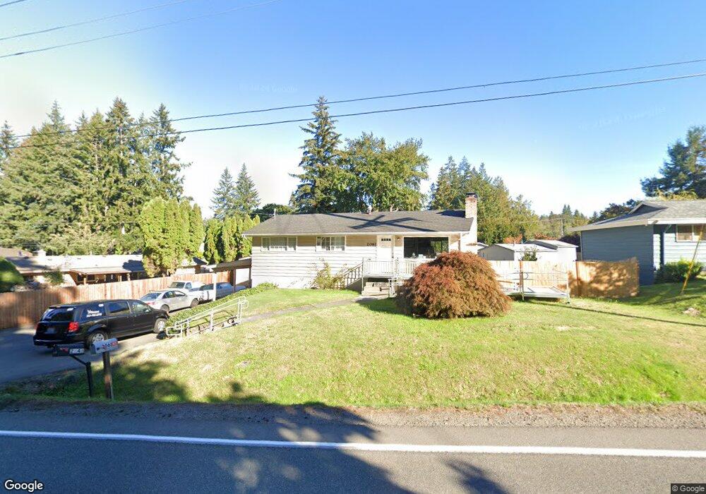
2061 Mitchell Rd SE Port Orchard, WA 98366
East Port Orchard NeighborhoodEstimated Value: $423,000 - $525,000
4
Beds
2
Baths
2,050
Sq Ft
$234/Sq Ft
Est. Value
About This Home
This home is located at 2061 Mitchell Rd SE, Port Orchard, WA 98366 and is currently estimated at $480,633, approximately $234 per square foot. 2061 Mitchell Rd SE is a home located in Kitsap County with nearby schools including East Port Orchard Elementary School, Marcus Whitman Middle School, and South Kitsap High School.
Ownership History
Date
Name
Owned For
Owner Type
Purchase Details
Closed on
Jan 22, 2020
Sold by
Nicolas Jose I San and Nicolas June San
Bought by
Nicolas Jose I San and Nicolas June San
Current Estimated Value
Home Financials for this Owner
Home Financials are based on the most recent Mortgage that was taken out on this home.
Original Mortgage
$335,394
Outstanding Balance
$296,904
Interest Rate
3.7%
Mortgage Type
New Conventional
Estimated Equity
$183,729
Purchase Details
Closed on
Mar 26, 2019
Sold by
Yingling Ryan K and Yingling Emily A
Bought by
San Nicolas Iii Jose L San and San Nicolas June
Home Financials for this Owner
Home Financials are based on the most recent Mortgage that was taken out on this home.
Original Mortgage
$330,000
Interest Rate
4.3%
Mortgage Type
VA
Purchase Details
Closed on
Jun 8, 2011
Sold by
Manning Lynn and Manning Pamela
Bought by
Yingling Ryan K and Yingling Emily A
Home Financials for this Owner
Home Financials are based on the most recent Mortgage that was taken out on this home.
Original Mortgage
$187,150
Interest Rate
4.71%
Mortgage Type
New Conventional
Purchase Details
Closed on
Sep 7, 2010
Sold by
The Bank Of New York Mellon Trust Compan
Bought by
Manning Lynn and Manning Pamela
Purchase Details
Closed on
Jun 4, 2010
Sold by
Burns Rodger and Mortgage Electronic Registrati
Bought by
The Bank Of New York Mellon Trust Compan and Protium Master Grantor Trust
Purchase Details
Closed on
May 26, 1999
Sold by
Oconnor Michael J and Oconnor Heidi M
Bought by
Burns Rodger
Home Financials for this Owner
Home Financials are based on the most recent Mortgage that was taken out on this home.
Original Mortgage
$103,988
Interest Rate
6.9%
Mortgage Type
FHA
Create a Home Valuation Report for This Property
The Home Valuation Report is an in-depth analysis detailing your home's value as well as a comparison with similar homes in the area
Home Values in the Area
Average Home Value in this Area
Purchase History
| Date | Buyer | Sale Price | Title Company |
|---|---|---|---|
| Nicolas Jose I San | -- | Chicago Title | |
| San Nicolas Iii Jose L San | $330,000 | Attorneys Ttl Of Kitsap Port | |
| Yingling Ryan K | $197,280 | Stewart Title Kitsap County | |
| Manning Lynn | $119,530 | Land Title | |
| The Bank Of New York Mellon Trust Compan | $108,000 | Land Title | |
| Burns Rodger | $105,000 | Transnation Title Insurance |
Source: Public Records
Mortgage History
| Date | Status | Borrower | Loan Amount |
|---|---|---|---|
| Open | Nicolas Jose I San | $335,394 | |
| Closed | San Nicolas Iii Jose L San | $330,000 | |
| Previous Owner | Yingling Ryan K | $187,150 | |
| Previous Owner | Burns Rodger | $103,988 |
Source: Public Records
Tax History Compared to Growth
Tax History
| Year | Tax Paid | Tax Assessment Tax Assessment Total Assessment is a certain percentage of the fair market value that is determined by local assessors to be the total taxable value of land and additions on the property. | Land | Improvement |
|---|---|---|---|---|
| 2026 | $3,669 | $445,350 | $71,820 | $373,530 |
| 2025 | $3,669 | $416,040 | $60,420 | $355,620 |
| 2024 | $3,558 | $416,040 | $60,420 | $355,620 |
| 2023 | $3,534 | $416,040 | $60,420 | $355,620 |
| 2022 | $3,462 | $341,540 | $56,420 | $285,120 |
| 2021 | $3,098 | $288,400 | $52,430 | $235,970 |
| 2020 | $3,050 | $275,950 | $49,930 | $226,020 |
| 2019 | $2,332 | $229,950 | $49,500 | $180,450 |
| 2018 | $2,451 | $188,530 | $49,500 | $139,030 |
| 2017 | $2,106 | $188,530 | $49,500 | $139,030 |
| 2016 | $2,067 | $169,330 | $49,500 | $119,830 |
| 2015 | $2,003 | $166,300 | $49,500 | $116,800 |
| 2014 | -- | $163,270 | $49,500 | $113,770 |
| 2013 | -- | $167,490 | $52,110 | $115,380 |
Source: Public Records
Map
Nearby Homes
- 1350 SE Shelton Ln
- 0 Lincoln Ave SE
- 2313 Lincoln Ave SE
- 2673 Harold Dr SE
- 2235 Eisenhower Ave SE
- 3132 Harris Rd SE
- 1325 Garrison Ave
- 0 Smith St
- 1408 West Ave
- 1234 Garrison Ave
- 410 Kendall St
- 2949 SE Mile Hill Dr Unit C7
- 2949 SE Mile Hill Dr Unit C-2
- 4990 Mile Hill Dr
- 911 Hull Ave
- 2198 SE Galeel Ct
- 528 Dwight St
- 130 Mitchell Ave
- 108 Kendall St
- 1369 Sherman Ave
- 2087 Mitchell Rd SE
- 2028 Jefferson Ave SE
- 2062 Jefferson Ave SE
- 2109 Mitchell Rd SE
- 2133 Mitchell Rd SE
- 2002 Mitchell Rd SE
- 2134 Jefferson Ave SE
- 1540 Mitchell Rd SE Unit D-100
- 1540 Mitchell Rd SE Unit A-102
- 1540 Mitchell Rd SE Unit D-101
- 1540 Mitchell Rd SE Unit A-101
- 1540 Mitchell Rd SE Unit B-101
- 1540 Mitchell Ave SE
- 1540 Mitchell Rd SE Unit B
- 1540 Mitchell Rd SE Unit B-102
- 1540 Mitchell Rd SE
- 1540 Mitchell Rd SE Unit D-102
- 1540 Mitchell Rd SE Unit B-100