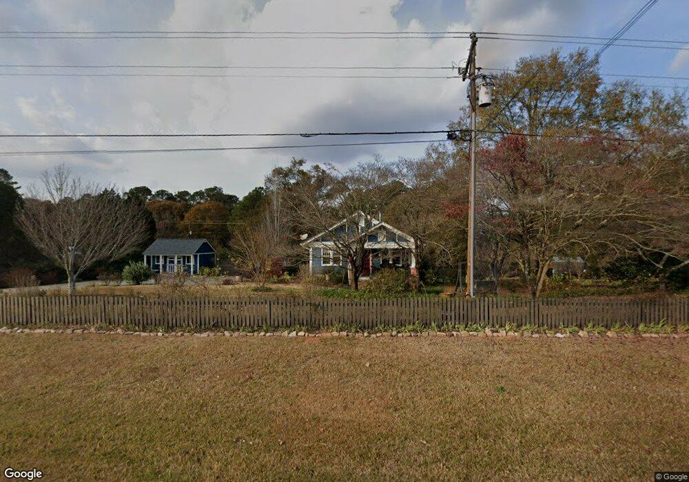
2061 S Barnett Shoals Rd Watkinsville, GA 30677
Estimated Value: $400,888 - $765,000
2
Beds
1
Bath
1,350
Sq Ft
$402/Sq Ft
Est. Value
About This Home
This home is located at 2061 S Barnett Shoals Rd, Watkinsville, GA 30677 and is currently estimated at $542,972, approximately $402 per square foot. 2061 S Barnett Shoals Rd is a home located in Oconee County with nearby schools including Colham Ferry Elementary School, Oconee County Middle School, and Oconee County High School.
Ownership History
Date
Name
Owned For
Owner Type
Purchase Details
Closed on
Mar 19, 2018
Sold by
Smith Robert H
Bought by
Gibson Burnley Clay Andrew and Gibson Burnley Francisca
Current Estimated Value
Home Financials for this Owner
Home Financials are based on the most recent Mortgage that was taken out on this home.
Original Mortgage
$190,800
Interest Rate
4.38%
Mortgage Type
New Conventional
Purchase Details
Closed on
Mar 20, 2015
Sold by
Wood Nolen L
Bought by
Smith Robert H
Home Financials for this Owner
Home Financials are based on the most recent Mortgage that was taken out on this home.
Original Mortgage
$50,745
Interest Rate
3.87%
Mortgage Type
New Conventional
Purchase Details
Closed on
Sep 19, 2006
Sold by
Not Provided
Bought by
Wood Nolen L
Create a Home Valuation Report for This Property
The Home Valuation Report is an in-depth analysis detailing your home's value as well as a comparison with similar homes in the area
Home Values in the Area
Average Home Value in this Area
Purchase History
| Date | Buyer | Sale Price | Title Company |
|---|---|---|---|
| Gibson Burnley Clay Andrew | $212,000 | -- | |
| Smith Robert H | $37,500 | -- | |
| Wood Nolen L | -- | -- |
Source: Public Records
Mortgage History
| Date | Status | Borrower | Loan Amount |
|---|---|---|---|
| Closed | Gibson Burnley Clay Andrew | $190,800 | |
| Previous Owner | Smith Robert H | $50,745 |
Source: Public Records
Tax History Compared to Growth
Tax History
| Year | Tax Paid | Tax Assessment Tax Assessment Total Assessment is a certain percentage of the fair market value that is determined by local assessors to be the total taxable value of land and additions on the property. | Land | Improvement |
|---|---|---|---|---|
| 2024 | $2,733 | $160,110 | $31,384 | $128,726 |
| 2023 | $2,954 | $150,556 | $29,059 | $121,497 |
| 2022 | $2,791 | $130,091 | $23,248 | $106,843 |
| 2021 | $2,735 | $118,161 | $21,134 | $97,027 |
| 2020 | $2,601 | $112,167 | $19,213 | $92,954 |
| 2019 | $2,413 | $104,054 | $16,706 | $87,348 |
| 2018 | $1,756 | $74,120 | $15,188 | $58,932 |
| 2017 | $939 | $46,639 | $12,657 | $33,982 |
| 2016 | $740 | $31,241 | $11,506 | $19,735 |
| 2015 | $393 | $16,560 | $11,506 | $5,054 |
Source: Public Records
Map
Nearby Homes
- 1300 Victoria Rd
- 1030 Rossiter Ct
- 1040 Rossiter Ct
- Laurel Plan at Wire Park - Trillium
- E Building Townhome Plan at Wire Park - The Towns
- Cubicasa Plan at Wire Park - The Towns
- 1121 Watson Ln Unit E2
- Azalea Plan at Wire Park - Trillium
- Jasmine Plan at Wire Park - Trillium
- E Building Townhome Plan at Wire Park - The Towns
- Cubicasa Plan at Wire Park - The Towns
- Dogwood Plan at Wire Park - Trillium
- 1170 Watson Ln Unit F5
- 1144 Watson Ln Unit F4
- 1120 Watson Ln Unit F3
- 1194 Watson Ln Unit F6
- 1145 Watson Ln Unit E3
- 1311 Watson Ln Unit E8
- 1171 Watson Ln Unit E4
- 1195 Watson Ln Unit E5
- 2031 S Barnett Shoals Rd
- 2041 S Barnett Shoals Rd
- 2091 S Barnett Shoals Rd
- 2021 S Barnett Shoals Rd
- 2100 S Barnett Shoals Rd Unit PII, Tract 1
- 2100 S Barnett Shoals Rd
- 2043 S Barnett Shoals Rd
- 2130 S Barnett Shoals Rd
- 1030 Porter Creek Dr
- 2151 S Barnett Shoals Rd
- 1160 Porter Creek Dr
- 1170 Porter Creek Dr
- 1050 Porter Creek Dr
- 1970 S Barnett Shoals Rd
- 1070 Porter Creek Dr
- 1090 Porter Creek Dr
- 1031 Porter Creek Dr
- 1110 Porter Creek Dr
- 1150 Porter Creek Dr
- 2025 S Barnett Shoals Rd