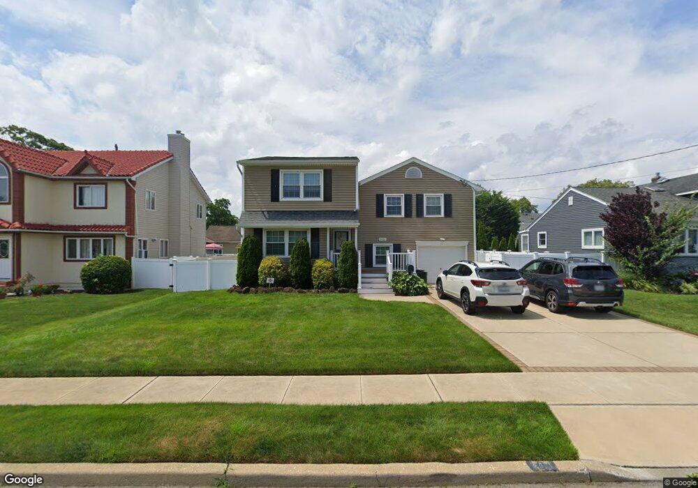
2061 Shoreham Way Merrick, NY 11566
Estimated Value: $844,694 - $957,000
4
Beds
2
Baths
1,878
Sq Ft
$480/Sq Ft
Est. Value
About This Home
This home is located at 2061 Shoreham Way, Merrick, NY 11566 and is currently estimated at $900,847, approximately $479 per square foot. 2061 Shoreham Way is a home located in Nassau County with nearby schools including Merrick Avenue Middle School, John F. Kennedy High School, and St. Elizabeth Ann Seton Regional School.
Ownership History
Date
Name
Owned For
Owner Type
Purchase Details
Closed on
Jul 26, 2000
Sold by
Kirey Brian and Kirey Alissa
Bought by
Nagel Dennis P and Nagel Jeanne A
Current Estimated Value
Purchase Details
Closed on
Mar 24, 1999
Sold by
Weisel Edward M and Weisel Martha S
Bought by
Kirey Brian and Kirey Alissa
Create a Home Valuation Report for This Property
The Home Valuation Report is an in-depth analysis detailing your home's value as well as a comparison with similar homes in the area
Home Values in the Area
Average Home Value in this Area
Purchase History
| Date | Buyer | Sale Price | Title Company |
|---|---|---|---|
| Nagel Dennis P | $385,000 | Laura Grossman | |
| Kirey Brian | $267,500 | -- |
Source: Public Records
Tax History
| Year | Tax Paid | Tax Assessment Tax Assessment Total Assessment is a certain percentage of the fair market value that is determined by local assessors to be the total taxable value of land and additions on the property. | Land | Improvement |
|---|---|---|---|---|
| 2025 | $15,905 | $560 | $255 | $305 |
| 2024 | $3,981 | $562 | $256 | $306 |
Source: Public Records
Map
Nearby Homes
- 2072 Brighton Way
- 110 Hampton Way
- 2845 Whaleneck Dr
- 109 Elliot St
- 2810 Wynsum Ave
- 2819 Harbor Rd
- 2077 Byron Rd
- 2066 Holland Way
- 2884 Bay Dr
- 2863 Harbor Rd
- 2829 Frankel Blvd
- 2729 Shore Dr
- 1945 Byron Rd
- 217 Bayview Ave
- 1903 George Ct
- 1360-1370 Merrick Rd
- 2043 Ripley Ln
- 163 Wynsum Ave
- 1993 Lowell Ln
- 23 Bay St
- 2067 Shoreham Way
- 82 Shoreham Way
- 90 Hampton Way
- 2064 Hampton Way
- 2073 Shoreham Way
- 2776 Whaleneck Dr
- 2070 Hampton Way
- 2052 Shoreham Way
- 4 Whaleneck Dr
- 2064 Shoreham Way
- 2778 Hewlett Ave
- 2782 Whaleneck Dr
- 2070 Shoreham Way
- 2082 Hampton Way
- 9 Whaleneck Dr
- 2782 Whaleneck Dr
- 2082 Shoreham Way
- 2063 Hampton Way
- 8 Whaleneck Dr
- 2057 Hampton Way
Your Personal Tour Guide
Ask me questions while you tour the home.