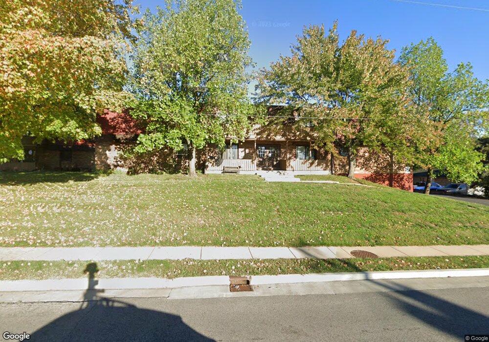
2061 W Monroe St Unit H Springfield, IL 62704
Pasfield Park Place NeighborhoodEstimated Value: $64,000 - $71,550
Studio
--
Bath
--
Sq Ft
--
Built
About This Home
This home is located at 2061 W Monroe St Unit H, Springfield, IL 62704 and is currently estimated at $67,888. 2061 W Monroe St Unit H is a home located in Sangamon County with nearby schools including Dubois Elementary School, U.S. Grant Middle School, and Springfield High School.
Ownership History
Date
Name
Owned For
Owner Type
Purchase Details
Closed on
Mar 14, 2023
Sold by
Ahmed Saad
Bought by
Bontemps Tyler
Current Estimated Value
Home Financials for this Owner
Home Financials are based on the most recent Mortgage that was taken out on this home.
Original Mortgage
$53,000
Outstanding Balance
$36,618
Interest Rate
6.75%
Mortgage Type
New Conventional
Estimated Equity
$31,270
Purchase Details
Closed on
Oct 17, 2022
Sold by
Thomas Rachel L
Bought by
Ahmed Saad
Purchase Details
Closed on
Jan 3, 1995
Create a Home Valuation Report for This Property
The Home Valuation Report is an in-depth analysis detailing your home's value as well as a comparison with similar homes in the area
Home Values in the Area
Average Home Value in this Area
Purchase History
| Date | Buyer | Sale Price | Title Company |
|---|---|---|---|
| Bontemps Tyler | $60,000 | -- | |
| Ahmed Saad | $50,000 | -- | |
| -- | $45,000 | -- |
Source: Public Records
Mortgage History
| Date | Status | Borrower | Loan Amount |
|---|---|---|---|
| Open | Bontemps Tyler | $53,000 |
Source: Public Records
Tax History
| Year | Tax Paid | Tax Assessment Tax Assessment Total Assessment is a certain percentage of the fair market value that is determined by local assessors to be the total taxable value of land and additions on the property. | Land | Improvement |
|---|---|---|---|---|
| 2024 | $1,480 | $23,618 | $1,919 | $21,699 |
| 2023 | $1,907 | $21,573 | $1,753 | $19,820 |
| 2022 | $1,016 | $13,150 | $1,664 | $11,486 |
| 2021 | $1,021 | $12,658 | $1,602 | $11,056 |
| 2020 | $999 | $12,677 | $1,604 | $11,073 |
| 2019 | $984 | $12,632 | $1,598 | $11,034 |
| 2018 | $958 | $14,221 | $1,799 | $12,422 |
| 2017 | $951 | $14,037 | $1,776 | $12,261 |
| 2016 | $529 | $13,832 | $1,750 | $12,082 |
| 2015 | $858 | $21,268 | $1,728 | $19,540 |
| 2014 | $840 | $21,131 | $1,717 | $19,414 |
| 2013 | $821 | $21,131 | $1,717 | $19,414 |
Source: Public Records
Map
Nearby Homes
- 2081 W Monroe St Unit 1 or A
- 1910 Jeanette Ln Unit 2
- 1921 Jeanette Ln Unit 2
- 2134 W Lawrence Ave
- 2138 W Lawrence Ave
- 2309 W Lawrence Ave
- 528 Rosehill Ave
- 2553 Chapel Hill Dr
- 2028 Parkview Dr
- 423 S Adelia St
- 1428 W Edwards St
- 2308 Westview Dr
- 2102 W Jefferson St
- 259 N Columbia Ave
- 832 Independence Ridge
- 1316 W Lawrence Ave
- 2011 W Jefferson St
- 160 S Durkin Dr Unit 4
- 817 S Park Ave
- 545 S Lincoln Ave
- 2061 W Monroe St
- 2061 W Monroe St Unit 7
- 2061 W Monroe St Unit F
- 2061 W Monroe St Unit D
- 2061 W Monroe St Unit 3
- 2061 W Monroe St
- 2061 W Monroe St Unit A
- 2061 W Monroe St Unit 3
- 2061 W Monroe St Unit 8
- 2061 W Monroe St Unit 5
- 2061 W Monroe St
- 2061 W Monroe St
- 2061 W Monroe St
- 2081 W Monroe St 5 (E)
- 2081 W Monroe St G
- 2081 W Monroe (6)
- 2071 W Monroe St
- 2071 W Monroe St Unit H
- 2071 W Monroe St Unit 6
- 2071 W Monroe St
Your Personal Tour Guide
Ask me questions while you tour the home.