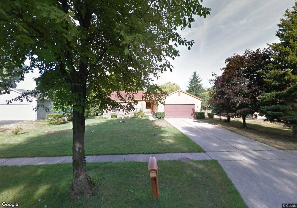
2061 Woonsocket Rd Toledo, OH 43615
Reynolds Corners NeighborhoodEstimated Value: $205,740 - $225,000
3
Beds
3
Baths
1,322
Sq Ft
$162/Sq Ft
Est. Value
About This Home
This home is located at 2061 Woonsocket Rd, Toledo, OH 43615 and is currently estimated at $213,935, approximately $161 per square foot. 2061 Woonsocket Rd is a home located in Lucas County with nearby schools including Hawkins Elementary School, Rogers High School, and St. Benedict Catholic School.
Ownership History
Date
Name
Owned For
Owner Type
Purchase Details
Closed on
Apr 23, 2018
Sold by
Hinton Betty J and Underwood Joseph J
Bought by
Hinton Betty J
Current Estimated Value
Purchase Details
Closed on
Sep 13, 2004
Sold by
Underwood Joseph J and Hinton Betty J
Bought by
Underwood Joseph J and Hinton Betty J
Purchase Details
Closed on
Apr 18, 1994
Purchase Details
Closed on
Jan 19, 1994
Create a Home Valuation Report for This Property
The Home Valuation Report is an in-depth analysis detailing your home's value as well as a comparison with similar homes in the area
Home Values in the Area
Average Home Value in this Area
Purchase History
| Date | Buyer | Sale Price | Title Company |
|---|---|---|---|
| Hinton Betty J | -- | None Available | |
| Underwood Joseph J | -- | -- | |
| -- | $81,000 | -- | |
| -- | -- | -- |
Source: Public Records
Tax History Compared to Growth
Tax History
| Year | Tax Paid | Tax Assessment Tax Assessment Total Assessment is a certain percentage of the fair market value that is determined by local assessors to be the total taxable value of land and additions on the property. | Land | Improvement |
|---|---|---|---|---|
| 2024 | $2,949 | $53,935 | $10,990 | $42,945 |
| 2023 | $2,435 | $45,500 | $9,135 | $36,365 |
| 2022 | $2,447 | $45,500 | $9,135 | $36,365 |
| 2021 | $2,498 | $45,500 | $9,135 | $36,365 |
| 2020 | $2,317 | $38,430 | $7,910 | $30,520 |
| 2019 | $2,260 | $38,430 | $7,910 | $30,520 |
| 2018 | $1,129 | $38,430 | $7,910 | $30,520 |
| 2017 | $2,088 | $34,615 | $6,650 | $27,965 |
| 2016 | $2,111 | $98,900 | $19,000 | $79,900 |
| 2015 | $2,093 | $98,900 | $19,000 | $79,900 |
| 2014 | $1,627 | $34,620 | $6,650 | $27,970 |
| 2013 | $1,627 | $34,620 | $6,650 | $27,970 |
Source: Public Records
Map
Nearby Homes
- 2026 Pautucket Rd
- 4709 W Bancroft St
- 4705 W Bancroft St
- 4515 W Bancroft St
- 4519 W Bancroft St
- 5331 Fleet Rd
- 5051 Wissman Rd
- 5041 Ancil Rd
- 2009 Garden Ln
- 4236 S Terrace View St
- 5057 Brandon Rd
- 801 Hilltop Ln
- 2720 Derby Rd
- 2222 Talmadge Rd
- 5212 Regency Dr
- 710 Hilltop Ln
- 5029 Kellogg Rd
- 1925 Olimphia Rd
- 1101 Sawyer Rd
- 4057 Hillandale Rd
- 2101 Woonsocket Rd
- 2053 Woonsocket Rd
- 2109 Woonsocket Rd
- 2045 Woonsocket Rd
- 2102 Willowhill Ln
- 2062 Willowhill Ln
- 2110 Willowhill Ln
- 2054 Willowhill Ln
- 2060 Woonsocket Rd
- 2117 Woonsocket Rd
- 2066 Woonsocket Rd
- 2104 Woonsocket Rd
- 2044 Willowhill Ln
- 2118 Willowhill Ln
- 2048 Woonsocket Rd
- 4912 Fleet Rd
- 4920 Fleet Rd
- 2110 Woonsocket Rd
- 2040 Woonsocket Rd
- 4928 Fleet Rd