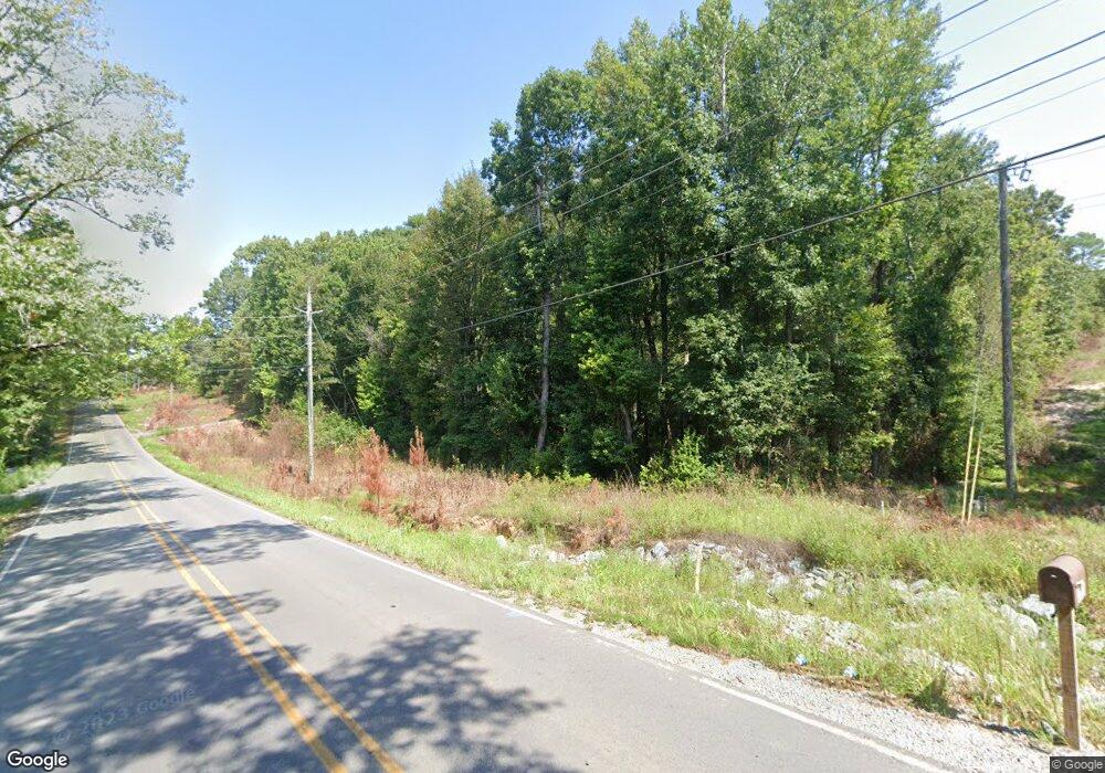
20611 N Sardis Rd Mabelvale, AR 72103
Estimated Value: $270,000 - $352,000
--
Bed
1
Bath
2,049
Sq Ft
$147/Sq Ft
Est. Value
About This Home
This home is located at 20611 N Sardis Rd, Mabelvale, AR 72103 and is currently estimated at $301,572, approximately $147 per square foot. 20611 N Sardis Rd is a home with nearby schools including Sheridan High School.
Ownership History
Date
Name
Owned For
Owner Type
Purchase Details
Closed on
Feb 27, 2020
Sold by
Cash Gary D and Cash Christy L
Bought by
Cash Gary D
Current Estimated Value
Home Financials for this Owner
Home Financials are based on the most recent Mortgage that was taken out on this home.
Original Mortgage
$193,750
Outstanding Balance
$171,552
Interest Rate
3.6%
Mortgage Type
New Conventional
Estimated Equity
$130,020
Purchase Details
Closed on
Oct 4, 2017
Sold by
M P N P Lp
Bought by
Cash Gary D and Cash Chirsty L
Home Financials for this Owner
Home Financials are based on the most recent Mortgage that was taken out on this home.
Original Mortgage
$160,000
Interest Rate
3.86%
Mortgage Type
Construction
Purchase Details
Closed on
Jul 15, 2005
Sold by
M P N P Lp
Bought by
Cash Gary and West Christy
Purchase Details
Closed on
Aug 28, 2001
Bought by
Mpnp
Purchase Details
Closed on
Feb 7, 1996
Bought by
Warnix
Create a Home Valuation Report for This Property
The Home Valuation Report is an in-depth analysis detailing your home's value as well as a comparison with similar homes in the area
Home Values in the Area
Average Home Value in this Area
Purchase History
| Date | Buyer | Sale Price | Title Company |
|---|---|---|---|
| Cash Gary D | -- | Servicelink | |
| Cash Gary D | $20,000 | Lenders Title | |
| Cash Gary | $20,000 | -- | |
| Mpnp | -- | -- | |
| Warnix | -- | -- |
Source: Public Records
Mortgage History
| Date | Status | Borrower | Loan Amount |
|---|---|---|---|
| Open | Cash Gary D | $193,750 | |
| Closed | Cash Gary D | $160,000 |
Source: Public Records
Tax History Compared to Growth
Tax History
| Year | Tax Paid | Tax Assessment Tax Assessment Total Assessment is a certain percentage of the fair market value that is determined by local assessors to be the total taxable value of land and additions on the property. | Land | Improvement |
|---|---|---|---|---|
| 2025 | $2,274 | $49,760 | $5,520 | $44,240 |
| 2024 | $2,085 | $49,760 | $5,520 | $44,240 |
| 2023 | $1,905 | $49,760 | $5,520 | $44,240 |
| 2022 | $2,232 | $49,760 | $5,520 | $44,240 |
| 2021 | $1,586 | $42,910 | $4,600 | $38,310 |
| 2020 | $1,586 | $42,910 | $4,600 | $38,310 |
| 2019 | $1,491 | $40,830 | $4,600 | $36,230 |
| 2018 | $244 | $5,330 | $4,000 | $1,330 |
| 2017 | $176 | $5,330 | $4,000 | $1,330 |
| 2016 | $168 | $4,000 | $4,000 | $0 |
| 2015 | $166 | $4,000 | $4,000 | $0 |
| 2014 | -- | $3,790 | $4,000 | $0 |
Source: Public Records
Map
Nearby Homes
- 3010 McPherson Ridge Dr
- 0 N Sardis Rd Unit 24039362
- 19670 Mcpherson Rd
- 10128 McPherson Ridge Rd
- TBD Hobby Trail
- 22683 Haskins Rd
- 308 Bristlecone Rd Unit Tract 46
- 262 Mountain Pine Rd Unit Tract 39
- 8422 Robinwood Dr
- 323 Bristlecone Ln Unit Tract 170
- 170 Mountain Pine Rd Unit Tract 7
- 156 Mountain Pine Rd Unit Tract 6
- 209 Mountain Pine Rd Unit Tract 173
- 8210 Clearlake Dr
- 10225 Pauls Valley
- 144 Mountain Pine Rd Unit Tract 5
- 201 Mountain Pine Rd Unit Tract 174
- 11018 Billy Williams Dr
- 22933 N Sardis Rd
- 8872 Kristen Cir
- 20513 N Sardis Rd
- 2033 Mcpherson Cove
- 0 Mcpherson Cove
- 2021 Mcpherson Cove
- 20620 N Sardis Rd
- 20725 N Sardis Rd
- 20307 N Sardis Rd
- 1051 McPherson Valley Rd
- 2006 Mcpherson Cove
- 9801 Bluebird Sardis
- 21409 Mcpherson Rd
- 21514 Mcpherson Rd
- 20508 N Sardis Rd
- 20815 N Sardis Rd
- 20302 N Sardis Rd
- 20119 N Sardis Rd
- 20408 N Sardis Rd
- 10000 Layton Ln
- 1136 McPherson Valley Rd
- 0 Layton Ln
