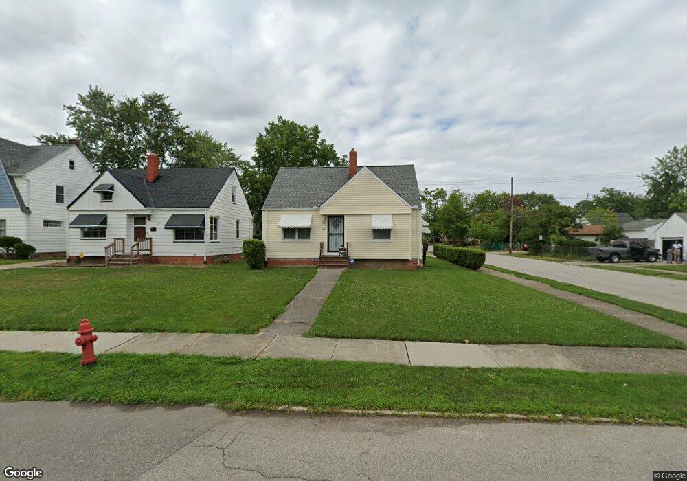
20615 Franklin Rd Maple Heights, OH 44137
Estimated Value: $111,000 - $124,000
2
Beds
1
Bath
716
Sq Ft
$164/Sq Ft
Est. Value
About This Home
This home is located at 20615 Franklin Rd, Maple Heights, OH 44137 and is currently estimated at $117,362, approximately $163 per square foot. 20615 Franklin Rd is a home located in Cuyahoga County with nearby schools including Abraham Lincoln Elementary School, Rockside/ J.F. Kennedy School, and Barack Obama School.
Ownership History
Date
Name
Owned For
Owner Type
Purchase Details
Closed on
Jul 21, 2000
Sold by
Kiernan Barry E and Kiernan Shirley H
Bought by
Williams Theodore A and Anderson Williams Carolyn
Current Estimated Value
Home Financials for this Owner
Home Financials are based on the most recent Mortgage that was taken out on this home.
Original Mortgage
$74,386
Outstanding Balance
$26,769
Interest Rate
8.31%
Mortgage Type
FHA
Estimated Equity
$90,593
Purchase Details
Closed on
Sep 16, 1993
Sold by
William Stark
Bought by
Kiernan Barry E
Purchase Details
Closed on
Sep 21, 1982
Sold by
Stark William and Stark Eleanor L
Bought by
William Stark
Purchase Details
Closed on
May 31, 1979
Sold by
William Stark
Bought by
Stark William and Stark Eleanor L
Purchase Details
Closed on
Apr 30, 1979
Sold by
Stark Wm and Stark Eleanor L
Bought by
William Stark
Purchase Details
Closed on
Jan 1, 1975
Bought by
Stark Wm and Stark Eleanor L
Create a Home Valuation Report for This Property
The Home Valuation Report is an in-depth analysis detailing your home's value as well as a comparison with similar homes in the area
Home Values in the Area
Average Home Value in this Area
Purchase History
| Date | Buyer | Sale Price | Title Company |
|---|---|---|---|
| Williams Theodore A | $75,000 | Title Xperts Agency Inc | |
| Kiernan Barry E | $54,500 | -- | |
| William Stark | -- | -- | |
| Stark William | -- | -- | |
| William Stark | -- | -- | |
| Stark Wm | -- | -- |
Source: Public Records
Mortgage History
| Date | Status | Borrower | Loan Amount |
|---|---|---|---|
| Open | Williams Theodore A | $74,386 |
Source: Public Records
Tax History
| Year | Tax Paid | Tax Assessment Tax Assessment Total Assessment is a certain percentage of the fair market value that is determined by local assessors to be the total taxable value of land and additions on the property. | Land | Improvement |
|---|---|---|---|---|
| 2024 | $2,456 | $35,455 | $7,875 | $27,580 |
| 2023 | $1,967 | $17,360 | $4,760 | $12,600 |
| 2022 | $1,174 | $17,360 | $4,760 | $12,600 |
| 2021 | $2,082 | $17,360 | $4,760 | $12,600 |
| 2020 | $1,797 | $13,160 | $3,610 | $9,560 |
| 2019 | $1,784 | $37,600 | $10,300 | $27,300 |
| 2018 | $1,774 | $13,160 | $3,610 | $9,560 |
| 2017 | $1,740 | $12,570 | $3,360 | $9,210 |
| 2016 | $1,681 | $12,360 | $3,360 | $9,000 |
| 2015 | $1,646 | $12,360 | $3,360 | $9,000 |
| 2014 | $1,646 | $13,590 | $3,680 | $9,910 |
Source: Public Records
Map
Nearby Homes
- 20517 Raymond St
- 20600 Watson Rd
- 5147 Warrensville Center Rd
- 20715 Watson Rd
- 20905 Clare Ave
- 20806 Clare Ave
- 20705 Hansen Rd
- 21202 Hillgrove Ave
- 21207 Franklin Rd
- 19931 Raymond St
- 21202 Gardenview Dr
- 21600 Franklin Rd
- 19520 Maple Heights Blvd
- 21607 Libby Rd
- 21860 Louis Rd
- 5165 Camden Rd
- 19289 Stafford Ave
- 5194 Homewood Ave
- 18990 Raymond St
- 18851 Raymond St
- 20611 Franklin Rd
- 20609 Franklin Rd
- 20701 Franklin Rd
- 20616 Raymond St
- 20607 Franklin Rd
- 20709 Franklin Rd
- 20650 Raymond St
- 20702 Raymond St
- 20614 Franklin Rd
- 20605 Franklin Rd
- 20713 Franklin Rd
- 20604 Raymond St
- 20706 Raymond St
- 20608 Franklin Rd
- 20700 Franklin Rd
- 20604 Franklin Rd
- 20600 Raymond St
- 20717 Franklin Rd
- 20710 Raymond St
- 20517 Franklin Rd
Your Personal Tour Guide
Ask me questions while you tour the home.