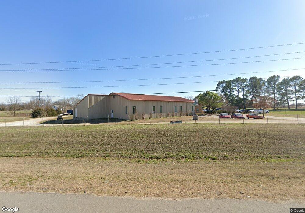
20619 E Highway 412 Springdale, AR 72764
Estimated Value: $181,354 - $527,000
Studio
1
Bath
980
Sq Ft
$302/Sq Ft
Est. Value
About This Home
This home is located at 20619 E Highway 412, Springdale, AR 72764 and is currently estimated at $296,339, approximately $302 per square foot. 20619 E Highway 412 is a home located in Washington County with nearby schools including Sonora Elementary School, Sonora Middle School, and Lakeside Junior High School.
Ownership History
Date
Name
Owned For
Owner Type
Purchase Details
Closed on
Oct 21, 2003
Sold by
Galloway Alice
Bought by
Johnson Ron G and Srader Teresa K
Current Estimated Value
Home Financials for this Owner
Home Financials are based on the most recent Mortgage that was taken out on this home.
Original Mortgage
$51,772
Interest Rate
5.96%
Mortgage Type
Purchase Money Mortgage
Purchase Details
Closed on
Jan 1, 1985
Bought by
Galloway Monroe and Galloway Alice
Create a Home Valuation Report for This Property
The Home Valuation Report is an in-depth analysis detailing your home's value as well as a comparison with similar homes in the area
Home Values in the Area
Average Home Value in this Area
Purchase History
| Date | Buyer | Sale Price | Title Company |
|---|---|---|---|
| Johnson Ron G | $73,000 | -- | |
| Galloway Monroe | -- | -- |
Source: Public Records
Mortgage History
| Date | Status | Borrower | Loan Amount |
|---|---|---|---|
| Closed | Johnson Ron G | $51,772 |
Source: Public Records
Tax History Compared to Growth
Tax History
| Year | Tax Paid | Tax Assessment Tax Assessment Total Assessment is a certain percentage of the fair market value that is determined by local assessors to be the total taxable value of land and additions on the property. | Land | Improvement |
|---|---|---|---|---|
| 2025 | $462 | $29,870 | $11,290 | $18,580 |
| 2024 | $524 | $29,870 | $11,290 | $18,580 |
| 2023 | $580 | $29,870 | $11,290 | $18,580 |
| 2022 | $656 | $23,560 | $9,290 | $14,270 |
| 2021 | $613 | $23,560 | $9,290 | $14,270 |
| 2020 | $565 | $23,560 | $9,290 | $14,270 |
| 2019 | $518 | $17,290 | $5,100 | $12,190 |
| 2018 | $543 | $17,290 | $5,100 | $12,190 |
| 2017 | $454 | $17,290 | $5,100 | $12,190 |
| 2016 | $438 | $15,220 | $5,100 | $10,120 |
| 2015 | $438 | $15,220 | $5,100 | $10,120 |
| 2014 | $429 | $15,040 | $4,100 | $10,940 |
Source: Public Records
Map
Nearby Homes
- TBD Tract B Hardwood Rd
- 19731 Nob Hill Loop
- 20507 Highway 303 S
- 22359 Derik Rd
- 0 War Eagle Wc 507
- 22490 Derik Rd
- 0 N Lakeshore Wc 1064
- 19123 Hill Rd
- TBD Hickory Springs Rd
- 21732 Chinquapin Rd
- 18318 Oakridge Rd
- 19512 Highway 303 S
- 0 Hickory Springs Rd
- 23386 Copeland Ln
- 22037 Dogwood Cir
- 4.32 AC Barzel Point Rd
- Lot 12 Barzel Point Rd
- 23122 N Hickory Flat Rd
- 17952 Pine Ridge
- 21830 Friendship View Dr
- 20665 E Highway 412
- 20646 E Hwy 412
- 20602 E Highway 412
- 17101 Johnston Rd
- 20467 E Highway 412
- 21002 Johnston Rd
- 0000 Johnson Rd
- 21109 Johnston Rd
- 20907 Johnston Rd
- 22118 E Highway 412
- 20717 E Highway 412
- 20438 E Hwy 412
- 0 Hwy 412 W Unit 299733
- 0 Hwy 412 W Unit 392240
- 0 Hwy 412 W Unit 453981
- 0 Hwy 412 W Unit 453418
- 0 Hwy 412 W Unit 520706
- 0 Hwy 412 W Unit 564507
- 0 Hwy 412 W Unit 629775
- 0 Hwy 412 W Unit 642511
