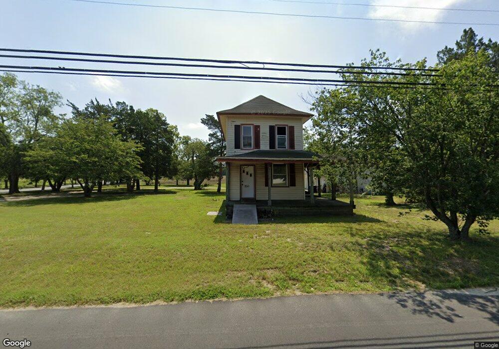
2063 Route 9 Ocean View, NJ 08230
Estimated Value: $508,616 - $668,000
--
Bed
--
Bath
2,904
Sq Ft
$210/Sq Ft
Est. Value
About This Home
This home is located at 2063 Route 9, Ocean View, NJ 08230 and is currently estimated at $609,154, approximately $209 per square foot. 2063 Route 9 is a home located in Cape May County with nearby schools including Upper Township Primary School, Upper Township Elementary School, and Upper Township Middle School.
Ownership History
Date
Name
Owned For
Owner Type
Purchase Details
Closed on
Dec 28, 2005
Sold by
Ulmer Thomas and Ulmer Elizabeth
Bought by
Pastime Place Llc
Current Estimated Value
Purchase Details
Closed on
Jul 19, 1991
Sold by
Blackley Jr William F and Blackley Laura E
Bought by
Ricco Peter J and Ricco Judith
Purchase Details
Closed on
May 7, 1990
Sold by
Blackley Jr William F and Blackley Laura E
Bought by
Atlantic City Electric Co
Create a Home Valuation Report for This Property
The Home Valuation Report is an in-depth analysis detailing your home's value as well as a comparison with similar homes in the area
Home Values in the Area
Average Home Value in this Area
Purchase History
| Date | Buyer | Sale Price | Title Company |
|---|---|---|---|
| Pastime Place Llc | -- | None Available | |
| Ricco Peter J | $120,500 | -- | |
| Atlantic City Electric Co | -- | -- |
Source: Public Records
Tax History Compared to Growth
Tax History
| Year | Tax Paid | Tax Assessment Tax Assessment Total Assessment is a certain percentage of the fair market value that is determined by local assessors to be the total taxable value of land and additions on the property. | Land | Improvement |
|---|---|---|---|---|
| 2025 | $6,665 | $290,400 | $104,600 | $185,800 |
| 2024 | $6,665 | $290,400 | $104,600 | $185,800 |
| 2023 | $6,337 | $290,400 | $104,600 | $185,800 |
| 2022 | $6,125 | $290,400 | $104,600 | $185,800 |
| 2021 | $5,550 | $290,400 | $104,600 | $185,800 |
| 2020 | $5,686 | $290,400 | $104,600 | $185,800 |
| 2019 | $5,550 | $290,400 | $104,600 | $185,800 |
| 2018 | $5,407 | $290,400 | $104,600 | $185,800 |
| 2017 | $5,346 | $290,400 | $104,600 | $185,800 |
| 2016 | $5,380 | $287,700 | $104,600 | $183,100 |
| 2015 | $5,239 | $287,700 | $104,600 | $183,100 |
| 2014 | $5,343 | $359,300 | $173,900 | $185,400 |
Source: Public Records
Map
Nearby Homes
- 2067 Route 9
- 2060 Route 9
- 2064 Rt Us 9 So
- 2068 Route 9
- 1536 Stagecoach Rd
- 1534 Stagecoach Rd
- 2069 Rt Us 9 So
- 2071 Rt Us 9 So
- 1532 Stagecoach Rd
- 2066 Rt Us 9 So
- 2043 Route 9
- 1530 Stagecoach Rd
- 1528 Stagecoach Rd
- 1526 Stagecoach Rd
- 2250 Route 9
- 2087 Shore Rd Rt#9 Rd
- 1524 Stagecoach Rd
- 2038 Route 9
- 1522 Stagecoach Rd
- 200 Tennyson Place