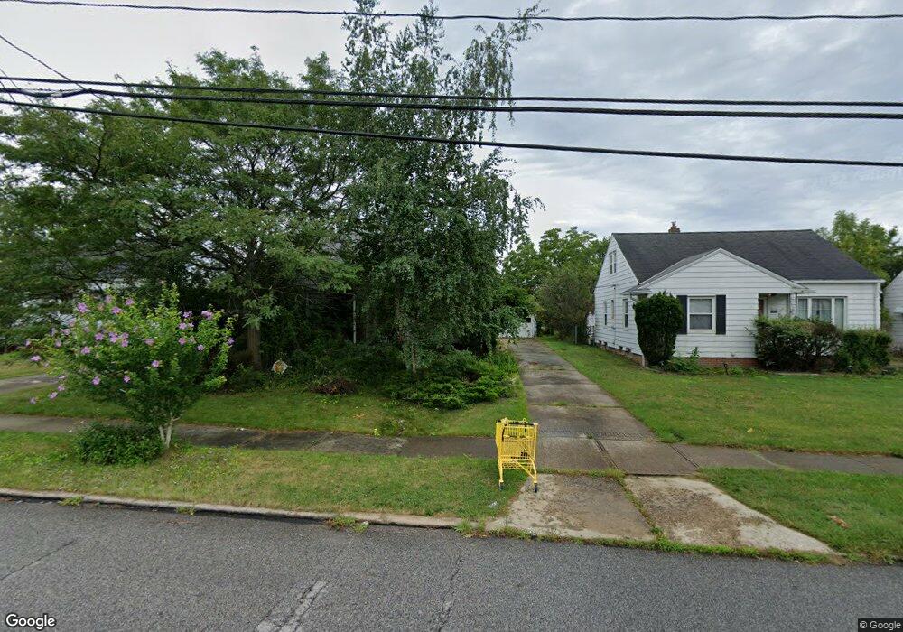
20632 Applegate Rd Maple Heights, OH 44137
Estimated Value: $108,000 - $140,000
3
Beds
1
Bath
1,248
Sq Ft
$99/Sq Ft
Est. Value
About This Home
This home is located at 20632 Applegate Rd, Maple Heights, OH 44137 and is currently estimated at $123,359, approximately $98 per square foot. 20632 Applegate Rd is a home located in Cuyahoga County with nearby schools including Abraham Lincoln Elementary School, Rockside/ J.F. Kennedy School, and Barack Obama School.
Ownership History
Date
Name
Owned For
Owner Type
Purchase Details
Closed on
Apr 28, 1988
Sold by
Mary E Angyal
Bought by
Angyal Margaret
Current Estimated Value
Purchase Details
Closed on
Oct 16, 1980
Sold by
Angyal John
Bought by
Mary E Angyal
Purchase Details
Closed on
Mar 31, 1977
Sold by
Angyal John and Angyal Mary E
Bought by
Angyal John
Purchase Details
Closed on
Jan 1, 1975
Bought by
Angyal John and Angyal Mary E
Create a Home Valuation Report for This Property
The Home Valuation Report is an in-depth analysis detailing your home's value as well as a comparison with similar homes in the area
Home Values in the Area
Average Home Value in this Area
Purchase History
| Date | Buyer | Sale Price | Title Company |
|---|---|---|---|
| Angyal Margaret | -- | -- | |
| Mary E Angyal | -- | -- | |
| Angyal John | -- | -- | |
| Angyal John | -- | -- |
Source: Public Records
Tax History
| Year | Tax Paid | Tax Assessment Tax Assessment Total Assessment is a certain percentage of the fair market value that is determined by local assessors to be the total taxable value of land and additions on the property. | Land | Improvement |
|---|---|---|---|---|
| 2024 | $2,133 | $32,830 | $7,000 | $25,830 |
| 2023 | $1,452 | $22,090 | $4,620 | $17,470 |
| 2022 | $1,485 | $22,090 | $4,620 | $17,470 |
| 2021 | $1,579 | $22,090 | $4,620 | $17,470 |
| 2020 | $1,133 | $16,730 | $3,500 | $13,230 |
| 2019 | $1,120 | $47,800 | $10,000 | $37,800 |
| 2018 | $1,073 | $16,730 | $3,500 | $13,230 |
| 2017 | $1,119 | $16,630 | $3,470 | $13,160 |
| 2016 | $1,076 | $16,630 | $3,470 | $13,160 |
| 2015 | $1,155 | $16,630 | $3,470 | $13,160 |
| 2014 | $1,155 | $18,280 | $3,820 | $14,460 |
Source: Public Records
Map
Nearby Homes
- 339 Grand Blvd
- 19113 Watercrest Ave
- 419 Center Rd
- 54 Willard Ave
- 123 Willard Ave
- 54 Hubbell Way
- 66 Hubbell Way
- 58 Hubbell Way
- 62 Hubbell Way
- 0 Hubbell Cir
- 61 Hubbell Way
- 57 Hubbell Way
- 21202 Gardenview Dr
- 19289 Stafford Ave
- 21607 Libby Rd
- 20806 Clare Ave
- 131 Noran Cir
- 21202 Hillgrove Ave
- 5147 Warrensville Center Rd
- 18811 Waterbury Ave
- 20636 Applegate Rd
- 20628 Applegate Rd
- 20624 Applegate Rd
- 20640 Applegate Rd
- 20620 Applegate Rd
- 20644 Applegate Rd
- 20631 Donny Brook Rd
- 20635 Donny Brook Rd
- 20627 Donny Brook Rd
- 20629 Bowling Green Rd
- 20638 Bowling Green Rd
- 20639 Donny Brook Rd
- 20623 Donny Brook Rd
- 20635 Donnybrook Rd
- 20627 Donnybrook Rd
- 20616 Applegate Rd
- 20648 Applegate Rd
- 20643 Donny Brook Rd
- 20619 Donny Brook Rd
- 20633 Bowling Green Rd
Your Personal Tour Guide
Ask me questions while you tour the home.