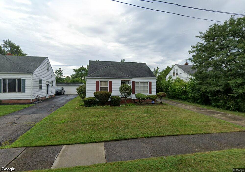
20636 Applegate Rd Maple Heights, OH 44137
Estimated Value: $124,000 - $127,000
3
Beds
1
Bath
1,248
Sq Ft
$101/Sq Ft
Est. Value
About This Home
This home is located at 20636 Applegate Rd, Maple Heights, OH 44137 and is currently estimated at $125,945, approximately $100 per square foot. 20636 Applegate Rd is a home located in Cuyahoga County with nearby schools including Abraham Lincoln Elementary School, Rockside/ J.F. Kennedy School, and Barack Obama School.
Ownership History
Date
Name
Owned For
Owner Type
Purchase Details
Closed on
Nov 6, 2017
Sold by
Thurman Charles D
Bought by
Hinton Elizabeth M
Current Estimated Value
Purchase Details
Closed on
Aug 23, 2013
Sold by
Hinton Elizabeth M
Bought by
Thurman Charlie D
Purchase Details
Closed on
Nov 29, 2002
Sold by
Giallombardo Angelo and Adnornetto Carol
Bought by
Hinton Elizabeth M
Home Financials for this Owner
Home Financials are based on the most recent Mortgage that was taken out on this home.
Original Mortgage
$82,400
Interest Rate
6.22%
Purchase Details
Closed on
Nov 16, 1981
Sold by
Giallombardo Carolina
Bought by
Giallombardo Rose
Purchase Details
Closed on
Jan 1, 1975
Bought by
Giallombardo Carolina
Create a Home Valuation Report for This Property
The Home Valuation Report is an in-depth analysis detailing your home's value as well as a comparison with similar homes in the area
Home Values in the Area
Average Home Value in this Area
Purchase History
| Date | Buyer | Sale Price | Title Company |
|---|---|---|---|
| Hinton Elizabeth M | $59,100 | None Available | |
| Thurman Charlie D | $25,000 | None Available | |
| Hinton Elizabeth M | $85,900 | Quality Title Agency Inc | |
| Giallombardo Rose | -- | -- | |
| Giallombardo Carolina | -- | -- |
Source: Public Records
Mortgage History
| Date | Status | Borrower | Loan Amount |
|---|---|---|---|
| Previous Owner | Hinton Elizabeth M | $82,400 |
Source: Public Records
Tax History
| Year | Tax Paid | Tax Assessment Tax Assessment Total Assessment is a certain percentage of the fair market value that is determined by local assessors to be the total taxable value of land and additions on the property. | Land | Improvement |
|---|---|---|---|---|
| 2024 | $3,592 | $39,935 | $7,000 | $32,935 |
| 2023 | $2,868 | $27,340 | $4,620 | $22,720 |
| 2022 | $2,858 | $27,340 | $4,620 | $22,720 |
| 2021 | $3,049 | $27,340 | $4,620 | $22,720 |
| 2020 | $2,599 | $20,720 | $3,500 | $17,220 |
| 2019 | $2,584 | $59,200 | $10,000 | $49,200 |
| 2018 | $2,571 | $20,720 | $3,500 | $17,220 |
| 2017 | $2,678 | $20,690 | $3,470 | $17,220 |
| 2016 | $2,589 | $20,690 | $3,470 | $17,220 |
| 2015 | $3,840 | $20,690 | $3,470 | $17,220 |
| 2014 | $3,840 | $22,720 | $3,820 | $18,900 |
Source: Public Records
Map
Nearby Homes
- 19113 Watercrest Ave
- 339 Grand Blvd
- 419 Center Rd
- 54 Willard Ave
- 123 Willard Ave
- 0 Hubbell Cir
- 54 Hubbell Way
- 66 Hubbell Way
- 58 Hubbell Way
- 62 Hubbell Way
- 61 Hubbell Way
- 57 Hubbell Way
- 19289 Stafford Ave
- 21202 Gardenview Dr
- 20806 Clare Ave
- 21607 Libby Rd
- 131 Noran Cir
- 18811 Waterbury Ave
- 19520 Maple Heights Blvd
- 21202 Hillgrove Ave
- 20632 Applegate Rd
- 20640 Applegate Rd
- 20628 Applegate Rd
- 20644 Applegate Rd
- 20638 Bowling Green Rd
- 20635 Donny Brook Rd
- 20624 Applegate Rd
- 20648 Applegate Rd
- 20639 Donny Brook Rd
- 20631 Donny Brook Rd
- 20643 Donny Brook Rd
- 20627 Donny Brook Rd
- 20635 Donnybrook Rd
- 20629 Bowling Green Rd
- 20652 Applegate Rd
- 20620 Applegate Rd
- 20647 Donny Brook Rd
- 20642 Bowling Green Rd
- 20623 Donny Brook Rd
- 20627 Donnybrook Rd
Your Personal Tour Guide
Ask me questions while you tour the home.