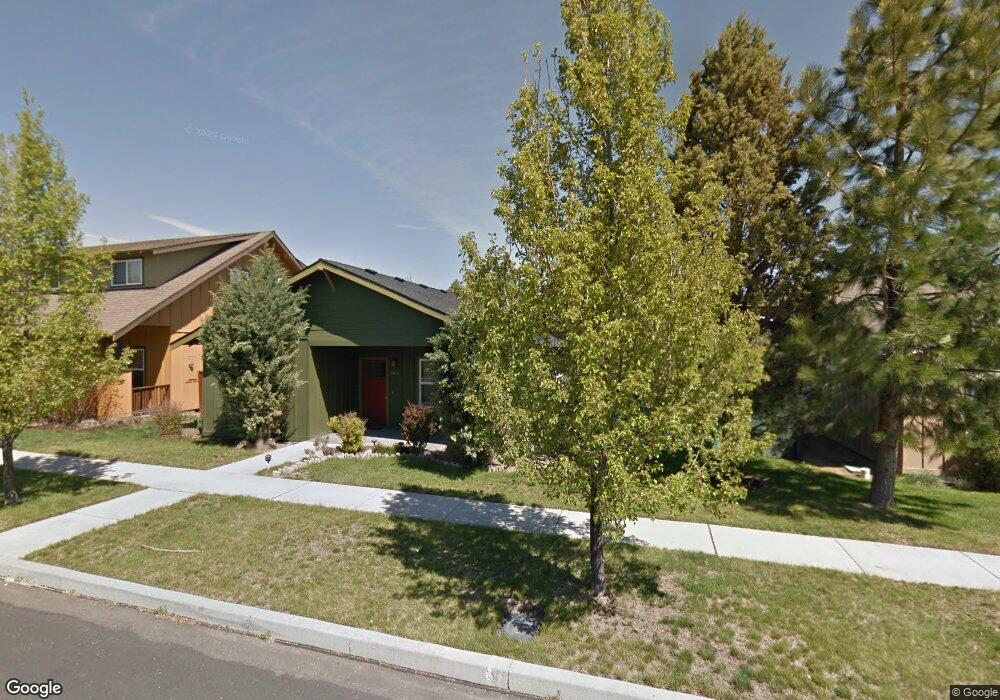
20638 Redwing Ln Bend, OR 97702
Old Farm District NeighborhoodEstimated Value: $510,120 - $560,000
3
Beds
2
Baths
1,350
Sq Ft
$396/Sq Ft
Est. Value
About This Home
This home is located at 20638 Redwing Ln, Bend, OR 97702 and is currently estimated at $534,530, approximately $395 per square foot. 20638 Redwing Ln is a home located in Deschutes County with nearby schools including R.E. Jewell Elementary School, High Desert Middle School, and Deschutes River Montessori School.
Ownership History
Date
Name
Owned For
Owner Type
Purchase Details
Closed on
Feb 28, 2005
Sold by
Peddicord Geoff K and Peddicord Teresa R
Bought by
Schmitt Landis R and Schmitt Tomoko Y
Current Estimated Value
Home Financials for this Owner
Home Financials are based on the most recent Mortgage that was taken out on this home.
Original Mortgage
$154,400
Outstanding Balance
$77,851
Interest Rate
5.73%
Mortgage Type
Unknown
Estimated Equity
$456,679
Create a Home Valuation Report for This Property
The Home Valuation Report is an in-depth analysis detailing your home's value as well as a comparison with similar homes in the area
Home Values in the Area
Average Home Value in this Area
Purchase History
| Date | Buyer | Sale Price | Title Company |
|---|---|---|---|
| Schmitt Landis R | $193,000 | Amerititle |
Source: Public Records
Mortgage History
| Date | Status | Borrower | Loan Amount |
|---|---|---|---|
| Open | Schmitt Landis R | $154,400 |
Source: Public Records
Tax History
| Year | Tax Paid | Tax Assessment Tax Assessment Total Assessment is a certain percentage of the fair market value that is determined by local assessors to be the total taxable value of land and additions on the property. | Land | Improvement |
|---|---|---|---|---|
| 2025 | $3,294 | $194,980 | -- | -- |
| 2024 | $3,170 | $189,310 | -- | -- |
| 2023 | $2,938 | $183,800 | $0 | $0 |
| 2022 | $2,741 | $173,260 | $0 | $0 |
| 2021 | $2,746 | $168,220 | $0 | $0 |
| 2020 | $2,605 | $168,220 | $0 | $0 |
| 2019 | $2,533 | $163,330 | $0 | $0 |
| 2018 | $2,461 | $158,580 | $0 | $0 |
| 2017 | $2,389 | $153,970 | $0 | $0 |
| 2016 | $2,278 | $149,490 | $0 | $0 |
| 2015 | $2,215 | $145,140 | $0 | $0 |
| 2014 | $2,150 | $140,920 | $0 | $0 |
Source: Public Records
Map
Nearby Homes
- 20634 Hummingbird Ln
- 20580 Klahani Dr
- 61260 Sunflower Ln
- 20657 Wild Goose Ln
- 20606 Songbird Ln
- 61346 Whitetail St
- 20627 White Dove Ln
- 20743 Blacksmith Cir
- 61187 Splendor Ln
- 20596 Button Brush Ave
- 61182 Larkspur Loop
- 61210 Larkspur Loop
- 20650 Honeysuckle Ln
- 20609 SE Gemstone Ave Unit 131
- 20513 SE Byron Ave
- 20608 Rolen Ave
- 61142 Brookhollow Dr
- 20749 Canterbury Ct
- 61441 SE Daybreak Ct Unit Lot 10
- 61376 Robin Hood Ln
- 20632 Redwing Ln
- 20644 Redwing Ln
- 20635 Foxborough Ln
- 20629 Foxborough Ln
- 20641 Foxborough Ln
- 20626 Redwing Ln
- 20623 Foxborough Ln
- 20647 Foxborough Ln
- 20637 Redwing Ln
- 20631 Redwing Ln
- 20643 Redwing Ln
- 20656 Redwing Ln
- 20620 Redwing Ln
- 20649 Redwing Ln
- 20625 Redwing Ln
- 0 Foxborough Ln
- 229 Foxborough Ln
- 20653 Foxborough Ln
- 20617 Foxborough Ln
- 20614 Redwing Ln
Your Personal Tour Guide
Ask me questions while you tour the home.