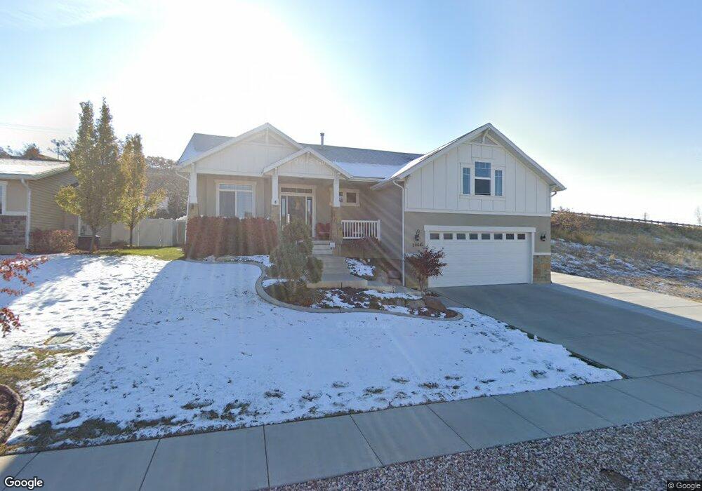
2064 E 3100 N Unit 101 Layton, UT 84040
Estimated Value: $662,000 - $714,666
5
Beds
3
Baths
2,021
Sq Ft
$339/Sq Ft
Est. Value
About This Home
This home is located at 2064 E 3100 N Unit 101, Layton, UT 84040 and is currently estimated at $685,917, approximately $339 per square foot. 2064 E 3100 N Unit 101 is a home located in Davis County with nearby schools including Mountain View Elementary School, North Layton Junior High School, and Northridge High School.
Ownership History
Date
Name
Owned For
Owner Type
Purchase Details
Closed on
Mar 8, 2022
Sold by
Tilt Gladys H
Bought by
Erickson Brad and Erickson Stacie
Current Estimated Value
Home Financials for this Owner
Home Financials are based on the most recent Mortgage that was taken out on this home.
Original Mortgage
$415,000
Outstanding Balance
$387,048
Interest Rate
3.92%
Mortgage Type
New Conventional
Estimated Equity
$298,869
Purchase Details
Closed on
Jul 17, 2019
Sold by
Castillo Jennifer L and Castillo David J
Bought by
Tilt Victor E and Tilt Gladys H
Home Financials for this Owner
Home Financials are based on the most recent Mortgage that was taken out on this home.
Original Mortgage
$360,000
Interest Rate
3.82%
Mortgage Type
New Conventional
Purchase Details
Closed on
Jun 10, 2014
Sold by
Haskell Jay E
Bought by
The Jay And Linda Haskell Irrevocable Tr and Haskell Linda M
Create a Home Valuation Report for This Property
The Home Valuation Report is an in-depth analysis detailing your home's value as well as a comparison with similar homes in the area
Home Values in the Area
Average Home Value in this Area
Purchase History
| Date | Buyer | Sale Price | Title Company |
|---|---|---|---|
| Erickson Brad | -- | None Listed On Document | |
| Tilt Victor E | -- | First American Title | |
| The Jay And Linda Haskell Irrevocable Tr | -- | Founders Title Co | |
| Haskell Jay E | -- | Security Title Of |
Source: Public Records
Mortgage History
| Date | Status | Borrower | Loan Amount |
|---|---|---|---|
| Open | Erickson Brad | $415,000 | |
| Previous Owner | Tilt Victor E | $360,000 |
Source: Public Records
Tax History
| Year | Tax Paid | Tax Assessment Tax Assessment Total Assessment is a certain percentage of the fair market value that is determined by local assessors to be the total taxable value of land and additions on the property. | Land | Improvement |
|---|---|---|---|---|
| 2025 | $3,653 | $362,450 | $99,191 | $263,259 |
| 2024 | $3,427 | $343,751 | $120,544 | $223,207 |
| 2023 | $3,591 | $641,000 | $118,066 | $522,934 |
| 2022 | $3,624 | $352,550 | $62,445 | $290,105 |
| 2021 | $3,782 | $551,000 | $103,036 | $447,964 |
| 2020 | $3,466 | $484,000 | $80,625 | $403,375 |
| 2019 | $3,012 | $412,000 | $83,667 | $328,333 |
| 2018 | $3,025 | $417,000 | $82,354 | $334,646 |
| 2016 | $2,826 | $202,950 | $39,158 | $163,792 |
| 2015 | $2,663 | $181,940 | $36,613 | $145,327 |
| 2014 | $894 | $60,517 | $60,517 | $0 |
Source: Public Records
Map
Nearby Homes
- 3232 N Redtail Way
- 1935 Deere Valley Dr
- 1827 E Whitetail Dr
- 2353 Canyon View Dr
- 1821 E Whitetail Way
- 1911 Deere Valley Dr
- 1785 E 2825 N
- 1731 E 2825 N
- 2826 N 1600 E
- 2597 N 2300 E
- 3176 N 1450 E
- 1447 E 2700 N
- 3142 E Thorley Dr
- 3138 E Thorley Dr
- 2340 N 2050 E
- 1321 E 3125 N
- 2273 N 1975 E
- 1266 E 3125 N
- 1241 E 3075 N
- 2189 N 1950 E
- 2064 E 3100 N
- 2080 E 3100 N Unit 102
- 2080 E 3100 N
- 2102 E 3100 N Unit 103
- 3101 N Broadwing Dr Unit 4
- 3101 N Broadwing Dr
- 3101 N Broadwing Dr Unit 4
- 2132 E 3100 N
- 3102 N Broadwing Dr Unit 1
- 3109 N Broadwing Dr
- 3109 N Broadwing Dr Unit 5
- 3109 N Broadwing Dr
- 3109 N Broadwing Dr Unit 5
- 2127 E 3000 N
- 2128 E 3000 N
- 3116 N Broadwing Dr Unit 2
- 3116 N Broadwing Dr
- 2131 E 3000 N
- 2135 E 3100 N
- 2142 E 3100 N
Your Personal Tour Guide
Ask me questions while you tour the home.