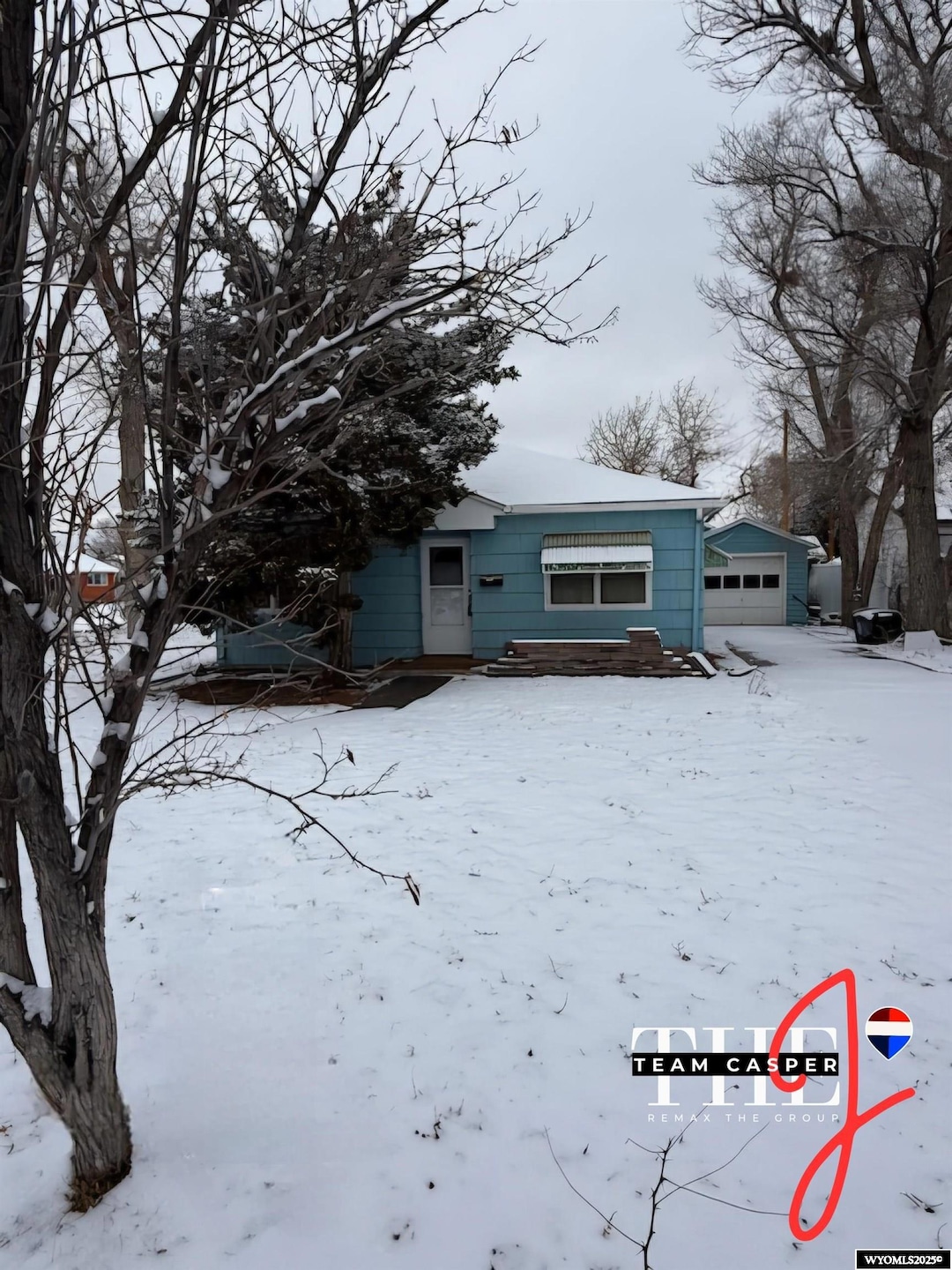
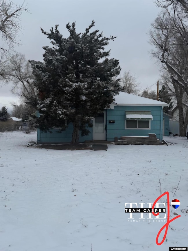
2064 E A St Casper, WY 82609
East Casper NeighborhoodEstimated payment $1,100/month
Highlights
- Ranch Style House
- Corner Lot
- 1 Car Detached Garage
- Wood Flooring
- No HOA
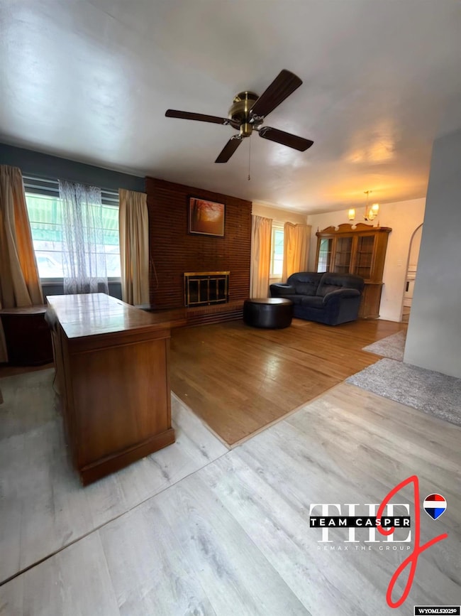
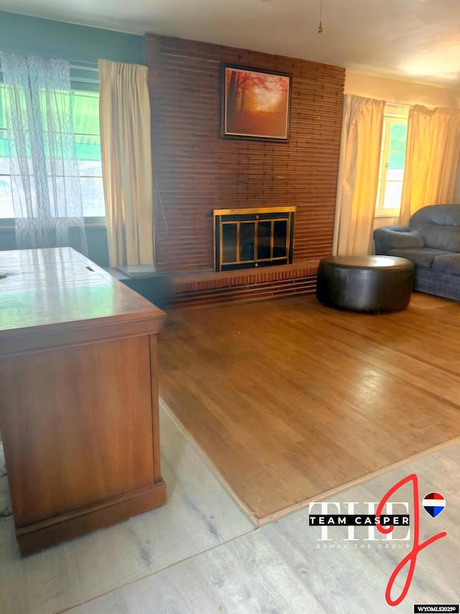
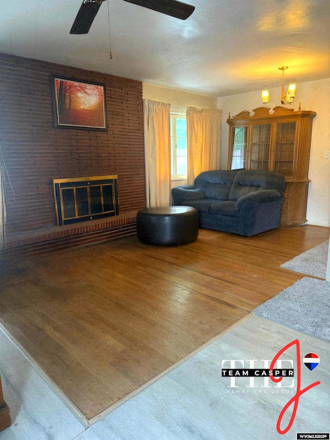
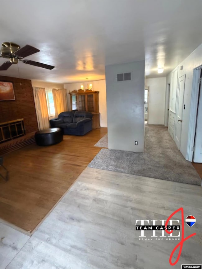
- Living Room
About This Home
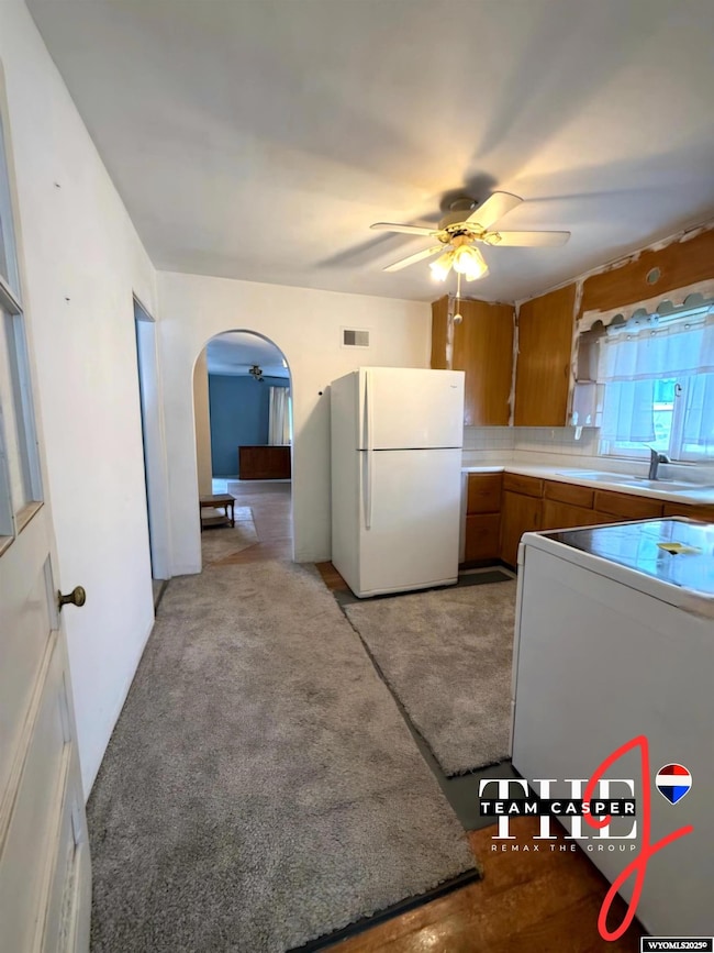
Experience the possibilities at 2064 E A St., perfectly positioned on a generous 10,000+ sq ft corner lot in one of Casper’s most convenient central locations. Just moments from schools, shopping, dining, and medical services, this home offers the ideal blend of space and accessibility. Step inside this single-level residence, where a bright and comfortable layout invites you to make it your own. A few thoughtful updates could easily transform this home into a standout charmer. The property is part of an estate and is being sold as is, with one valuable perk: a brand-new roof will be installed with an acceptable offer, and you get to select the shingle color—a rare opportunity to personalize from the start. Enjoy a spacious living area, two cozy bedrooms, and one full bathroom, all designed for easy everyday living. The impressive oversized detached garage, complete with a workshop area, provides exceptional storage, hobby space, or room for outdoor gear. Homes with this kind of potential and lot size are hard to find. For additional details or a private showing, contact Jennifer Gladson with J Team RE/MAX The Group at 307-259-5074.
Home Details
Home Type
- Single Family
Est. Annual Taxes
- $1,102
Year Built
- Built in 1949
Lot Details
- 10,019 Sq Ft Lot
- Landscaped
- Corner Lot
- Property is zoned R2
Parking
- 1 Car Detached Garage
Home Design
- Ranch Style House
- Concrete Foundation
Interior Spaces
- 1,055 Sq Ft Home
- Wood Burning Fireplace
- Living Room
- Dining Room
- Oven or Range
Flooring
- Wood
- Carpet
Bedrooms and Bathrooms
- 2 Bedrooms
- 1 Bathroom
Laundry
- Laundry on main level
- Dryer
- Washer
Utilities
- Forced Air Heating System
Community Details
- No Home Owners Association
Map
Home Values in the Area
Average Home Value in this Area
Tax History
| Year | Tax Paid | Tax Assessment Tax Assessment Total Assessment is a certain percentage of the fair market value that is determined by local assessors to be the total taxable value of land and additions on the property. | Land | Improvement |
|---|---|---|---|---|
| 2025 | $1,091 | $15,197 | $3,790 | $11,407 |
| 2024 | $1,431 | $19,923 | $5,833 | $14,090 |
| 2023 | $1,426 | $19,562 | $5,663 | $13,899 |
| 2022 | $1,108 | $15,203 | $5,034 | $10,169 |
| 2021 | $781 | $13,720 | $4,774 | $8,946 |
| 2020 | $1,161 | $15,922 | $8,989 | $6,933 |
| 2019 | $828 | $14,357 | $4,645 | $9,712 |
| 2018 | $738 | $13,129 | $4,645 | $8,484 |
| 2017 | $536 | $13,350 | $4,645 | $8,705 |
| 2015 | $740 | $13,156 | $4,645 | $8,512 |
| 2014 | $705 | $12,673 | $4,645 | $8,028 |
Property History
| Date | Event | Price | List to Sale | Price per Sq Ft |
|---|---|---|---|---|
| 01/02/2026 01/02/26 | Price Changed | $194,000 | -2.5% | $184 / Sq Ft |
| 12/02/2025 12/02/25 | For Sale | $199,000 | -- | $189 / Sq Ft |
Purchase History
| Date | Type | Sale Price | Title Company |
|---|---|---|---|
| Warranty Deed | -- | First American Title |
Mortgage History
| Date | Status | Loan Amount | Loan Type |
|---|---|---|---|
| Open | $162,011 | FHA | |
| Closed | $12,250 | No Value Available |
Source: Wyoming MLS
MLS Number: 20256315
APN: 33-79-02-3-1-201800
Disclaimer: Certain information contained herein is derived from information provided by parties other than Homes.com. All information provided is deemed reliable, but is not guaranteed to be accurate and should be independently verified.
![]() Information deemed reliable but not guaranteed. All properties are subject to prior sale, change or withdrawal. The data relating to real estate on this web site comes in part from the Wyoming MLS Internet Data Exchange Program. Real estate listings held by brokerage firms other than the listing office named are marked with the Wyoming MLS IDX logo and detailed information about them includes the name of the listing broker. The information being provided is for consumers’ personal, non-commercial use and may not be used for any purpose other than to identify prospective properties consumers may be interested in purchasing.
Information deemed reliable but not guaranteed. All properties are subject to prior sale, change or withdrawal. The data relating to real estate on this web site comes in part from the Wyoming MLS Internet Data Exchange Program. Real estate listings held by brokerage firms other than the listing office named are marked with the Wyoming MLS IDX logo and detailed information about them includes the name of the listing broker. The information being provided is for consumers’ personal, non-commercial use and may not be used for any purpose other than to identify prospective properties consumers may be interested in purchasing.
- 2061 E A St
- 2112 E 1st Ln
- 120 S Beverly St
- 377 N Minnesota Ave
- 311 S Elk St
- 263 S Kenwood St
- 505 Swanton Ave
- 1302 E 7th St
- 241 S Mckinley St
- 823 N Washington St
- 917 N Washington St
- 632 S Jackson St
- 1019 E 6th St
- 111 N Forest #64 Dr
- 914 S Melrose St
- 1231 S Missouri Ave
- 2009 S Beverly St
- 531 Seminoe St
- 3504 E 8th St
- 1016 S Washington St
- 2385 E 8th St
- 627 S Melrose St
- 842 E Yellowstone Hwy Unit 842-ALL
- 406 S Kimball St Unit (upstairs in back)
- 3870 E 8th St
- 2300 E 18th St
- 1900 S Missouri Ave
- 623 S Wolcott St Unit 316
- 218 E 7th St Unit 104
- 310 N Center St Unit 310-ALL
- 922 S David St Unit A
- 415 S Oak St
- 760 Landmark Dr
- 5200 Blackmore Rd
- 1700 W 25th St
- 1427 Morado Dr
- 4400 S Poplar St Unit 208
- 4440 S Poplar St Unit 104 B
- 3585 Gila Bend
- 728 S 3rd St
