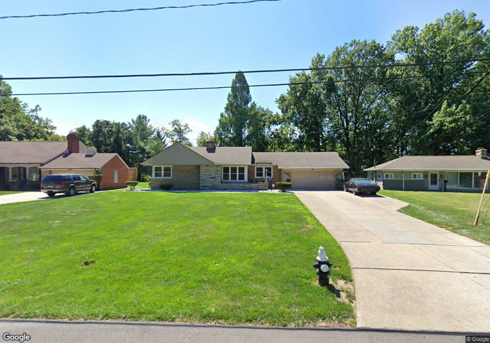
2064 Miami Rd Euclid, OH 44117
Estimated Value: $163,000 - $177,000
2
Beds
2
Baths
1,213
Sq Ft
$140/Sq Ft
Est. Value
About This Home
This home is located at 2064 Miami Rd, Euclid, OH 44117 and is currently estimated at $169,904, approximately $140 per square foot. 2064 Miami Rd is a home located in Cuyahoga County with nearby schools including Bluestone Elementary School, Euclid Middle School, and Euclid High School.
Ownership History
Date
Name
Owned For
Owner Type
Purchase Details
Closed on
Sep 8, 2025
Sold by
Goolsby Daniel
Bought by
Noah-Goolsby Deborah
Current Estimated Value
Purchase Details
Closed on
Mar 14, 2014
Sold by
Tomaosne Steve and Tomasone Shelli A
Bought by
Goolsby Daniel
Purchase Details
Closed on
Dec 12, 2008
Sold by
Deutsche Bank National Trust Company
Bought by
Goolsby Daniel and Tomasone Steve
Purchase Details
Closed on
May 20, 2008
Sold by
Shaw Terry and Shaw La Taunya
Bought by
Deutsche Bank National Trust Co
Purchase Details
Closed on
May 26, 2005
Sold by
Miree Gary L and Miree Oveater G
Bought by
Shaw Terry and Shaw La Taunya E
Home Financials for this Owner
Home Financials are based on the most recent Mortgage that was taken out on this home.
Original Mortgage
$127,775
Interest Rate
9.3%
Mortgage Type
Purchase Money Mortgage
Purchase Details
Closed on
Jul 10, 1986
Sold by
Hays Birt J
Bought by
Miree Gary L
Purchase Details
Closed on
Apr 15, 1981
Sold by
Lane Larry D and Lane Cheryl H
Bought by
Hays Birt J
Purchase Details
Closed on
Jan 1, 1975
Bought by
Lane Larry D and Lane Cheryl H
Create a Home Valuation Report for This Property
The Home Valuation Report is an in-depth analysis detailing your home's value as well as a comparison with similar homes in the area
Home Values in the Area
Average Home Value in this Area
Purchase History
| Date | Buyer | Sale Price | Title Company |
|---|---|---|---|
| Noah-Goolsby Deborah | -- | None Listed On Document | |
| Goolsby Daniel | $39,050 | Northcoast Title Agency | |
| Goolsby Daniel | $44,000 | None Available | |
| Deutsche Bank National Trust Co | $73,334 | Attorney | |
| Shaw Terry | $134,500 | Midland Title Agency | |
| Miree Gary L | $86,900 | -- | |
| Hays Birt J | $89,500 | -- | |
| Lane Larry D | -- | -- |
Source: Public Records
Mortgage History
| Date | Status | Borrower | Loan Amount |
|---|---|---|---|
| Previous Owner | Shaw Terry | $127,775 |
Source: Public Records
Tax History Compared to Growth
Tax History
| Year | Tax Paid | Tax Assessment Tax Assessment Total Assessment is a certain percentage of the fair market value that is determined by local assessors to be the total taxable value of land and additions on the property. | Land | Improvement |
|---|---|---|---|---|
| 2024 | $3,703 | $53,970 | $12,635 | $41,335 |
| 2023 | $3,761 | $43,960 | $9,870 | $34,090 |
| 2022 | $3,674 | $43,960 | $9,870 | $34,090 |
| 2021 | $4,091 | $43,960 | $9,870 | $34,090 |
| 2020 | $3,431 | $33,320 | $7,490 | $25,830 |
| 2019 | $3,086 | $95,200 | $21,400 | $73,800 |
| 2018 | $2,971 | $33,320 | $7,490 | $25,830 |
| 2017 | $3,069 | $27,340 | $5,950 | $21,390 |
| 2016 | $3,075 | $27,340 | $5,950 | $21,390 |
| 2015 | $2,868 | $27,340 | $5,950 | $21,390 |
| 2014 | $2,868 | $27,340 | $5,950 | $21,390 |
Source: Public Records
Map
Nearby Homes
- 2441 Malden Rd
- 2337 Greenvale Rd
- 2536 Greenvale Rd
- 2150 Glenridge Rd
- 2217 Belvoir Blvd
- 3803 Bridgeview Dr
- 19871 Upper Valley Dr
- 565 Quilliams Rd
- 19201 Shawnee Rd
- 3757 Princeton Blvd
- 4002 Lancaster Rd
- 220 Greenvale Rd
- 19201 Genesee Rd
- 1897 Torbenson Dr
- 4031 Suffolk Rd
- 1777 Catalpa Rd
- 3595 Runnymede Blvd
- 1849 Torbenson Dr
- 3790 Sherwood Rd
- 209 Greenbriar Ct